Maps of Buffalo
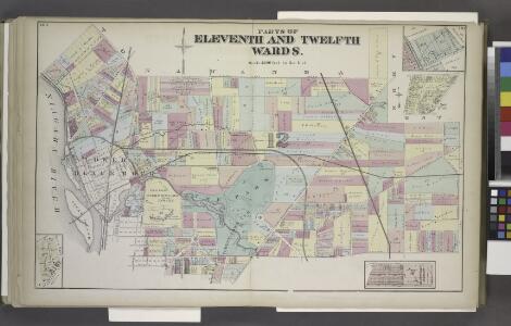
Parts of Eleventh and Twelfth Wards.
from Atlas of the City of Buffalo, Erie Co., New York : from actual surveys & official records.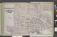
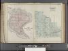
Lower Blackrock being a Part of Twelfth Ward.
from Atlas of the City of Buffalo, Erie Co., New York : from actual surveys & official records.
Buffalo, V. 3, Double Page Plate No. 10 [Map bounded by Prospect Ave., Miller Blvd., Belmont St., Hiler Ave., Kenmore Ave., Military Rd.] / engraved by Albert Volk.
From v. 3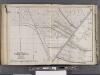
Buffalo, V. 1, Double Page Plate No.1 [Map bounded by Kenmore Ave., Minnesota Ave., Hertel Ave., Dryden Ave.] / engraved by Albert Volk.
From v. 1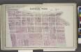
Part of Eleventh Ward.
from Atlas of the City of Buffalo, Erie Co., New York : from actual surveys & official records.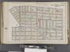
Buffalo, V. 1, Double Page Plate No.17 [Map bounded by Grant St., Forest Ave., Elmwood Ave., Lexington Ave., Massachusetts St., Lawrence Pl.] / engraved by Albert Volk.
From v. 1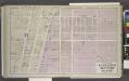
Parts of Eleventh and Seventh Wards.
from Atlas of the City of Buffalo, Erie Co., New York : from actual surveys & official records.
Buffalo.
1 : 16000 Rand McNally and Company
City of Buffalo
from Illustrated historical atlas of Erie Co., New York from actual surveys and records.
"Outline Map of Buffalo, New York."
from Atlas of the City of Buffalo, Erie Co., New York : from actual surveys & official records.
Buffalo.
1 : 32000 Rand McNally and Company
Buffalo NE
1 : 24000
Buffalo NE
1 : 24000
Buffalo NE
1 : 24000
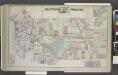
"Part of 5th, 6th, 7th, and 12th Wards."
from Atlas of the City of Buffalo, Erie Co., New York : from actual surveys & official records.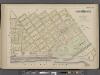
Buffalo, Double Page Plate No. 20 [Map bounded by Porter Ave., Niagara River, Ferry St.]
From Atlas of the City of Buffalo, New York : from official records, private plans and actual surveys.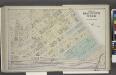
Part of Eleventh Ward.
from Atlas of the City of Buffalo, Erie Co., New York : from actual surveys & official records.
Buffalo
1 : 62500
Buffalo
1 : 62500
Buffalo
1 : 62500
Buffalo
1 : 62500
Buffalo
1 : 62500
Buffalo
1 : 62500
Buffalo
1 : 62500
Buffalo
1 : 62500
Buffalo
1 : 62500
Buffalo
1 : 62500
Buffalo
1 : 62500
Tonawanda [Township]
from New topographical atlas of Erie Co., New York, from actual surveys especially for this atlas.