Maps of Adirondack Mountains
"St. Lawrence, Franklin, Clinton, and Essex"
from New topographical atlas and gazetteer of New York, comprising a topographical view of the several counties of the state, ... including ... map of the United States and territories ... Compiled from the latest astronomical observations, official surveys and records of the United States and territories ...
Survey of the several routes for a rail road from Ogdensburgh to Lake Champlain : made in pursuance of an act of the State of New York, passed May 14th, 1840 / by Edw H. Brodhead, chief engineer ; J.H. Jackson, H. Thomas & V. Whitney, commissrs.
from (A-Z)
Map of the New York wilderness : to accompany Wallace's Descriptive guide to the Adirondacks
1 : 253440 Ely, William Watson G. W. & C. B. Colton & Co.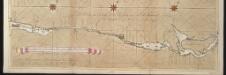
La riviere de Canada ou de St. Laurens de I. de Montreal jusqu'à le lac Ontario aux Nord de l'Amérique
Canada Gerard van Keulen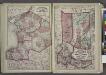
"Jefferson, Oswego, and Lewis Counties"
from New topographical atlas and gazetteer of New York, comprising a topographical view of the several counties of the state, ... including ... map of the United States and territories ... Compiled from the latest astronomical observations, official surveys and records of the United States and territories ...
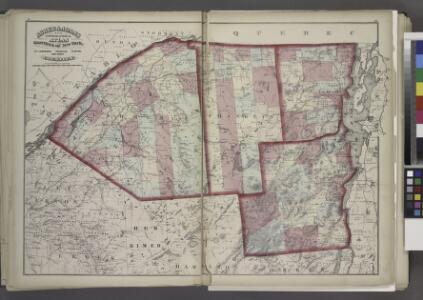
Map of the Adirondack wilderness
1 : 255000 Stoddard, Seneca Ray, 1844-1917 S.R. Stoddard
East End of Lake Ontario and River St Lawrence.
1 : 348480 Melish, John
Ogdensburg
1 : 250000
Ogdensburg
1 : 250000
Ogdensburg
1 : 250000
Ogdensburg
1 : 250000
Ogdensburg
1 : 250000
East End of Lake Ontario and River St. Lawrence from Kingston to French Mills.
1 : 360000 Melish, John
A SURVEY OF LAKE CHAMPLAIN
1 : 2700000 Brasier, William Amherst, Jeffery
(This Topographical map of the Province of Lower Canada. Sheet) E.
1 : 174240 Faden, William, 1750?-1836
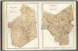
"Herkimer, Hamilton, and Montgomery"
from New topographical atlas and gazetteer of New York, comprising a topographical view of the several counties of the state, ... including ... map of the United States and territories ... Compiled from the latest astronomical observations, official surveys and records of the United States and territories ...
Outline plan of Franklin Co.
from Atlas of Franklin County, New York. : From actual surveys and official records.
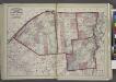
Outline map of Essex County, New York.
from New topographical atlas of Essex County, New York : from official records, unpublished maps and plans, and special explorations and surveys; with a supplement comprising a map of the state of New York, and general maps of the United States and the world, with descriptions / O. W. Gray and Son.
A survey of Lake Champlain, including Lake George, Crown Point, and St. John
1 : 400000 Brasier, William Robert Sayer & John Bennett (Firm)
A Survey of Lake Champlain, including Lake George, Crown Point and St. John.
1 : 400000 Robert Sayer and John Bennett (Firm)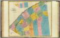
St. Lawrence County.
1 : 151000 Burr, David H., 1803-1875
St. Lawrence County.
1 : 158400 Bien, Joseph Rudolf
Essex County.
1 : 158400 Bien, Joseph Rudolf
"Plan of Clinton Co., N.Y."
from Atlas of Clinton Co., New York : from actual surveys / by and under the direction of F.W. Beers, assisted by Geo. P. Sanford & others.
Watertown Business Directory. ; North Watertown [Village]; Juhelville [Village]
from New topographical atlas of Jefferson Co., New York : From actual surveys / by S.N. & D.G. Beers and assistants.
Franklin County.
1 : 158400 Bien, Joseph Rudolf
Franklin County.
1 : 151000 Burr, David H., 1803-1875
Essex County.
1 : 151000 Burr, David H., 1803-1875
Lewis County.
1 : 151000 Burr, David H., 1803-1875