Maps of Splitsko-Dalmatinska

Lesina.
from Spezialkarte der osterreichisch-ungarischen Monarchie.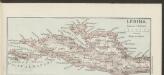
Lesina [Westhälfte]
1 : 200000 Kroatien Hvar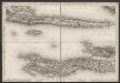
[Kanal von Korčula]
Kroatien Dalmatien Korčula Umland
Velaluka.
from Spezialkarte der osterreichisch-ungarischen Monarchie.
Almissa und S. Pietro Della Brazza.
from Spezialkarte der osterreichisch-ungarischen Monarchie.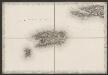
[Vis]
Kroatien Dalmatien Vis (Kroatien) Umland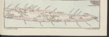
Lesina [Osthälfte]
1 : 200000 Kroatien Hvar
Bis
1 : 200000 Vis (Chorvatsko : ostrov) Kartografska radionica
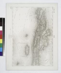
Adriatisches Meer, Küstenkarte
1 : 180000 Hvar (Chorvatsko : ostrov) Oesterreicher, Tobias von Hydrographisches Amt der k. u. k. Kriegs-Marine
Charte des sudöstlichen Theiles von Dalmatien mit dem Oesterreichischen Antheile von Albanien
1 : 540000 Albánie Kipferling, Karl Joseph
Střední Dalmacie
1 : 750000 Dalmácie střední (Chorvatsko) Machát, František c. a k. voj. zeměpisný ústav
Charte des sudöstlichen Theiles von Dalmatien mit dem oesterreichischen Antheile von Albanien
Albánie im Verlage des Kunst und Industrie Comptoirs
Partie de la Dalmatie du sud est avec l'Albanie
Albánie im Verlage des Kunst und Industrie Comptoirs
Skelet-Karte für Curs-Skizzen
Chorvatsko K. u. k. Kriegs-Marine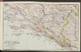
Die adriatische Küste von Spalato bis Cattaro
1 : 900000 Kroatien Adriaküste
Generalkarte von Zentraleuropa

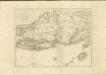
Le gouvernement de Raguse estant une partie de Dalmatie, avec quelques isles
1 : 310000 Dubrovník-oblast (Chorvatsko) Coronelli, Vincenzo Maria Schenk, Pieter apud Petrum Schenk Jun.
I. Lissa [Vis].
from Spezialkarte der osterreichisch-ungarischen Monarchie.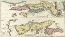
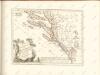
Le Gouvernement de Raguse
Mollova mapová sbírka Coronelli, Vincenzo Maria Schenk, Peter II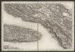
[Kanal von Brač]
Kroatien Dalmatien Brač Umland
[Umgebung von Šolta]
Kroatien Dalmatien Šolta Umland
Ravca und Zastrazisce.; Spezialkarte der osterreichisch-ungarischen Monarchie.
from Spezialkarte der osterreichisch-ungarischen Monarchie. Austro-Hungarian Monarchy. Militärgeographisches Institut.,
Imotski und Macarsca.
from Spezialkarte der osterreichisch-ungarischen Monarchie.
I. Solta.
from Spezialkarte der osterreichisch-ungarischen Monarchie.
I. Busi.
from Spezialkarte der osterreichisch-ungarischen Monarchie.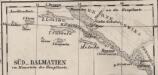
Süd-Dalmatien
Dalmatien

Eisenbahnkarte der k.u.k. oesterreichisch-ungarischen Monarchie