Maps of Mali Zvornik Municipality

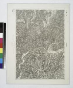
Zvornik.
from Spezialkarte der osterreichisch-ungarischen Monarchie.
Vlasenica und Srebrenica.
from Spezialkarte der osterreichisch-ungarischen Monarchie.
Janja.
from Spezialkarte der osterreichisch-ungarischen Monarchie.
Blatt XI, [Geologisch overzicht], uit: Geologische Übersichts-Karte der Österreichisch-Ungarischen Monarchie / nach den Aufnahmen der K.K. Geologischen Reichsanstalt bearb. von Franz Ritter von Hauer ; gezeichn. von Eduard Jahn
1 : 576000 Annotatie geografische gegevens: Gebaseerd op veldwerk in de jaren 1850 tot 1865 Hauer, Franz Ritter von; Jahn, Eduard; Kaiserlich-Königliche Geologische Reichsanstalt, Wenen Wien : Beck
Zvornik
1 : 200000 Zvornik (Bosna a Hercegovina : oblast) Kartografska radionica
[Generalkarte von Bosnien und der Hercegovina] K. 10. (Brod)
1 : 300000 Bosnien-Herzegowina Bosnien
Carte der Besitznehmung von Lesenitza, Lipanitza, Losenitza gegen Zwornick und Zokol von den K.K. Tr
1 Karte : Kupferdruck ; 12 x 17 cm [Trattner]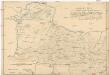
Sitvations-Plan des ganzen Šabacer und eines Theils des Waljewer Districts
1 : 77000 Valjevo (Srbsko) Guretzki von Kornitz
Dubrava DL. und Ribnica.; Spezialkarte der osterreichisch-ungarischen Monarchie.
from Spezialkarte der osterreichisch-ungarischen Monarchie. Austro-Hungarian Monarchy. Militärgeographisches Institut.,
Krupanj.; Spezialkarte der osterreichisch-ungarischen Monarchie.
from Spezialkarte der osterreichisch-ungarischen Monarchie. Austro-Hungarian Monarchy. Militärgeographisches Institut.,
Kladanj und Cevljanovic.
from Spezialkarte der osterreichisch-ungarischen Monarchie.
Fakovic.
from Spezialkarte der osterreichisch-ungarischen Monarchie.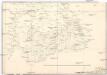
Strassen-Carte der Slawon. Militär-Gränze o. I. u. O
1 : 430000 Srbsko
Vermehrte und Verbesserte Landkarten des Königreichs Ungarn :
1 : 500000 Mollova mapová sbírka Stier, Martin Böner, Johann-Alexander Endter, Martin
Reg. Bosniae
1 : 875000 Mollova mapová sbírka Bruggen, Johann van der Brugge, Johannes van der
Reg. Bosniae
1 : 875000 Mollova mapová sbírka Pfeffel, Johann Andreas Pfeffel, Johann Andreas I.
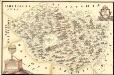
Knjažestvo Srbije
1 : 493000 Srbsko Milenkovie, Iovan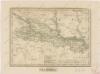
Slavonsko
Mapa Particvlaris Regni Bosniae
Mollova mapová sbírka Geyer
Ungarn:. Comitate: Baranya, Bács, Csanád, Temes, Torontal. Slavonien. Comit.: Sirmien, Veröcze. Militär Gränze: Brod, Petervardein, Csajkisten Kreisz, Deutschbanater Regiment
Ungarn Verkehrsweg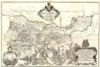
Tabula Geographica Nova et Exacta Distincte exhibens Regnum Sclavoniae cum Syrmii Ducatu
1 : 300000 Mollova mapová sbírka Gadea, Joseph
Agram, Brod, Esseg, Glina, Knin, Sarajevo
1 : 750000 Knin (Chorvatsko : oblast) K. u. k. militär-geographisches Institut
Agram, Brod, Esseg, Glina, Knin, Sarajevo
1 : 750000 Glina (Chorvatsko) K. k. militär-geographisches Institut
Das Königreich Bosnia
1 : 1570000 Bosna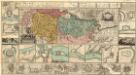
Regnum Bosniae, una cum finitimis Croatiae, Dalmatiae, Slavoniae, Hung. et Serviae partibus praecipuorum in his regionibus munimentorum ichnographia Curantibus
1 : 840000 Mollova mapová sbírka Ötinger, Johann Homann, Johann Baptista - dědici
Bosnia & Hercegovina
Bosna a Hercegovina Jordán, J. P. J.P. Jordán
Sclavonia Croatia Bosnia cum Dalmatiae Parte
1 : 930000 Mollova mapová sbírka Mercator, Gerhard Mercator, Gerard
Letecká mapa Evropy

Republik Bosnien-Herzegowina. Katasterkarte: Bosniaken-Muslime
Bosnien-Herzegowina Bosnier, Grundeigentum