Maps of Timiș

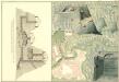
Buziasfurdo.; Spezialkarte der osterreichisch-ungarischen Monarchie.
from Spezialkarte der osterreichisch-ungarischen Monarchie. Austro-Hungarian Monarchy. Militärgeographisches Institut.,
Buziás
1 : 75000 Buziaș Geripp: Fwkr. Heller. Terrain: J. Le Gay Edl. v. Lierfels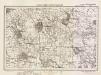
Lambert-Cholesky sheet 1857 (Sacosul Turcesc)
1 : 20000 Romanian military topographic map sheet under Lambert-Cholensky projection Direcția Topografică Militară geo-spatial.org Direcția Topografică Militară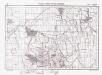
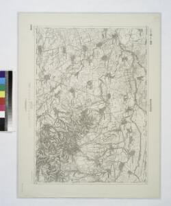
Lambert-Cholesky sheet 1957 (Buziaş)
1 : 20000 Romanian military topographic map sheet under Lambert-Cholensky projection Direcția Topografică Militară geo-spatial.org Direcția Topografică Militară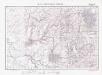
Lambert-Cholesky sheet 1956 (Sacoşul-Mare)
1 : 20000 Romanian military topographic map sheet under Lambert-Cholensky projection Serviciul Geografic al Armatei geo-spatial.org Serviciul Geografic al Armatei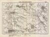
Lambert-Cholesky sheet 1856 (Cerna)
1 : 20000 Romanian military topographic map sheet under Lambert-Cholensky projection Direcția Topografică Militară geo-spatial.org Direcția Topografică Militară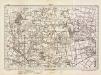
Lambert-Cholesky sheet 1858 (Bazos)
1 : 20000 Romanian military topographic map sheet under Lambert-Cholensky projection Direcția Topografică Militară geo-spatial.org Direcția Topografică Militară
Lambert-Cholesky sheet 1958 (Racoviţa)
1 : 20000 Romanian military topographic map sheet under Lambert-Cholensky projection Direcția Topografică Militară geo-spatial.org Direcția Topografică Militară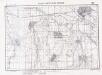
Lambert-Cholesky sheet 2057 (Lugoj)
1 : 20000 Romanian military topographic map sheet under Lambert-Cholensky projection Serviciul Geografic al Armatei geo-spatial.org Serviciul Geografic al Armatei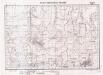
Lambert-Cholesky sheet 2056 (Scăiuş)
1 : 20000 Romanian military topographic map sheet under Lambert-Cholensky projection Serviciul Geografic al Armatei geo-spatial.org Serviciul Geografic al Armatei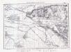
Lambert-Cholesky sheet 2058 (Ţipari)
1 : 20000 Romanian military topographic map sheet under Lambert-Cholensky projection Institutul Geografic Militar geo-spatial.org Institutul Geografic Militar
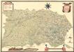
Tekintetes Temes vármegye térképe
Temešvár (Rumunsko) Györy, Lajos Beichel, J.
Übersicht-Karte von der südlichen größeren Hälfte des Temesvarer Banat's
1 : 230000 Banát Petrovics, Paul k. k. Generalquartiermeistabes
C. Temesiensis
Rumänien Komitat Temesvár
Plan der Angriffsarbeiten gegen die Festung Temesvár im Jahre 1849
1 : 14000 Temešvár (Rumunsko)
Gattaja und Dognacska.
from Spezialkarte der osterreichisch-ungarischen Monarchie.
Otelek und Szephely.
from Spezialkarte der osterreichisch-ungarischen Monarchie.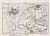
Lambert-Cholesky sheet 1756 (Jebel)
1 : 20000 Romanian military topographic map sheet under Lambert-Cholensky projection Direcția Topografică Militară geo-spatial.org Direcția Topografică Militară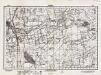
Lambert-Cholesky sheet 1757 (Pădureni)
1 : 20000 Romanian military topographic map sheet under Lambert-Cholensky projection Direcția Topografică Militară geo-spatial.org Direcția Topografică Militară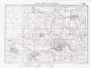
Lambert-Cholesky sheet 1955 (Ramna)
1 : 20000 Romanian military topographic map sheet under Lambert-Cholensky projection Direcția Topografică Militară geo-spatial.org Direcția Topografică Militară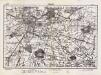
Lambert-Cholesky sheet 1758 (Timişoara)
1 : 20000 Romanian military topographic map sheet under Lambert-Cholensky projection Direcția Topografică Militară geo-spatial.org Direcția Topografică Militară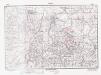
Lambert-Cholesky sheet 2055 (Fârliug)
1 : 20000 Romanian military topographic map sheet under Lambert-Cholensky projection Direcția Topografică Militară geo-spatial.org Direcția Topografică Militară

Übersichts-Karte von der südlichen und grösseren Hälfte des Temesvarer Banat's
1 : 230000 Banát Petrovics, Paul Sollinger, Johann Paul
C. Krassó
Rumänien Komitat Caraşova
Generalkarte von Zentraleuropa

Krassó - Szörény Vármegye
Mappa Der Grenz Scheidung Des Banat Temeswar Von Anno 1749 Mit Den Türken Geschlosen Von Herren General Feldmarschaů Lieutinont Freiheren Frantz Von Engelshofen A. 1749
Mollova mapová sbírka Geyer