Maps of Dávod

Zombor.
from Spezialkarte der osterreichisch-ungarischen Monarchie.
Zombor
1 : 75000 Sombor, Wojwodina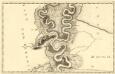
Sectio. IX Mohács - Vrangos
Mollova mapová sbírka Marsili, Luigi Ferdinando
Apatin und Erdut.
from Spezialkarte der osterreichisch-ungarischen Monarchie.
Baja.
from Spezialkarte der osterreichisch-ungarischen Monarchie.
Mohacs und Villany.
from Spezialkarte der osterreichisch-ungarischen Monarchie.
Apatin
1 : 75000 Apatin, Wojwodina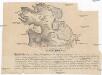
Mohácsiütközet terve
Mohács (Maďarsko)
C. Bacsiensis
Ungarn Komitat Bács-Bodrog

Subotica
1 : 200000 Subotica (Srbsko) Kartografska radionica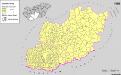
Serben in Süd-Transdanubien und im Komitat Bács-Kiskun 1980
Transdanubien (Süd), Bács-Kiskun, Serben, Siedlung Bottlik, Zsolt
Bács-Bodrog vármegye térképe
1 : 450000 Kogutowicz, Manó Magyar Földrajzi Intézet
A Dunavölgy Átnézeti Térképe, Carte d ́ensemble del la Vallée du Danube XIX.
Charte von dem Kanal Franz des zweiten: Nach M. Votésky's Reduction von Ant. Quits Charte der Bácser Gespanschaft
1 : 510000 Landes-Industrie-Comptoir
Baranya vármegye térképe
1 : 385000 Baranya (Maďarsko : župa) Kogutowicz, Manó Magyar Földrajzi Intézet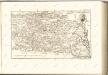
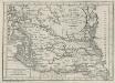
C. Baranyiensis
Ungarn Komitat Baranya
Comitat Baranya
1 : 290000 Baranya (Maďarsko : župa)
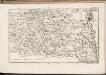
Comitat Baranya
1 : 288000 Baranya (Maďarsko : župa)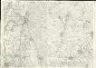
Baja
1 : 75000 Baja
Bajmok
1 : 75000 Bajmok, Wojwodina
Plan der Bergwerg fekete Patak und Berznye
Mollova mapová sbírka Geyer
Bajmok und Bacs-Topolya.; Spezialkarte der osterreichisch-ungarischen Monarchie.
from Spezialkarte der osterreichisch-ungarischen Monarchie. Austro-Hungarian Monarchy. Militärgeographisches Institut.,
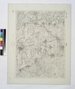
Mohács
1 : 75000 Mohács
Uj-[Neu]-Verbasz.
from Spezialkarte der osterreichisch-ungarischen Monarchie.
Bataszek und Pecsvarad.
from Spezialkarte der osterreichisch-ungarischen Monarchie.
Umgebung von Esseg
1 : 75000 Osijek (Chorvatsko) K. u. K. Militärgeographisches Institut
Schlacht b. Mohacs 1526
Mohács Schlacht bei Mohács <1526>