Maps of Schio

Rovereto und Riva.
from Spezialkarte der osterreichisch-ungarischen Monarchie.
Zone 22, Col. IV, Rovereto und Riva, uit: Geologische Karte der im Reichsrathe vertretenen Königreiche und Länder der Österreich-Ungarischen Monarchie : auf Grundlage der Specialkarte i.M. 1:75.000 des k.u.k. Militär-geographischen Institutes / neu bearb. und als Kartenwerk von 341 Blattnummern in zwanglosen Lfg. hrsg. durch die k.k. Geologische Reichsanstalt in Wien
1 : 75000 titelvariant: Geologische Spezialkarte der im Reichsrate vertretenen Königreiche und Länder der Österreichisch-Ungarischen Monarchie; Geologische Specialkarte der im Reichsrathe vertretenen Königreiche und Länder der Österreichisch-Ungarischen Monarchie; Annotatie: Titel bovenaan kaartblad: Geologische Spezialkarte der im Reichsrate vertretenen Königreiche und Länder der Österreichisch-Ungarischen Monarchie en Geologische Specialkarte der im Reichsrathe vertretenen Königreiche und Länder der Österreichisch-Ungarischen Monarchie; Annotatie geografische gegevens: Coördinaten gebaseerd op nulmeridiaan van Ferro (Hierro) Kaiserlich-Königliche Geologische Reichsanstalt, Wenen Wien : K.K. Geologische Reichsanstalt
Rovereto und Riva
1 : 75000 Riva del Garda (Itálie) Leitner, G. Kriegsmappierungsabteilung No. 14
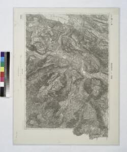
Pedescala
1 : 10000 Benátsko (Itálie)
M. Civello, Italy
1 : 10000 M. Civello, Italy. From a collection of maps of the theatre of war in Italy, 1917-18. War Office
Albaredo, Italy: enemy trenches corrected to 28.8.18.
1 : 10000 Albaredo, Italy. Enemy trenches corrected to 28.8.18. From a collection of maps of the theatre of war in Italy, 1917-18. War Office
Albaredo, Italy: enemy trenches corrected to 1.6.18.
1 : 10000 Albaredo, Italy. Enemy trenches corrected to 1.6.18. From a collection of maps of the theatre of war in Italy, 1917-18. War Office
Mt. Pau
1 : 10000 Benátsko (Itálie) Kriegsvermessung Nr. 11.
Arsiero, Italy
1 : 25000 Arsiero, Italy. From a collection of maps of the theatre of war in Italy, 1917-18. War Office
Rotzo, Italy
1 : 25000 Rotzo, Italy. From a collection of maps of the theatre of war in Italy, 1917-18. War Office
Arsiero, Italy 9th April 1918
1 : 25000 Arsiero, Italy 9th April 1918. From a collection of maps of the theatre of war in Italy, 1917-18. War Office
Monte Verena, Italy
1 : 25000 Monte Verena, Italy. From a collection of maps of the theatre of war in Italy, 1917-18. War Office
Mezzaselva, Italy
1 : 10000 Mezzaselva, Italy. Enemy trenches corrected to 10.5.18. From a collection of maps of the theatre of war in Italy, 1917-18. War Office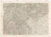
[Rivereto, Vicenza und Umgebung]
1 : 75000 K. u. k. Militärgeographisches Institut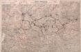
Italy: Trentino Orientale
Trentino Orientale: Enemy's organisation affecting British front. May 1918. From a collection of maps of the theatre of war in Italy, 1917-18. War Office
La Territoire de Vicenza Ou sont marquées toutes les Vallees Cols, Passages et Mines d'Argent. Qui sont dans les Montagnes qui separent ce Pays de Léveché de Trente
1 : 370000 Mollova mapová sbírka Nolin, Jean-Baptiste Nolin, Jean Baptiste
Diocesi Padovana con tutta la sua Estensione ne Vicini Territori
1 : 150000 Mollova mapová sbírka Clarici, Paolo Bartolommeo
Trient mit der Gegend
1 : 160000 Trident (Itálie : provincie) Bodenehr, Gabriel
Trient.
from Spezialkarte der osterreichisch-ungarischen Monarchie.
Avio und Valdagno.
from Spezialkarte der osterreichisch-ungarischen Monarchie.
Zone 21, Col. IV, Trient, uit: Geologische Karte der im Reichsrathe vertretenen Königreiche und Länder der Österreich-Ungarischen Monarchie : auf Grundlage der Specialkarte i.M. 1:75.000 des k.u.k. Militär-geographischen Institutes / neu bearb. und als Kartenwerk von 341 Blattnummern in zwanglosen Lfg. hrsg. durch die k.k. Geologische Reichsanstalt in Wien
1 : 75000 titelvariant: Geologische Spezialkarte der im Reichsrate vertretenen Königreiche und Länder der Österreichisch-Ungarischen Monarchie; Geologische Specialkarte der im Reichsrathe vertretenen Königreiche und Länder der Österreichisch-Ungarischen Monarchie; Annotatie: Titel bovenaan kaartblad: Geologische Spezialkarte der im Reichsrate vertretenen Königreiche und Länder der Österreichisch-Ungarischen Monarchie en Geologische Specialkarte der im Reichsrathe vertretenen Königreiche und Länder der Österreichisch-Ungarischen Monarchie; Annotatie geografische gegevens: Coördinaten gebaseerd op nulmeridiaan van Ferro (Hierro) Kaiserlich-Königliche Geologische Reichsanstalt, Wenen Wien : K.K. Geologische Reichsanstalt
Val D'Assa, Italy: May 9th 1918
1 : 25000 Val D'Assa, Italy: May 9th 1918. From a collection of maps of the theatre of war in Italy, 1917-18. War Office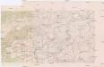
Cesuna
1 : 10000 Benátsko (Itálie) Kriegsvermessung Nr. 11.
[Gradkartenblatt]
1 : 25000 Benátsko (Itálie) Militärgeographisches Institut
Val D'Assa, Italy: June 10th 1918
1 : 25000 Val D'Assa, Italy. June 10th 1918. From a collection of maps of the theatre of war in Italy, 1917-18. War Office
Val D'Assa, Italy: June 25th 1918
1 : 25000 Val D'Assa, Italy. June 25th 1918. From a collection of maps of the theatre of war in Italy, 1917-18. War Office
Val D'Assa, Italy: July 9th 1918
1 : 25000 Val D'Assa, Italy. July 9th 1918. From a collection of maps of the theatre of war in Italy, 1917-18. War Office
Val D'Assa, Italy: August 30th 1918
1 : 25000 Val D'Assa, Italy: August 12th 1918. From a collection of maps of the theatre of war in Italy, 1917-18. War Office
Val D'Assa, Italy: August 12th 1918
1 : 25000 Val D'Assa, Italy: August 12th 1918. From a collection of maps of the theatre of war in Italy, 1917-18. War Office