Maps of Ljubljana

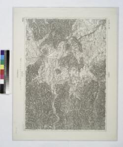
Laibach.
from Spezialkarte der osterreichisch-ungarischen Monarchie.
Yugoslavia 1:100,000, Ljubljana
Yugoslavia 1:100,000 , Series GSGS 4396. Great Britain. War Office. [London] : War Office
Laibach
1 : 75000 Ljubljana
Die Kulturlandinseln (Rodungsinseln) des Plateaus von Ulrichsberg, von St. Leonhard u. St. Ambrosi
Oberkrain Siedlungsform
Inselhafte Waldverbreitung in der Ebenen-Gemeinde Michelstetten am Südrand der Steiner Alpen
Steiner Alpen, Velesovo, Siedlungsform
Laibach

Übergang von der Einöd- zur Blockflur im Tertiärhügelland von Stein bei Koschische, verbunden mit Gehöftgruppensiedlung
Oberkrain, Kamnik, Flurform
Grundriss der Haupt-Stadt Laibach im Königreiche Illyrien
Deschmann, Franz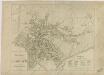
Grundriss der Haupt-Stadt Laibach

Plan der Stadt Laibach

Stockwerkförmige Anordnung des Kultur- und Siedlungslandes am Nordhang des Tschernatals
Oberkrain, Steiner Alpen, Siedlungsform
Kulturlandbucht mit den Keuschlerdörfern Adergaß und Trata, sowie dem ehemaligen Kloster Michelstetten (Frauenthal)
Oberkrain, Velesovo, Siedlungsform
Olscheuk (Olševek)
Oberkrain Siedlungsform
Einödblöckeflur mit Gehöftgruppensiedlung im Tertiärhügelland von Stein
Oberkrain, Kamnik, Siedlungsform
Haufendorf Supainenive (Županje njive), mit Blockflur teilweise streifenartig entwickelt
Oberkrain Siedlungsform
Übergang von gewannartiger Streifenflur zur echten Blockflur in den Rieden Raune u. Fuschine der Gemeinde Koschische
Oberkrain, Kamnik, Flurform
Die Gebirgsgemeinde Tscherna mit vorherrschenden Streusiedlungen
Oberkrain, Steiner Alpen, Siedlungsform
Ljubljana
1 : 200000 Lublaň (Slovinsko : oblast) Kartografska radionica
Ducatus Carnioliae Tabula Chorographica Iusu Sumptuque inclytorum Provinciae Statuum.
1 : 100000 Mollova mapová sbírka Florjančič de Grienfeld, Janez Dizma
Weixelburg und Zirknitz.
from Spezialkarte der osterreichisch-ungarischen Monarchie.
Ducatus Carnioliae Tabula Chorographica Iusu Sumptuque inclytorum Provinciae Statuum.
1 : 100000 Mollova mapová sbírka Florjančič de Grienfeld, Janez Dizma
Eisenkappel und Kanker.
from Spezialkarte der osterreichisch-ungarischen Monarchie.
Bischoflack und Idria.
from Spezialkarte der osterreichisch-ungarischen Monarchie.
Cilli und Ratschach.
from Spezialkarte der osterreichisch-ungarischen Monarchie.
Italy 1:100,000 / Sardinia 1:100,000, Idria
Italy 1:100,000 / Sardinia 1:100,000 , Series GSGS 4164. Great Britain. War Office. General Staff. Geographical Section. [London] : War Office
Die Flurformen des südlichen Jauntals, der nördlichen oberkrainischen Ebene, sowie der Steiner Alpen und Ost Karawanken, n.d. Franziszeischen Kataster 1825-1828
1 : 115200 Oberkrain Landschaftsgliederung, Flurform
Weixelburg (?)
1 : 75000 Višnja Gora
Hochgebirgsgemeinde im Quellgebiet der Steiner Feistritz
Oberkrain, Steiner Alpen, Siedlungsform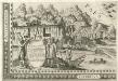
Stÿriae Ducatus Fertilisimi Nova Geographica Descriptio
1 : 200000 Mollova mapová sbírka Vischer, Georg Matthaeus Trost, Andreas