Maps of Tótkomlós

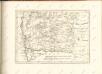
Foldeak und Mezohegyes.; Spezialkarte der osterreichisch-ungarischen Monarchie.
from Spezialkarte der osterreichisch-ungarischen Monarchie. Austro-Hungarian Monarchy. Militärgeographisches Institut.,
Földeák
1 : 75000 Komitat Csongrád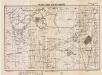
Lambert-Cholesky sheet 1464 (Csanad Palota)
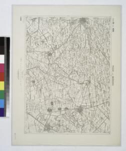
1 : 20000 Romanian military topographic map sheet under Lambert-Cholensky projection Serviciul Geografic al Armatei geo-spatial.org Serviciul Geografic al Armatei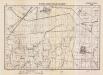
Lambert-Cholesky sheet 1564 (Nemet-Pereg)
1 : 20000 Romanian military topographic map sheet under Lambert-Cholensky projection Serviciul Geografic al Armatei geo-spatial.org Serviciul Geografic al Armatei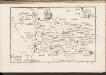
C. Csanád
Ungarn Csanád (Megye)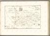
C. Csongrád
Ungarn Komitat Csongrád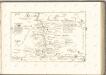

C. Békés
Ungarn Komitat Békés
Comitat Békés Csanád
1 : 290000
Comitat Békés Csanád
1 : 288000
Segedin
1 : 200000 Szeged (Maďarsko) Kartografska radionica
Csaba 164, uit: Special-Karte von Mittel-Europa / nach amtlichen Quellen bearbeitet von W. Liebenow
1 : 300000 titelvariant: W. Liebenow's Mittel-Europa; Annotatie: Titel boven de bladen: W. Liebenow's Mittel-Europa Johannes Wilhelm Liebenow 1822-1897 Frankfurt a. M. : Ludwig Ravenstein
Oroshaza.
from Spezialkarte der osterreichisch-ungarischen Monarchie.
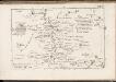
Kistelek und Szeged.
from Spezialkarte der osterreichisch-ungarischen Monarchie.
Serben in der Südlichen Tiefebene 1980
Großes Ungarisches Tiefland (Süd) Serben, Siedlung Bottlik, Zsolt
Generalkarte von Zentraleuropa

Serben in der Südlichen Tiefebene 1941
Großes Ungarisches Tiefland (Süd) Serben, Siedlung Bottlik, Zsolt
A szerbek aránya és száma a Dél-Alföldön 1880-ban
Großes Ungarisches Tiefland (Süd) Serben, Siedlung Bottlik, Zsolt
Serben in der Südlichen Tiefebene 1880
Großes Ungarisches Tiefland (Süd) Serben, Siedlung Bottlik, Zsolt
A szerbek aránya és száma a Dél-Alföldön 1941-ben
Großes Ungarisches Tiefland (Süd) Serben, Siedlung Bottlik, Zsolt
A szerbek aránya és száma a Dél-Alföldön 1980-ban
Großes Ungarisches Tiefland (Süd) Serben, Siedlung Bottlik, Zsolt
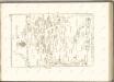
Plan von Bergwerg Laposneck
Mollova mapová sbírka Geyer
Pesth-Solter, Csongráder, Szolnoker Comitat und das Ober Capitanat von Jazygien und Cumanien
1 : 280000 Budapešť-oblast (Maďarsko)
Plan des Bergwergs zu Lupkovo
Mollova mapová sbírka Geyer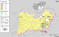
Siedlungsgebiet der Slowaken nach dem Nachbarschaftsindex für die Südliche Tiefebene 1880
Ungarn (Süd) Slowaken, Siedlung Bottlik, Zsolt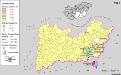
Siedlungsgebiet der Slowaken nach dem Nachbarschaftsindex für die Südliche Tiefebene 1941
Ungarn (Süd) Slowaken, Siedlung Bottlik, Zsolt
A szlovákok településterülete a szomszédsági mutató alapján Dél-Alföldön 1880-ban
Ungarn (Süd) Slowaken, Siedlung Bottlik, Zsolt