Maps of Kiskunhalasi járás

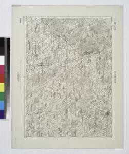
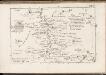
Kis-Kun-Halas.
from Spezialkarte der osterreichisch-ungarischen Monarchie.
Kis-Kun-Halas
1 : 75000 Kiskunhalas, Bács-Kiskun
A Dunavölgy Átnézeti Térképe, Carte d ́ensemble del la Vallée du Danube XVI.

Kistelek und Szeged.
from Spezialkarte der osterreichisch-ungarischen Monarchie.
Hajos.
from Spezialkarte der osterreichisch-ungarischen Monarchie.
Maria-Theresiopel
1 : 75000 Subotica, Wojwodina
Maria-Theresiopel.; Spezialkarte der osterreichisch-ungarischen Monarchie.
from Spezialkarte der osterreichisch-ungarischen Monarchie. Austro-Hungarian Monarchy. Militärgeographisches Institut.,
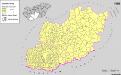
Siedlungsgebiet der Deutschen nach dem Nachbarschaftsindex für das Komitat Bács-Kiskun 1980
Bács-Kiskun Deutsche, Siedlung Bottlik, Zsolt
Kroaten im Komitat Bács-Kiskun 1980
Bács-Kiskun Kroaten, Siedlung Bottlik, Zsolt
Siedlungsgebiet der Deutschen nach dem Nachbarschaftsindex für das Komitat Bács-Kiskun 1880
Bács-Kiskun Deutsche, Siedlung Bottlik, Zsolt
Kroaten im Komitat Bács-Kiskun 1880
Bács-Kiskun Kroaten, Siedlung Bottlik, Zsolt
Generalkarte von Zentraleuropa

Siedlungsgebiet der Deutschen nach dem Nachbarschaftsindex für das Komitat Bács-Kiskun 1941
Bács-Kiskun Deutsche, Siedlung Bottlik, Zsolt
A horvátok aránya és száma Bács-Kiskun megyében 1880-ban
Bács-Kiskun Kroaten, Siedlung Bottlik, Zsolt
Kroaten im Komitat Bács-Kiskun 1941
Bács-Kiskun Kroaten, Siedlung Bottlik, Zsolt
A horvátok aránya és száma Bács-Kiskun megyében 1941-ben
Bács-Kiskun Kroaten, Siedlung Bottlik, Zsolt
A horvátok aránya és száma Bács-Kiskun megyében 1980-ban
Bács-Kiskun Kroaten, Siedlung Bottlik, Zsolt
A németek településterülete a szomszédsági mutató alapján Bács-Kiskun megyében 1980-ban
Bács-Kiskun Deutsche, Siedlung Bottlik, Zsolt
A németek településterülete a szomszédsági mutató alapján Bács-Kiskun megyében 1880-ban
Bács-Kiskun Deutsche, Siedlung Bottlik, Zsolt
A németek településterülete a szomszédsági mutató alapján Bács-Kiskun megyében 1941-ban
Bács-Kiskun Deutsche, Siedlung Bottlik, Zsolt
Pest-Pilis-Solt-Kiskun vármegye
1 : 500000 Budapešť (Maďarsko : oblast) Kogutowicz, Manó Magyar Földrajzi Intézet
C. Bacsiensis
Ungarn Komitat Bács-Bodrog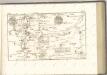
Serben in Süd-Transdanubien und im Komitat Bács-Kiskun 1980
Transdanubien (Süd), Bács-Kiskun, Serben, Siedlung Bottlik, Zsolt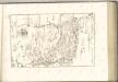
C. Csongrád
Ungarn Komitat Csongrád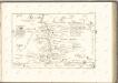

Bács-Bodrog vármegye térképe
1 : 450000 Kogutowicz, Manó Magyar Földrajzi Intézet
Subotica
1 : 200000 Subotica (Srbsko) Kartografska radionica