Maps of Cluj-Napoca

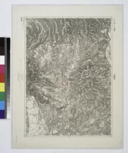
Torda.
from Spezialkarte der osterreichisch-ungarischen Monarchie.
Torda
1 : 75000 Turda, Turda (Region)
Lambert-Cholesky sheet 2869 (Gilău)
1 : 20000 Romanian military topographic map sheet under Lambert-Cholensky projection Direcția Topografică Militară geo-spatial.org Direcția Topografică Militară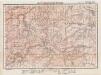
Lambert-Cholesky sheet 2868 (Muntele Rece)
1 : 20000 Romanian military topographic map sheet under Lambert-Cholensky projection Institutul Geografic Militar geo-spatial.org Institutul Geografic Militar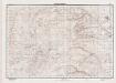
Lambert-Cholesky sheet 2867 (Muntele Băișorii)
1 : 20000 Romanian military topographic map sheet under Lambert-Cholensky projection Direcția Topografică Militară geo-spatial.org Direcția Topografică Militară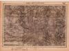
Lambert-Cholesky sheet 2866 (Runc)
1 : 20000 Romanian military topographic map sheet under Lambert-Cholensky projection Serviciul Geografic al Armatei geo-spatial.org Serviciul Geografic al Armatei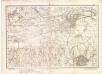
Lambert-Cholesky sheet 2969 (Cluj)
1 : 20000 Romanian military topographic map sheet under Lambert-Cholensky projection Direcția Topografică Militară geo-spatial.org Direcția Topografică Militară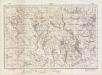
Lambert-Cholesky sheet 2968 (Sălicea)
1 : 20000 Romanian military topographic map sheet under Lambert-Cholensky projection Direcția Topografică Militară geo-spatial.org Direcția Topografică Militară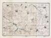
Lambert-Cholesky sheet 2967 (Iara)
1 : 20000 Romanian military topographic map sheet under Lambert-Cholensky projection Direcția Topografică Militară geo-spatial.org Direcția Topografică Militară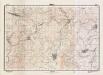
Lambert-Cholesky sheet 2966 (Rimetea )
1 : 20000 Romanian military topographic map sheet under Lambert-Cholensky projection Direcția Topografică Militară geo-spatial.org Direcția Topografică Militară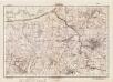
Lambert-Cholesky sheet 3069 (Cojocna)
1 : 20000 Romanian military topographic map sheet under Lambert-Cholensky projection Direcția Topografică Militară geo-spatial.org Direcția Topografică Militară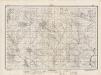
Lambert-Cholesky sheet 3068 (Aiton )
1 : 20000 Romanian military topographic map sheet under Lambert-Cholensky projection Direcția Topografică Militară geo-spatial.org Direcția Topografică Militară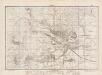
Lambert-Cholesky sheet 3067 (Turda)
1 : 20000 Romanian military topographic map sheet under Lambert-Cholensky projection Direcția Topografică Militară geo-spatial.org Direcția Topografică Militară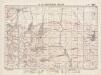
Lambert-Cholesky sheet 3066 (Bădeni)
1 : 20000 Romanian military topographic map sheet under Lambert-Cholensky projection Direcția Topografică Militară geo-spatial.org Direcția Topografică Militară
Nagy-Enyed.
from Spezialkarte der osterreichisch-ungarischen Monarchie.
Kolozsvar [Klausenburg].
from Spezialkarte der osterreichisch-ungarischen Monarchie.
Nagy-Enyed
1 : 75000 Aiud, Judeţ Klausenburg
Lambert-Cholesky sheet 3169 (Suatul)
1 : 20000 Romanian military topographic map sheet under Lambert-Cholensky projection Direcția Topografică Militară geo-spatial.org Direcția Topografică Militară
Lambert-Cholesky sheet 3168 (Ceanul Mare)
1 : 20000 Romanian military topographic map sheet under Lambert-Cholensky projection Direcția Topografică Militară geo-spatial.org Direcția Topografică Militară
Lambert-Cholesky sheet 3167 (Câmpia Turzii)
1 : 20000 Romanian military topographic map sheet under Lambert-Cholensky projection Direcția Topografică Militară geo-spatial.org Direcția Topografică Militară
Lambert-Cholesky sheet 3166 (Luncani)
1 : 20000 Romanian military topographic map sheet under Lambert-Cholensky projection Direcția Topografică Militară geo-spatial.org Direcția Topografică Militară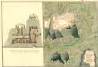
Plan des Bergwergs Weres Patack
Mollova mapová sbírka Geyer
Transilvania
Mollova mapová sbírka Hoffmann, Johannes Hoffmann, Johann
Vermehrte und Verbesserte Landkarten des Königreichs Ungarn :
1 : 500000 Mollova mapová sbírka Stier, Martin Böner, Johann-Alexander Endter, Martin
Siebenbürgen
1 : 600000 Siebenbürgen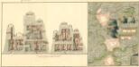
Plan deren Bergwerg Nagiay: i Offi und Bedas
Mollova mapová sbírka Geyer
Gyeres.
from Spezialkarte der osterreichisch-ungarischen Monarchie.
Magura.
from Spezialkarte der osterreichisch-ungarischen Monarchie.
Klausenburg
1 : 75000 Cluj-Napoca
Plan sraženija pri selenii Bojlešti 14go sentjabra 1828go goda
1 : 56000