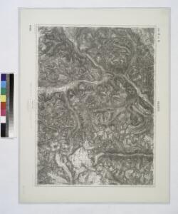
Maps of Pfunds

Nauders.
from Spezialkarte der osterreichisch-ungarischen Monarchie.
Oetzthal & Stubai
1 : 50000 Südost-Blatt Simon, Simon Deutscher u. Oesterreichischer Alpen-Verein
Oetzthal & Stubai

Skiroutenkarte der Ötztaler Alpen
1 : 50000 Ötztalské Alpy (Itálie a Rakousko : pohoří) Kuntscher, Karl Artaria
Glockthurm
1 : 50000 Východní Alpy (pohoří) Haushofer, Karl Hoffmann, Carl J. Lindauer'sche Buchhandlung
Glockthurm
1 : 50000 Východní Alpy (pohoří) Haushofer, Karl Hoffmann, Carl Deutscher und Oesterreichischer Alpenverein
Karte der centralen Ötzthalergruppe
1 : 50000 Ötztalské Alpy (Itálie a Rakousko : pohoří) Haushofer, Karl Hoffmann, Carl Deutscher und Oesterreichischer Alpenverein
Wildspitze
1 : 50000 Východní Alpy (pohoří) Haushofer, Karl Hoffmann, Carl J. Lindauer'sche Buchhandlung
Wildspitze
1 : 50000 Východní Alpy (pohoří) Haushofer, Karl Hoffmann, Carl Deutscher und Oesterreichischer Alpenverein
Similaun
1 : 50000 Východní Alpy (pohoří) Haushofer, Karl Hoffmann, Carl J. Lindauer'sche Buchhandlung
Similaun
1 : 50000 Východní Alpy (pohoří) Haushofer, Karl Hoffmann, Carl Deutscher und Oesterreichischer Alpenverein
Weisskugel
1 : 50000 Východní Alpy (pohoří) Haushofer, Karl Hoffmann, Carl Deutscher und Oesterreichischer Alpenverein
Weisskugel
1 : 50000 Východní Alpy (pohoří) Haushofer, Karl Hoffmann, Carl J. Lindauer'sche Buchhandlung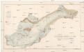
Der Hintereis-Ferner im Jahre 1894
1 : 10000 Ötztalské Alpy (Itálie a Rakousko : pohoří) Blümcke, Adolf Hess, Hans Deutscher und Österreichischer Alpenverein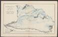
Der Hochjochferner im Jahre 1893
1 : 20000 Blümcke, A. ; Hess, H. [Lindauer]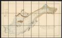
Der Hintereis-Ferner im Jahre 1894
1 : 10000 Blümcke, A. ; Hess, H. Deutscher und Oesterr. Alpenverein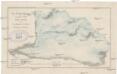
Der Hochjochferner im Jahre 1893
1 : 20000 Ötztalské Alpy (Itálie a Rakousko : pohoří) Blümcke, Adolf Hess, Hans Deutscher und Österreichischer Alpenverein
Wandkarte der Schweiz
1 : 200000 1 Karte auf 8 Blättern J.M. Ziegler Wurster, Winterthur
Uebersichts-Karte des Oetzthaler Gletscher-Gebietes
1 : 144000 Sonklar von Innstädten, Carl ; Berghaus, Hermann Justus Perthes
Uebersichtskarte des Oetzthaler Gletscher-Gebietes
1 : 144000 Ötztalské Alpy (Itálie a Rakousko : pohoří) Berghaus, Hermann Sonklar, Karl von Justus Perthes
Nördl. Oetzthaler- und Stubaier Alpen, Nordwest. Kalkalpen
1 : 130000 Alpy rakouské (pohoří) Maschek, R. Meuer, Julius Artaria
Karte des Unter-Engadins
1 : 50000 1 Karte auf 2 Blättern bearbeitet von J.M. Ziegler ; Stich & Druck der Topogr. Anstalt v. Wurster, Randegger & Co. Topogr. Anstalt v. Wurster, Randegger & Co., Winterthur
Geologische Karte des Unter-Engadin
1 : 150000 Theobald, Gottfried Ludwig Topogr. Anstalt v. Wurster, Randegger & Co.
Glurns und Ortler.
from Spezialkarte der osterreichisch-ungarischen Monarchie.
Reduzirte Karte des Unter-Engadin
1 : 150000 1 Karte Topogr. Anstalt v. Wurster, Randegger & Cie., Winterthur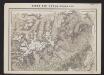
Karte des Unter-Engadins
1 : 50000 Nord-Blatt Ziegler, Jakob Melchior Topogr. Anstalt v. Wurster, Randegger & Co.
Skiroutenkarte der Ötztaler Alpen
1 : 50000 Ötztalské Alpy (Itálie a Rakousko : pohoří) Kuntscher, Karl Artaria
Landeck.
from Spezialkarte der osterreichisch-ungarischen Monarchie.
Solden und St. Leonhard (Tirol).
from Spezialkarte der osterreichisch-ungarischen Monarchie.