Maps of Miskolci járás

Miskolcz.
from Spezialkarte der osterreichisch-ungarischen Monarchie.
Miskolcz
1 : 75000 Miskolc, Umland Geripp: J. Mulač. Terrain: Wachtmeister Rudolf Palitschek v. Palmforst
Miskolcz
1 : 75000 Maďarsko Mulač, J. K. u. k. Militärgeographisches Institut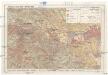
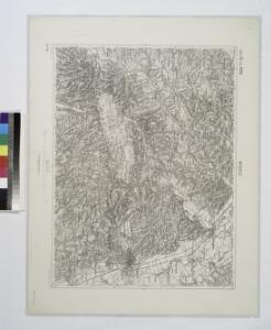
Miskolc - Lillafüred - Tapolcafürdo
1 : 50000 M. Kir. Állami Térképészet
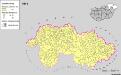
Borsod vármegye
1 : 410000 Görög, Demeter Biller, Bernhard Görög
Erlau und Mezo-Keresztes..
from Spezialkarte der osterreichisch-ungarischen Monarchie.
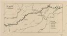
Szendro und Putnok (Ungarn).
from Spezialkarte der osterreichisch-ungarischen Monarchie.
Szikszo und Tisza-Dob.
from Spezialkarte der osterreichisch-ungarischen Monarchie.
Arlo und K.Terenne (Ungarn).
from Spezialkarte der osterreichisch-ungarischen Monarchie.
Erlau und Mező-Keresztes
1 : 75000 Eger (Komitat Heves), Umland Geripp: Offic. Scherling
III. vojenské mapování 4764/2
1 : 25000
[Gradkartenblatt]
1 : 25000 Slovensko
III. vojenské mapování 4665/3
1 : 25000
[Mapový list]
1 : 25000 Slovensko Vojenský zeměpisný ústav
Borsoder Comitat
1 : 288000
Borsoder Comitat
1 : 288000
C. Borsodiensis
Ungarn Komitat Borsod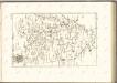
Neubertova generální automapa Republiky československé
1 : 200000 Debrecín (Maďarsko : oblast) Soukup, Jan V. Neubert a synové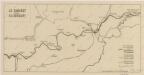
Sbírka map a diagramů použitých na mírových konferencích v Paříži v letech 1919 - 1920
Sbírka map a diagramů použitých na mírových konferencích v Paříži v letech 1919 - 1920
Siedlungsgebiet der Slowaken nach dem Nachbarschaftsindex für Nordost-Ungarn 1941
Ungarn (Nordost) Slowaken, Siedlung Bottlik, Zsolt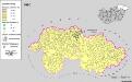
Siedlungsgebiet der Slowaken nach dem Nachbarschaftsindex für Nordost-Ungarn 1980
Ungarn (Nordost) Slowaken, Siedlung Bottlik, Zsolt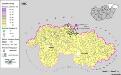
Siedlungsgebiet der Slowaken nach dem Nachbarschaftsindex für Nordost-Ungarn 1880
Ungarn (Nordost) Slowaken, Siedlung Bottlik, Zsolt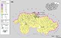
A szlovákok településterülete a szomszédsági mutató alapján Északkelet-Magyarországon 1880-ban
Ungarn (Nordost) Slowaken, Siedlung Bottlik, Zsolt
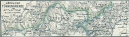
Nördliche Türkengrenze im 16ten u. 17ten Jhdt.
1 : 1850000 Osmanisches Reich / Europäischer Teil Grenze
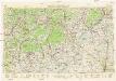
Comitat Abaúj-Torna
1 : 290000 Košice (Slovensko : oblast)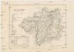
Comitat Abaúj-Torna
1 : 288000 Košice-oblast jižní (Slovensko)