Maps of District of Nitra

Neutra.
from Spezialkarte der osterreichisch-ungarischen Monarchie.
Manöver-Terrain bei Freystadtl [sic] (Galgóc)
1 : 75000 Nitra (Slovensko : oblast) K. u. k. militär-geographisches Institut
Nitra
1 : 75000 Nitra-oblast (Slovensko) Vojenský zeměpisný ústav
Nitra
1 : 75000 Nitra (Slovensko : oblast) Vojenský zeměpisný ústav
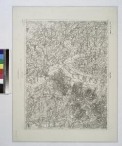
III. vojenské mapování 4660
1 : 75000
Nitra a okolí
1 : 75000 Nitra (Slovensko : oblast) Vojenský zeměpisný ústav
Nitra
1 : 75000 Nitra (Slovensko : oblast) Kartografické odd. při Min. nár. obrany
Nitra
1 : 75000 Nitra (Slovensko : oblast) Kartografické odd. při Min. nár. obrany
III. vojenské mapování 4660/2
1 : 25000
III. vojenské mapování 4660/1
1 : 25000
III. vojenské mapování 4660/3
1 : 25000
III. vojenské mapování 4660/4
1 : 25000
III. vojenské mapování 4760/1
1 : 25000
III. vojenské mapování 4760/2
1 : 25000
Sellye und Nagy-Surany.
from Spezialkarte der osterreichisch-ungarischen Monarchie.
Nyitra-Zsambokret und Pistyan-Teplitz.
from Spezialkarte der osterreichisch-ungarischen Monarchie.
Tyrnau.
from Spezialkarte der osterreichisch-ungarischen Monarchie.
Konigsberg und Szt. Beneder.
from Spezialkarte der osterreichisch-ungarischen Monarchie.
Šurany
1 : 75000 Slovensko Vojenský zeměpisný ústav
Šurany
1 : 75000 Slovensko Vojenský zeměpisný ústav
Zone 13, Kol. XVIII, Umgebung von Vágsellye und Nagysurány, uit: [Geologische Specialkarte der im Reichsrathe vertretenen Königreiche und Länder der österreichisch-ungarischen Monarchie] / geologische Aufnahmen der königl. ung. Geologischen Anstalt
1 : 75000 Annotatie: Verantwoordelijkheidsvermelding in 1909 veranderd in: Königliche Ungarische Geologische Reichsanstalt; Sommige bladen in het Frans; Annotatie geografische gegevens: Coördinaten gebaseerd op nulmeridiaan van Ferro (Hierro) Königliche Ungarische Geologische Reichsanstalt; Königliche Ungarische Geologische Anstalt Budapest : [Königliche Ungarische Geologische Anstalt]
III. vojenské mapování 4760
1 : 75000
Pöstyén u. Umgebung

III. vojenské mapování 4659/2
1 : 25000
III. vojenské mapování 4659/4
1 : 25000
III. vojenské mapování 4560/3
1 : 25000
III. vojenské mapování 4560/4
1 : 25000
III. vojenské mapování 4661/1
1 : 25000
III. vojenské mapování 4661/3
1 : 25000