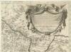
Maps of Ternopil Raion

Tarnopol.
from Spezialkarte der osterreichisch-ungarischen Monarchie.
Tarnopol
1 : 75000 Ukrajina Ginzkey, K. K. u. k. Militärgeographisches Institut

Zalozce.
from Spezialkarte der osterreichisch-ungarischen Monarchie.
Trembowla (Galizien).
from Spezialkarte der osterreichisch-ungarischen Monarchie.
Pomorzany.
from Spezialkarte der osterreichisch-ungarischen Monarchie.
General-Karte des Königreiches Galizien und des Herzogthumes Bukovina

Generalkarte von Zentraleuropa

Generalkarte von Zentraleuropa

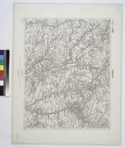
Trembowla
1 : 75000 Terebovlja-oblast (Ukrajina) Löber, Alfred K. u. k. Militärgeographisches Institut
Załoźce
1 : 75000 Ukrajina Ahl, W. K. u. k. Militärgeographisches Institut
Podwołoczyska
1 : 75000 Gottwald, K. K. u. k. Militärgeographisches Institut
Avstro - Vengrija. Pomožany

Podwoloczyska.; Spezialkarte der osterreichisch-ungarischen Monarchie.
from Spezialkarte der osterreichisch-ungarischen Monarchie. Austro-Hungarian Monarchy. Militärgeographisches Institut.,
Pomorzany
1 : 75000 Ukrajina K. u. k. Militärgeographisches Institut
Skalat und Grzymakow.
from Spezialkarte der osterreichisch-ungarischen Monarchie.
Zloczow.
from Spezialkarte der osterreichisch-ungarischen Monarchie.
Brzezany (Galizien).
from Spezialkarte der osterreichisch-ungarischen Monarchie.
Skałat und Grzymałów
1 : 75000 Ukrajina Steindl, F. K. u. k. Militärgeographisches Institut
Strecke
Ivano-Frankivsk (Ukrajina) K. k. Österreichische Staatsbahnen
Russia
Mollova mapová sbírka Hoffmann, Johannes Hoffmann, Johann
Ost Galizien
Halič (Polsko a Ukrajina) Liesganig, Joseph m Verlage des Kunst- und Industrie- Comptoirs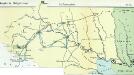
Nr. 6b. Kämpfe in Ostgalizien. Im Dnjestrgebiet
Galizien Weltkrieg <1914-1918>, Ostfront
Tarnopol, Brody, Stryj, Czernowitz
1 : 750000 Brody (Ukrajina) Erben, F. K. u. k. Militärgeographisches Institut
Tarnopol, Brody, Stryj, Czernowitz
1 : 750000 Brody (Ukrajina) Erben, F. K. u. k. Militärgeographisches Institut
Tarnopol, Brody, Stryj, Czernowitz
1 : 750000 K. u. k. militär-geographisches Institut
Tarnopol, Brody, Stryj, Czernowitz
1 : 750000 Brody (Ukrajina) K. k. militär-geographisches Institut
Übrige Länder der ehemaligen Österreich-Ung. Monarchie
1 : 900000 Halič (Polsko a Ukrajina) Koch, Wilhelm Opitz, Carl Arnd
Carte de la Roumanie et pays limitrophes. Lemberg
1 : 500000 France. Service géographique de l'armée [Paris] : Service géographique de l'armée