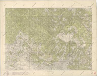
Maps of Ajdovščina

Sektion 5652/1

Zone 22, Col. X, Haidenschaft und Adelsberg, uit: Geologische Karte der im Reichsrathe vertretenen Königreiche und Länder der Österreich-Ungarischen Monarchie : auf Grundlage der Specialkarte i.M. 1:75.000 des k.u.k. Militär-geographischen Institutes / neu bearb. und als Kartenwerk von 341 Blattnummern in zwanglosen Lfg. hrsg. durch die k.k. Geologische Reichsanstalt in Wien
1 : 75000 titelvariant: Geologische Spezialkarte der im Reichsrate vertretenen Königreiche und Länder der Österreichisch-Ungarischen Monarchie; Geologische Specialkarte der im Reichsrathe vertretenen Königreiche und Länder der Österreichisch-Ungarischen Monarchie; Annotatie: Titel bovenaan kaartblad: Geologische Spezialkarte der im Reichsrate vertretenen Königreiche und Länder der Österreichisch-Ungarischen Monarchie en Geologische Specialkarte der im Reichsrathe vertretenen Königreiche und Länder der Österreichisch-Ungarischen Monarchie; Annotatie geografische gegevens: Coördinaten gebaseerd op nulmeridiaan van Ferro (Hierro) Kaiserlich-Königliche Geologische Reichsanstalt, Wenen Wien : K.K. Geologische Reichsanstalt
Adelsberg.
from Spezialkarte der osterreichisch-ungarischen Monarchie.
Ducatus Carnioliae Tabula Chorographica Iusu Sumptuque inclytorum Provinciae Statuum.
1 : 100000 Mollova mapová sbírka Florjančič de Grienfeld, Janez Dizma
Bischoflack und Idria.
from Spezialkarte der osterreichisch-ungarischen Monarchie.
Italy 1:100,000 / Sardinia 1:100,000, Postumia
Italy 1:100,000 / Sardinia 1:100,000 , Series GSGS 4164. Great Britain. War Office. General Staff. Geographical Section. [London] : War Office
Italy 1:100,000 / Sardinia 1:100,000, Corizia
Italy 1:100,000 / Sardinia 1:100,000 , Series GSGS 4164. Great Britain. War Office. General Staff. Geographical Section. [London] : War Office
Mappa Generalis in Qua Danubii Fl. Caetium Montem inter et Bulgariae Flumen Jantram, Intercepti Tractus Integer In Subsequentibus XVIII. Secrionibus Divisim Specialissimè Exhibendus Repraesentatur. Notandum Sectionibus illis Lineolas per Transversum Secantes Danubium Iisque Interpositos Numeros Respondere
1 : 100000 Mollova mapová sbírka Marsili, Luigi Ferdinando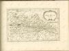

Der Goerzer Kreis und der Triester Kreis
1 : 260000 Gorizia (Itálie) Kindermann, Joseph Karl Junker, Christoph Franz Xaver Miller
Comitatus Goritiae et Gradiscae
1 : 216000 Mollova mapová sbírka Coronini, Rudolf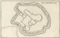
Gründt Riß der Statt Görtz
Mollova mapová sbírka Merian, Matthaeus Merian, Caspar
Comitatus Goritiae et Gradiscae cum limitibus Venetis et vicinia
1 : 220000 Benátky (Itálie) Coronini, Rudolf Quischae, D.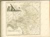

Dioecesan-Carte von Laibach
1 : 260000 Lublaň-oblast (Slovinsko) Mascon, Johann Wolf, Anton Alojzij Johann Mascon
Aus der Übersichtskarte von Mittel-Europa 1:750 000
1 : 750000 Evropa střední K. k. Österreichische Staatsbahnen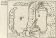
Buccari samt dessen Seehafen und derer tieffen in Istrien am Adriatischen Meer gelegen dem Kayser gehörig
Mollova mapová sbírka Bodenehr, Gabriel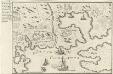
Accurater Plan des Kayserliche freyen See-Hafen Fiume oder S. Veit am Flaun, an den Grentzen des Hertzogthus Crain und des Oesterreichischen Istrien am Golfo di Carnero, und am Einfluss des Flusses Fiume
Mollova mapová sbírka Bodenehr, Gabriel
Carta delle contee di Gorizia, di Gradisca, distetto di Trieste, e del Friuli Veneto
1 : 208000 Burgenland (Rakousko) Capellaris, Giann Antonio Tommasini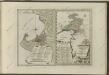

Generalkarte von Zentraleuropa

Patria del Friuli olim Forum Iulii [Karte], in: Novus Atlas, das ist, Weltbeschreibung, Bd. 3, S. 148.
1 Karte aus Atlas Blaeu, Joan Blaeu, Willem Janszoon
Patria del Friuli olim Forum Iulii [Karte], in: Theatrum orbis terrarum, sive, Atlas novus, Bd. 3, S. 128.
1 Karte aus Atlas Blaeu, Joan Blaeu, Willem Janszoon
Nuova carta topografica del territorio di Friul
1 : 210000 Furlandsko Capellaris, Gio. Antonio Furlanetto, Lodovico Lodovico Furlanetto
Der südliche Theil von Untersteyermark oder der Cillier Kreis
1 : 260000 Celje (Slovinsko) Kindermann, Joseph Karl Junker, Christoph Franz Xaver Miller
G. Freytags Karte der Isonzo-Front
1 : 350000 Gorizia (Itálie : provincie) Kartogr. Anstalt G. Freytag & Berndt
Istria, olim Lapidia. [Karte], in: Novus atlas absolutissimus, Bd. 5, S. 65.
1 Karte aus Atlas Janssonius Offizin
Karte vom Herzogthum Krain
1 : 290000 Kraňsko Loschan, Gottfried Stein, Carl
Patria del Friuli olim Forum Iulii [Karte], in: Le théâtre du monde, ou, Nouvel atlas contenant les chartes et descriptions de tous les païs de la terre, Bd. 3, S. 150.
1 Karte aus Atlas Blaeu, Willem Janszoon und Blaeu, Joan Blaeu, Willem Janszoon