Maps of Kostopil Raion

Neue Generalkarte des Österr.-ungar.-russischen Kriegsschauplatzes

Generalkarte von Zentraleuropa

Generalkarte von Zentraleuropa


Zalozce.
from Spezialkarte der osterreichisch-ungarischen Monarchie.

Teremno und Zurawicze
1 : 75000 Jakubec, J. K. u. k. Militärgeographisches Institut
Dubno
1 : 75000 Fitz, J. K. u. k. Militärgeographisches Institut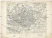
Dubno
1 : 75000 Fitz, J. K. u. k. Militärgeographisches Institut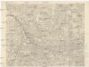
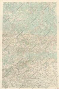
Kostopol
1 : 75000 K. u. k. Militärgeographisches Institut
Iziaslawl
1 : 75000 K. u. k. Militärgeographisches Institut
Ostrog
1 : 75000 Ostrih (Ukrajina) K. u. k. Militärgeographisches Institut
Derazno
1 : 75000 K. u. k. Militärgeographisches Institut
Rowno
1 : 75000 Rovno (Ukrajina) Schubert, F. K. u. k. Militärgeographisches Institut
Leschnewka
1 : 75000 K. u. k. Militärgeographisches Institut
Kremieniec
1 : 75000 Kremenec (Ukrajina) Nikel, L. K. u. k. Militärgeographisches Institut
Szumsk
1 : 75000 K. u. k. Militärgeographisches Institut
Tuczyn
1 : 75000 K. u. k. Militärgeographisches Institut
Beresteczko und Szczurowice
1 : 75000 Bittmann, V. K. u. k. Militärgeographisches Institut
Trojanowka
1 : 75000 K. u. k. Militärgeographisches Institut
Ołyka und Młynow
1 : 75000 Dokaupil, R. K. u. k. Militärgeographisches Institut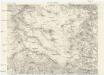
Teofipol (Czugan)
1 : 75000 K. u. k. Militärgeographisches Institut
Łuck
1 : 75000 Luck-oblast (Ukrajina) Brantner, A. K. u. k. Militärgeographisches Institut
Jampol
1 : 75000 Schwarz, J. K. u. k. Militärgeographisches Institut
Mizocz
1 : 75000 Richter, A. K. u. k. Militärgeographisches Institut
Stepan
1 : 75000 K. u. k. Militärgeographisches Institut
Karte des Westlichen Russlands: Q39 Luck

Załoźce
1 : 75000 Ukrajina Ahl, W. K. u. k. Militärgeographisches Institut