Maps of Lithuania

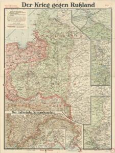
Paasche's Frontenkarte, Nr.6. Der Krieg gegen Russland
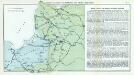
Nr. 7. Kämpfe in Kurland und Nordpolen zum Schutze Ostpreußens
Baltikum Weltkrieg <1914-1918>, Ostfront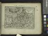
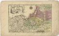
Prussia.
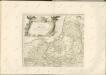
from Abraham Ortelius his epitome of the theater of the worlde / nowe latlye ... renewed and augmented ... by Micheal Coignet, mathematitian of Antwarpe.
Übersichtskarte von Ostpreußen, Kurland und den angrenzenden Gebieten
1 : 750000 Kuronsko k. u. k. Hof- und Universitätsbuchhandlung R. Lechner (W. Müller)
Skizze zur Orientirung ϋber den Feldzug 1807
Théatre de la guerre actuelle, en Allemagne, en Pologne et en Turquie. n4 (bis), Dantzig
1 : 900000 Chanlaire, Pierre Grégoire 1758-1817 Paris : chez l'auteur P. G. Chanlaire
Regni Prussici Accuratissima Delineatio Edita Studio

West Galizien auf allerhoechsten Befehl astronomisch- trigonometrisch
1 : 850000 Halič (Polsko a Ukrajina) Metzburg, Georg Ignaz von Juncker, Christian T. Mollo
Verwaltungsgebiet Ober Ost. Einteilung der Kreise und Eisenbahnlinien
Baltikum Oberost Weltkrieg <1914-1918> Eisenbahnnetz
Verwaltungsgebiet Ober Ost und geschlossene Sprachgebiete
Baltikum Oberost Weltkrieg <1914-1918>
Kalnuotumo ir nuotakumo Lietuvos
1 : 630000 Lotyšsko Matulionis, P. S. Schropp'sche Lehrmittel-Handlung
Friedrich I., König in Preussen. - Der deutsche Orden und die Hohenzollern
Ostpreußen, Westpreußen, ethnische Gruppe

Borussiae regnum cum adjacentibus regionibus mappa geographica delineat
1 : 1760000 Neuchâtel (Švýcarsko) Seutter, Matthäus Silbereisen, Andreas T.C. Lotter

REGNI PRUSSIAE accurata delineatio
1 : 2500000 Prusko
(La Prusse)
1 : 4000000 Bruyset, Jean-Marie; Schneider, J. H.
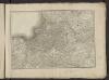
Prussia.
1 : 1900000 Bowen, Frances
Borussiae regnum complectens circulos Sambiensem, Natangiensem et Hockerlandiae nec non Borussia polonica, exhibens palatinatus Culmiensem, Marienburgensem, Pomerelliae et Varmae cum adjacentibus aliis provinciis mappa geographica
1 : 730000 sumtibus et curis exarata Tobiae Conradi Lotteri. Aug. Vind : [T.C. Lotter]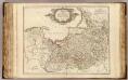
La Prusse.
1 : 720000 Robert de Vaugondy, Gilles, 1688-1766
Burgen-Karte von Preussen zur Zeit Deutschen Ordens
1 : 750000 Prusko Fischer, von Herwig, C. G.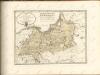

Karte der Eisenbahnen Deutschlands
1 : 700000 Nordost-Blatt Stich, Druck u. Verlag des lithographischen Instituts von Aug. Wehrt

Borussiae regnum complectens circulos Sambiensem, Natangiensem et Hockerlandiae nec non Borussia Polonica exhibens palatinatus Culmiensem, Marienburgensem, Pomerelliae et Varmiae cum adjacentibus aliis provinciis
1 : 732000 Prusko Lotter, Tobias Conrad sumtibus et curis exarata Tobiae Conradi Lotteri
Prussia.
1 : 1670000 Lucas, Fielding Jr.
Regnum Borussiae
1 : 725500 Prusko a Ioh. Baptista Homanno
Kreise der Provinz Preußen 1864
Preußen, Provinz Preußen, Verwaltungsgliederung Kunz, Andreas ; Moeschl, Joachim Robert