Maps of Balkan Pen.

Karte der Balkan - Halbinsel und der angrenzenden Gebiete

Karte der Balkan-Halbinsel und der angrenzenden Gebiete
1 : 1600000 Balkánský poloostrov A. Hartleben's Verlag
Karte der Balkan-Halbinsel und der angrenzenden Gebiete
1 : 1600000 Balkánský poloostrov A. Hartleben's Verlag
Karte der Balkan-Halbinsel und der angrenzenden Gebiete
1 : 1600000 Balkánský poloostrov A. Hartleben's Verlag
Karte der Balkan-Halbinsel und der angrenzenden Gebiete
1 : 1600000 Balkánský poloostrov A. Hartleben's Verlag
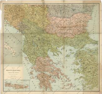
Karte der Balkan-Halbinsel und der angrenzenden Gebiete / nach den neuesten Quellen bearb. von Gustav Freytag
1 : 1600000 Annotatie: Met administratieve indeling van het Koninkrijk Griekenland; Annotatie geografische gegevens: Inzetkrt.: Insel Kreta (Candia) Gustav Freytag [S.l. : A. Hartleben's Verlag]
Die Balkanländer
1 : 1700000 Dardanely (Turecko : průliv) Carl Flemming
Übersicht der Bodenkultur
Osmanisches Reich / Europäischer Teil, Griechenland, Bodennutzung
Graecia nova et mare Aegeum s. Archipelagus, in qua mappa Macedonia, Albania, Epirus, Thessalia et Morea, cum circumjacentibus insulis Corcyra, Cephalonia, Zacynthos, Stalimene, Metelino, Chios, distinctae exhibentur
1 : 1660000 Achaia (Řecko) Lotter, Tobias Conrad sumtibus Tobiae Conradi Lotteri
Graecia nova et mare Aegeum s. Archipelagus, in qua mappa Macedonia, Albania, Epirus, Thessalia et Morea cum circumjacentibus insulis Corcyra, Cephalonia, Zacynthos, Stalimene, Metelino, Chios, distinctae exhibentur
1 : 1660000 Achaia (Řecko) Lotter, Tobias Conrad sumtibus Tobiae Conradi Lotteri
Anbau und Januar-Isothermen
Balkanhalbinsel Pflanzenbau, Klima
Anbau und Juli-Isothermen
Balkanhalbinsel Pflanzenbau, Klima
Balkanhalbinsel
1 : 5000000 Balkánský poloostrov F. A. Brouckaus' Geogr.-artist. Anstalt
Der Europäische Theil des Osmanischen Reichs oder die Europäische Türkey
Stieler's Hand-Atlas Stieler, Adolf bei Justus Perthes
Turecká říše w Ewropé, Řecko, Jonické ostrowy
1 : 6500000 Jónské ostrovy (Řecko) Merklas, Václav
Turkey In Europe.
1 : 10700000 Mitchell, Samuel Augustus
Türkei und Griechenland.
1 : 5000000 Osmanisches Reich / Europäischer Teil, Griechenland
Die Europaeische Türkei, Griechenland und die Jonischen Inseln
E. von Sydow's Schul-Atlas in sechs und dreissig Karten Sydow, Emil von bei Justus Perthes
Karten zum russisch-türkischen Krieg 1877-1878. Europäische Türkei und Balkanstaaten bis zum Kriegsende
1 : 6000000 Balkanhalbinsel Russisch-Türkischer Krieg <1877-1878>
Das Osmanische Reich in Europa, Griechenland und die Jonischen Inseln
Schul-Atlas über alle Theile der Erde nach dem neuesten Zustande, und über das Weltgebäude Stieler, Adolf Justus Perthes
Karten zum russisch-türkischen Krieg 1877-1878. Europäische Türkei und Balkanstaaten nach dem Berliner Kongress
1 : 6000000 Balkanhalbinsel Russisch-Türkischer Krieg <1877-1878> , Berliner Kongress
Die E. Türkei Griechenland und die Ionischen Inseln
Jónské ostrovy (Řecko)
Carte generale de la Turquie d'Europe a la droite du Danube ou des beglerbegliks de Roum Ili, Bosna et Moree
1 : 1300000 Dardanely (Turecko : průliv) Vaudoncourt, Guillaume de Reinhard, Carl Depôt geographique
Balkan-Halbinsel, politische Übersicht
1 : 6000000 Balkanhalbinsel
Die Europäische Türkey, Griechenland und die Jonischen Inseln
Schul-Atlas über alle Theile der Erde nach dem neuesten Zustande, und über das Weltgebäude Stieler, Adolf bei Justus Perthes
Balkan-Halbinsel, Flusz- & Gebirgskarte
1 : 6000000 Balkanhalbinsel
Die EuropaeischeTuerkey, Griechenland und die Jonischen Inseln
Osmanisches Reich / Europäischer Teil, Griechenland
Der Europäische Theil des Türkischen Reichs
1 : 2020000 Balkánský poloostrov Reichard, C. G. Campe, Friedrich bei Friedrich Campe
Turkey in Europe. Greece.
1 : 3500000 Schonberg & Co.