Maps of Khmelnytskyi Oblast

Bez titulu: Šest listů speciálních map Ukrajiny

Sheet V: Karte Des Oesterreichischen Kaiserstaates.
1 : 576000 Scheda, Josef
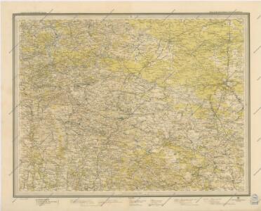
Generalkarte von Zentraleuropa

Generalkarte von Zentraleuropa

Ukrainae pars, quae Podolia palatinatus vulgo dicitur / per Guil. le Vasseur de Beauplan s. r. m.tis
1 : 420000 1 Karte : Kupferdruck ; 43 x 52 cm Beauplan, Guillaume le Vasseur de [Verlag nicht ermittelbar]
Neue Generalkarte des Österr.-ungar.-russischen Kriegsschauplatzes

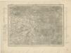
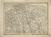
Generalkarte von Zentraleuropa

Generalkarte von Zentraleuropa
g. Volynskoj (Rjad XXII., list 6)


General-Karte des Königreiches Galizien und des Herzogthumes Bukovina


Borszczow.
from Spezialkarte der osterreichisch-ungarischen Monarchie.
Jagielnica und Czernelica.
from Spezialkarte der osterreichisch-ungarischen Monarchie.
Buczacz und Czortkow.
from Spezialkarte der osterreichisch-ungarischen Monarchie.
Skalat und Grzymakow.
from Spezialkarte der osterreichisch-ungarischen Monarchie.
Trembowla (Galizien).
from Spezialkarte der osterreichisch-ungarischen Monarchie.
Zalozce.
from Spezialkarte der osterreichisch-ungarischen Monarchie.
Tarnopol.
from Spezialkarte der osterreichisch-ungarischen Monarchie.
Buczacz und Czortków
1 : 75000 Buchach (Ukrajina) Gehrke, A. K. u. k. Militärgeographisches Institut
Skałat und Grzymałów
1 : 75000 Ukrajina Steindl, F. K. u. k. Militärgeographisches Institut

Teremno und Zurawicze
1 : 75000 Jakubec, J. K. u. k. Militärgeographisches Institut
Jagielnica und Czernelica
1 : 75000 Ukrajina K. u. k. Militärgeographisches Institut
Dubno
1 : 75000 Fitz, J. K. u. k. Militärgeographisches Institut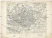
Dubno
1 : 75000 Fitz, J. K. u. k. Militärgeographisches Institut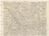
Kostopol
1 : 75000 K. u. k. Militärgeographisches Institut