Maps of Region of Žilina
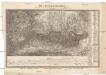
General-Karte des Königreiches Galizien und des Herzogthumes Bukovina

[Rechterblad], uit: Podrobná mapa Vysokých Tater
1 : 25000 Annotatie: Opname 1896/97, gedeeltelijk herzien 1931; Annotatie geografische gegevens: Inzet: Pérehled oblasti Tater. - 1:200.000 [Praag : Vojenský Zeméepisný Ústav]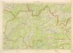
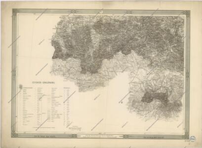
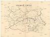
Kraj Žilinský
Orawa i Spisz
Orava (Polsko a Slovensko)

Stolice Orava a Liptov
Komitat Arva, Komitat Liptau, ethnische Gruppe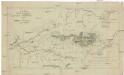
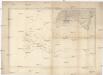
Mappa physico-geographica Carpatorum principalium e quibus Wagus et Dunajetz origines trahunt
1 : 190000 Tatry (Polsko a Slovensko) Bojtár, St.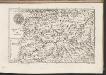
C. Arvensis
Slowakei Polen Komitat Arva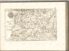


Die Central-Karpaten
1 : 200000 Karpaty Sydow, A. von Wolff
Comitat Árva-Thúrócz
1 : 288000 Dolný Kubín-oblast (Slovensko)
Comitat Árva-Thúrócz
1 : 290000 Dolný Kubín (Slovensko : oblast)
Comitat Árva-Thúrócz
1 : 288000 Dolný Kubín-oblast (Slovensko)
Ducatus Oswieczensis, Et Zatoriensis, Descriptio. [Karte], in: Theatrum orbis terrarum, S. 375.
1 Karte aus Atlas Ortelius, Abraham Vrients, Jan Baptista
Ducatus Oswieczensis, Et Zatoriensis, Descriptio. [Karte], in: Theatrum orbis terrarum, S. 280.
1 Karte aus Atlas Ortelius, Abraham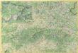
Malá Fatra

Auschwitz u. Sator
1 : 2000000 Herzogtum Auschwitz
Comitat-Liptau
1 : 288000 Liptov (Slovensko)
Comitat-Liptau
1 : 288000 Liptov (Slovensko)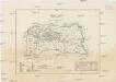
Comitat-Liptau
1 : 288000 Liptov (Slovensko)
Borsod vármégye térképe
1 : 375000 Kogutowicz, Manó Magyar Földrajzi Intézet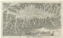
Mappa Comitatvs Liptoviensis :
1 : 160000 Mollova mapová sbírka Nicolaï, Georg David Christoph Straub, Paul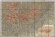
Podrobná mapa Vysokých Tater
1 : 25000 Vysoké Tatry, pohoří-oblast (Polsko a Slovensko) Čs. voj. zeměpisný ústav
Saybusch.
from Spezialkarte der osterreichisch-ungarischen Monarchie.
Makow und Podvilk.
from Spezialkarte der osterreichisch-ungarischen Monarchie.
Malá Fatra

Turdossin an der Arva.
from Spezialkarte der osterreichisch-ungarischen Monarchie.