Maps of okres Jeseník

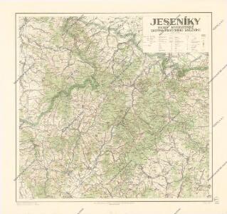
Jeseníky
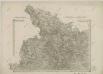
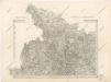
II. vojenské mapování 1
1 : 144000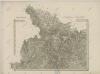
II. vojenské mapování 1
1 : 144000
Jeseníky
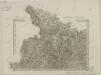
Special - Karte der Markgrafschaft Maehren und des Herzogthums Schlesien
II. vojenské mapování 1
1 : 144000
Umgebungen von Friedberg und Freywaldau
1 : 144000 K.K. Militärisches Geographisches Institut
II. vojenské mapování - speciální mapa Markrabství moravského s částí Slezského vévodství 1
1 : 144000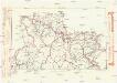
Komunikační mapa země Moravskoslezské
1 : 100000 Jeseník (Česko : oblast) Morslez. zem. výbor
Umgebungen von Friedberg und Freywaldau
Jeseník-oblast (Česko)
Jeseníky

[Circuli Olomucensis pars borealis]
1 : 150000 Morava (Česko) Müller, Johann Christoph
Circuli Olomucensis pars borealis
1 : 150000 Morava (Česko) Müller, Johann Christoph
Circuli Olumucensis pars Borealis /
1 : 233000 Mollova mapová sbírka Müller, Johann Christoph Homann, Johann Baptista - dědici
145. Glatz, uit: Topographische Uebersichtskarte des Deutschen Reiches / herausgegeben v. d. Kartogr. Abt. d. Königl. Preuß. Landesaufnahme
1 : 200000 titelvariant: Topogr. Übersichtskarte des Deutschen Reiches; Annotatie: Titel boven bladen ook: Topogr. Übersichtskarte des Deutschen Reiches; Annotatie geografische gegevens: Op elk blad twee maatstokken: 10 Kilometer = 5,5 cm; 1 geogr. Meile = 3,6 cm; Legenda onder op elk blad Königlich Preußische Landesaufnahme. Kartographische Abtheilung [S.l : Königlich Preußische Landesaufnahme, Kartographische Abtheilung]
Freiwaldeau.
from Spezialkarte der osterreichisch-ungarischen Monarchie.
Generální mapa okresních hejtmanství

Podrobná mapa Markrabství moravského a Vévodství slezkého
1 : 100000 Králíky (Ústí nad Orlicí, Česko : oblast) Srp, Jan Jos. R. Vilímek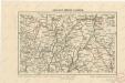
Kralický sněžník a Jeseníky

Jauernig und Weidenau.
from Spezialkarte der osterreichisch-ungarischen Monarchie.
Podrobná mapa Markrabství moravského a Vévodství slezkého
1 : 100000 Bruntál (Česko : oblast) Srp, Jan Jos. R. Vilímek
Reymann ́s Special Karte 190 Troppau

Freiwaldau
1 : 75000 Jeseník (Česko : oblast) Richter K. u. k. Militärgeographisches Institut
III. vojenské mapování 3958
1 : 75000
Kreis Habelschwerdt, Regierungs-Bezirk Breslau
1 : 100000 Jeseník-oblast (Česko) Alt, Wilhelm
Frývaldov
1 : 75000 Jeseník (Česko : oblast) Vojenský zeměpisný ústav
Frývaldov
1 : 75000 Jeseník (Česko : oblast) Vojenský zeměpisný ústav
Frývaldov a okolí
1 : 75000 Jeseník (Česko : oblast) Vojenský zeměpisný ústav
Podrobná mapa Království českého
1 : 100000 Králíky (Ústí nad Orlicí, Česko : oblast) Srp, Jan Jaroslav Bursík