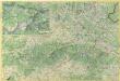
Maps of Central Slovakia
Bez titulu: mapy slovenských krajů

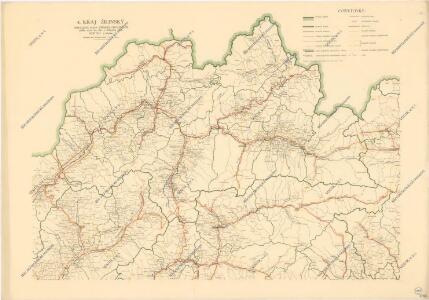
Kraj žilinský

Stredoslovenský kraj
Kraj Žilinský

Trentschin 120, uit: Special-Karte von Mittel-Europa / nach amtlichen Quellen bearbeitet von W. Liebenow
1 : 300000 titelvariant: W. Liebenow's Mittel-Europa; Annotatie: Titel boven de bladen: W. Liebenow's Mittel-Europa Johannes Wilhelm Liebenow 1822-1897 Frankfurt a. M. : Ludwig Ravenstein
Comitat Trencsin
1 : 288000 Trenčín-oblast (Slovensko)
Comitat Trencsin
1 : 280000 Trenčín-oblast (Slovensko)
Stolice Trenčín. Stolice Turec
Trenčín (Okres), Komitat Martin (Slowakei), ethnische Gruppe
Trencsén vármegye térképe
1 : 355000 Trenčín (Slovensko : oblast) Kogutowicz, Manó Magyar Földrajzi Intézet
C. Trencsin
Slowakei Komitat Trentschin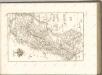

Comitat Árva-Thúrócz
1 : 288000 Dolný Kubín-oblast (Slovensko)
Comitat Árva-Thúrócz
1 : 290000 Dolný Kubín (Slovensko : oblast)
Comitat Árva-Thúrócz
1 : 288000 Dolný Kubín-oblast (Slovensko)
Generální mapa Protektorátu Čechy a Morava

Trenčín
1 : 75000 Slovensko Vojenský zeměpisný ústav
Neubertova generální automapa Republiky československé
1 : 200000 Banská Bystrica (Slovensko : oblast) Soukup, Jan V. Neubert a synové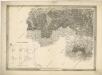
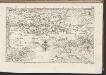
General-Karte des Königreiches Galizien und des Herzogthumes Bukovina

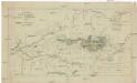
Stolice Orava a Liptov
Komitat Arva, Komitat Liptau, ethnische Gruppe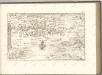
Malá Fatra

Mappa physico-geographica Carpatorum principalium e quibus Wagus et Dunajetz origines trahunt
1 : 190000 Tatry (Polsko a Slovensko) Bojtár, St.
Leutschau 121, uit: Special-Karte von Mittel-Europa / nach amtlichen Quellen bearbeitet von W. Liebenow
1 : 300000 titelvariant: W. Liebenow's Mittel-Europa; Annotatie: Titel boven de bladen: W. Liebenow's Mittel-Europa Johannes Wilhelm Liebenow 1822-1897 Frankfurt a. M. : Ludwig Ravenstein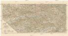
Střední Pováží
1 : 200000 Pováží (Slovensko) odbor Klubu českoslov. turistů
Markgrafschaft Mähren und Herzogthum Schlesien
Die Central-Karpaten
1 : 200000 Karpaty Sydow, A. von Wolff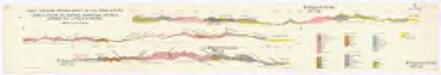
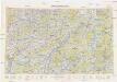
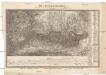
Profily Centrálními Západními Karpaty na listu Báňská Bystrica
1 : 50000 Banská Bystrica (Slovensko : oblast) V. Neubert a synové