Maps of Greece
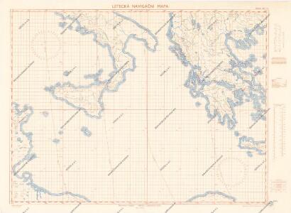
Letecká navigační mapa

Grece et ses Colonies.
Andriveau-Goujon, J.
Řecko, Albanie a jižní Italie [sic]
1 : 2500000 Albánie V. Neubert a synové
A chart of the sea coast of ITALY, SICILY and part of BARBARY
from The sea-atlas : containing an hydrographical description of most of the sea-coasts of the known parts of the world.
[XXIII], uit: Geognostische Karte des Oesterreichischen Kaiserstaates mit einem grossen Theile Deutschland's u. Italien / hauptsachlich nach ... Haidinger's geognostischer Karte dieses Staates bearb. von Josef Scheda
1 : 3000000 titelvariant: General-Karte von Europa in 25 Blättern; Annotatie: Bijlage bij: General-Karte von Europa in 25 Blättern. - 1:2.592.000. - 1845-1847 Scheda, Joseph Wien : K.K. Militär. Geografisch. Institut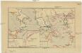
Řecko a jeho kolonie r. 500 př. Kr
Řecko
Carte de la Turque d'Europe et de la Grece.
1 : 3450000 Vivien de St Martin, L.
Naples et Sicile. Europe 26.
1 : 1641836 Vandermaelen, Philippe, 1795-1869
Feuille 39 (D VI), uit: Carte géologique internationale de l'Europe : la carte, votée au congrès géologique international de Bologne en 1881, est exécutée conformément aux décisions d'une commission internationale, avec le concours des gouvernements, sous le dir. de M.M. Beyrich et Hauchecorne
Annotatie: Blad 48 gamme des couleurs; blad 49: bladwijzer en titelblad Heinrich Ernst Beyrich 1815-1896; Wi. Hauchecorne Berlin : Reimer / (Berlin: Institut lithographique)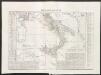
Regno delle due Sicilie
1 : 2200000 Marzolla, Benedetto nello Stabilimento Geografico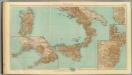
27-29. Italia sud.
1 : 1500000 Touring club italiano
Italy III.
1 : 1770000 Society for the Diffusion of Useful Knowledge (Great Britain)
Ancient Italy III.
1 : 1770000 Society for the Diffusion of Useful Knowledge (Great Britain)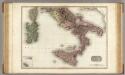
Southern Italy.
1 : 1500000 Pinkerton, John, 1758-1826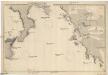
Mittelmeer
1 : 750000 Středozemní moře Reichs-Marine-Amt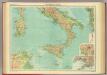
Southern Italy.
1 : 2000000 John Bartholomew and Son
Tabula Europae X. [Karte], in: Geographia universalis vetus et nova complectens Claudii Ptolemaei Alexandrini enarrationis libros VIII, S. 251.
1 Karte aus Atlas Münster, Sebastian [und Ptolemaeus, Claudius]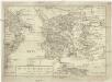
Das alte Griechenland mit dessen vmliegenden Insvlen
Řecko
Regno di Grecia, e Repubblica delle Isole Jonie.
1 : 1950000 Picquet, C.
Les Royaumes De Naples Et De Sicile
1 : 1400000 Mollova mapová sbírka Fer, Nicolas de Fer, Nicolas de
Das Alte Griechenland
Historisch-genealogisch-geographischer Atlas von Le Sage Las Cases, Emmanuel Auguste Dieudonné Marius Joseph de Johann Velten, Kunsthändler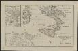
Schul-Atlas für die alte Erdbeschreibung : zur allgemeinen Schul-encyclopädie gehörig
J. H. Campe Zusammensetzung und Zeichnung von [...] Dufour, unter Leitung von Heusinger ; gestochen von Frentzel. Braunschweig : Schulbuchhandlung
NOVISSIMA et ACCURATISSIMA REGNORVM, et INSULARUM SICILIAE, ET SARDINIAE, Hydro-Geographica Exhibitio
1 : 1700000 Korsika (Francie) Rizzi Zannoni, Giovanni Antonio Homannianis Hered.
Italiae pars australis, Corsica.
1 : 6000000 Fenner, Rest.
Li Regni di Sicilia, e Sardegna, colle adiacenti Isole di Corsica, Elba, Malta, e Liparee, o di Vulcano, non men che Parte delle Spiagge Settentrionali dell'Africa, e delle Meridionali d'Italia;
1 : 1700000 Mollova mapová sbírka Rizzi Zannoni, Giovanni Antonio Homann, Johann Baptista - dědici
Übersichtskarte von Griechenland
Originaltitel: Carte Griechenlands nach den neuesten und besten Quellen bearbeitet. Mit Erklärung der Zeichen sowie einer Nebenkarte. Fischer, J., Lithograf
Specialia vom Vulkan-Gürtel des Atlantischen Ocean's
Erster Band, enthaltend in vier Abtheilungen die Erscheinungen der anorganischen Natur: 1. Meteorologie und Klimatographie. 2. Hydrologie und Hydrographie. 3. Geologie. 4. Tellurischer Magnetismus Humboldt, Alexander von Verlag von Justus Perthes
(Italien 2)
1 : 1800000 Flemming, Carl