Maps of Veliko Tarnovo

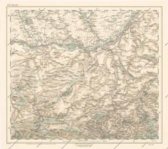
Generalkarte von Zentraleuropa

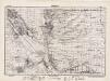
Bulgarisch-rumänische Grenze
1 : 600000 Bulgarien, Rumänien, Grenze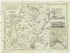
Karte von den durch die Waffen erroberten und durch den Frieden zu Szistow am 4 August 1791 von der ottomanischen Pforte an das Erzhaus Oestreich abgetrettenen Antheilen von Turkisch Kroatien und der Walachey
1 : 170000 Rumunsko Reilly, Franz Johann Josef von F. I. I. von Reilly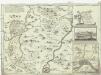
Karte von den durch die Waffen erroberten und durch den Frieden zu Szistow am 4 August 1791 von der ottomanischen Pforte an das Erzhaus Oestreich abgetrettenen Antheilen von Turkisch Kroatien und der Walachey
1 : 170000 Bulharsko Reilly, Franz Johann Josef von F. I. I. von Reilly
Ėskiz
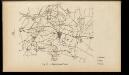
1 : 1200000 Bulgarien Pleven Russisch-Türkischer Krieg <1877-1878> Schlacht von Pleven
[Pleven]
1 : 800000 Bulgarien Pleven Russisch-Türkischer Krieg <1877-1878> Schlacht von Pleven
[Pleven]
1 : 800000 Bulgarien Pleven Russisch-Türkischer Krieg <1877-1878> Schlacht von Pleven
Nicopolis - Jantra
Mollova mapová sbírka Marsili, Luigi Ferdinando
Zimnicea si Petrosani
Impresurarea Plevnei
Bulgarien Pleven Russisch-Türkischer Krieg <1877-1878>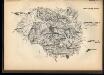
Pervyj boj pod Plevnoj
Bulgarien Pleven Russisch-Türkischer Krieg <1877-1878> Schlacht von Pleven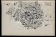
Tretīj boj pod Plevnoj
Bulgarien Pleven Russisch-Türkischer Krieg <1877-1878> Schlacht von Pleven
Carte des bei der Recognoscirung den 13 Mai 1790 bei der Festung Turnul vorgefallenen Scharmützels
1 Karte : Kupferdruck ; 12 x 17 cm [Trattner]
Blokada Plevny. Oktjabr' - Nojabr' 1877 g.
Bulgarien Pleven Russisch-Türkischer Krieg <1877-1878> Schlacht von Pleven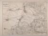
Sturm auf Plewna am 11. September 1877
1 : 42000
Bataille de Nicopolis
Nouvel atlas physique politique et historique de l'Empire ottoman et des états limitrophes en Europe, en Asie et en Afrique, en quarante feuilles Hellert, J.J. Bellizard, Dufour et Cie
[Ruse]
Bulgarien Ruse Russisch-Türkischer Krieg <1806-1812>
[Ruse]
Bulgarien Ruse Russisch-Türkischer Krieg <1828-1829>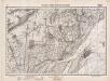
Lambert-Cholesky sheet 4238 (Frăteşti)
1 : 20000 Romanian military topographic map sheet under Lambert-Cholensky projection Serviciul Geografic al Armatei geo-spatial.org Serviciul Geografic al Armatei
Lambert-Cholesky sheet 4237 (Giurgiu şi Russe (Rusciuc))
1 : 20000 Romanian military topographic map sheet under Lambert-Cholensky projection Serviciul Geografic al Armatei geo-spatial.org Serviciul Geografic al Armatei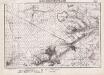
Lambert-Cholesky sheet 4138 (Stăneşti)
1 : 20000 Romanian military topographic map sheet under Lambert-Cholensky projection Serviciul Geografic al Armatei geo-spatial.org Serviciul Geografic al Armatei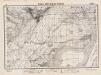
Lambert-Cholesky sheet 4137 (Slobozia)
1 : 20000 Romanian military topographic map sheet under Lambert-Cholensky projection Direcția Topografică Militară geo-spatial.org Direcția Topografică Militară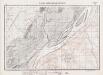
Lambert-Cholesky sheet 4136 (Arsache)
1 : 20000 Romanian military topographic map sheet under Lambert-Cholensky projection Serviciul Geografic al Armatei geo-spatial.org Serviciul Geografic al Armatei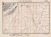
Lambert-Cholesky sheet 4135 (Tristenik)
1 : 20000 Romanian military topographic map sheet under Lambert-Cholensky projection Serviciul Geografic al Armatei geo-spatial.org Serviciul Geografic al Armatei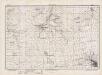
Lambert-Cholesky sheet 4038 (Trestenicu)
1 : 20000 Romanian military topographic map sheet under Lambert-Cholensky projection Direcția Topografică Militară geo-spatial.org Direcția Topografică Militară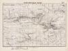
Lambert-Cholesky sheet 4037 (Gogoşarii)
1 : 20000 Romanian military topographic map sheet under Lambert-Cholensky projection Serviciul Geografic al Armatei geo-spatial.org Serviciul Geografic al Armatei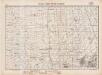
Lambert-Cholesky sheet 4036 (Găujani)
1 : 20000 Romanian military topographic map sheet under Lambert-Cholensky projection Serviciul Geografic al Armatei geo-spatial.org Serviciul Geografic al Armatei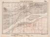
Lambert-Cholesky sheet 4035 (Pietroşani)
1 : 20000 Romanian military topographic map sheet under Lambert-Cholensky projection Serviciul Geografic al Armatei geo-spatial.org Serviciul Geografic al Armatei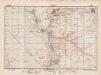
Lambert-Cholesky sheet 3938 (Pielea)
1 : 20000 Romanian military topographic map sheet under Lambert-Cholensky projection Direcția Topografică Militară geo-spatial.org Direcția Topografică Militară