Maps of Slovenia

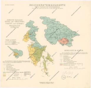
Reichsratwahlkarte

Königreich Illyrien, gouvernement Laibach
1 : 450000 Ilýrie Renner Apelt, O. C.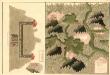
Plan des Anno 1751 von Herren von ferner in Unter Carnten neüenteckten Silber Bergwergs, Ober Trüxen, und Weisenburg, 3 meil von Glagenfurt
Mollova mapová sbírka Geyer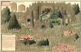
Plann der bei Cornial in Karst, wunderbahren, und ungenein grossen Grotta. In diser Grotta kan man under irdisch gehen, bis widach ist 3 1/2 Theil
Mollova mapová sbírka Geyer
Karte vom Herzogthum Krain
1 : 290000 Kraňsko Loschan, Gottfried Stein, Carl

Generalkarte von Zentraleuropa

Krain-Küstenland
1 : 850000 Kraňsko Meyer, Joseph Bibliographisches Institut
Dioecesan-Carte von Laibach
1 : 260000 Lublaň-oblast (Slovinsko) Mascon, Johann Wolf, Anton Alojzij Johann Mascon
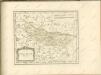
Der südliche Theil von Untersteyermark oder der Cillier Kreis
1 : 260000 Celje (Slovinsko) Kindermann, Joseph Karl Junker, Christoph Franz Xaver Miller
Ducatus Carnioliae accuratissima Delineatio per
1 : 670000 Mollova mapová sbírka Weigel, Christoph Köhler, Johann David
Unter Krain
1 : 500000 Unterkrain
Übersicht der Krainer Metulum-Hypothesen
1 : 750000 Kroatien Ogulin (Region) Illyrien Augustus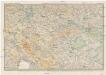
Karte des Krainisch-Kroatischen Gebirgslandes
1 : 250000 Chorvatsko Ravenstein, Ludwig Ludwig Ravenstein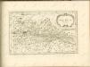

Naseljenost prebivalstva na Kranjskem
1 : 400000 Kraňsko Lončar, Dragotin Kaisvinkler, Bohumil
Die slovenischen Mundarten
Drau-Gebiet Slowenisch, Mundart
Aus der Übersichtskarte von Mittel-Europa 1:750 000
1 : 750000 Evropa střední K. k. Österreichische Staatsbahnen
Celje
1 : 200000 Celje (Slovinsko) Kartografska radionica
G. Freytags Karte der Isonzo-Front
1 : 350000 Gorizia (Itálie : provincie) Kartogr. Anstalt G. Freytag & Berndt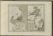

Deutsche und Slowenen in der Untersteiermark nach dem Stande der Volkszählung von 1910
1 : 500000 Untersteiermark ethnische Gruppe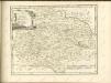

Der Goerzer Kreis und der Triester Kreis
1 : 260000 Gorizia (Itálie) Kindermann, Joseph Karl Junker, Christoph Franz Xaver Miller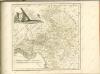
Mappa comitatus Zagrabiensis
1 : 240000 Záhřeb-oblast (Chorvatsko) Szemán, Joseph Kaiser, J. F.
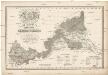
Neueste special Karte des Cillier Kreises im Herzogthume Steyermark
1 : 210000 Celje (Slovinsko) Kaiser, Joseph Franz Jos. Fr. Kaiser
Neueste special Karte des Cillier Kreises im Herzogthume Steyermark
1 : 210000 Štýrsko (Rakousko) Kaiser, Jos. Fr. Jos. Fr. Kaiser