Maps of Rocky Mountains
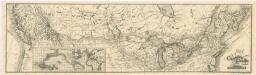
Map of the Canadian Pacific Railway and its connections
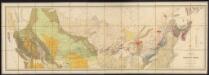
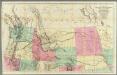
Map of the Dominion of Canada
1 : 2700000 Geological and Natural History Survey (Canada) Geological and Natural History Survey of Canada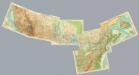
Composite: Canada 1:2,500,000.
1 : 2500000 John Bartholomew and Son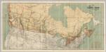
Map Shewing the Railways of Canada.
1 : 2660000 Canada Government Railways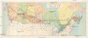
Canadian national railways
1 : 4730000 Kanada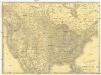
Rand McNally new official railroad map of the United States and southern Canada
1 : 5258880 Kanada Rand McNally
Pulp & paper map of Canada
1 : 6270000 Kanada Department of the Interior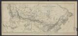
Carte de la puissance du Canada dressée et publiée par l'ordre du Ministre des Chemins de fer et des Canaux (1882)
1 : 8300000 [Lieu de publication inconnu] : éditeur inconnu]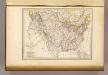
Etats-Unis d'Amerique, 1835.
1 : 16200000 Malte-Brun, Conrad, 1775-1826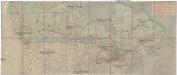
Canada's Grand Trunk Eisenbahnsystem
1 : 7500000 Kanada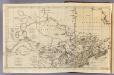
Canada, N. pt. Louisiana.
1 : 7700000 Jefferys, Thomas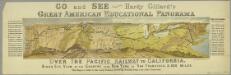
Go and see Hardy Gillard's great American educational panorama, Over the Pacific Railway to California : bird's eye view of the country from New York to San Francisco, 3,500 miles.
from Parts
Chicago-Milwaukee & St. Paul Railway and connections.
1 : 4700000 Chicago, Milwaukee, and St. Paul Railway Company
Canada, Nova Scotia.
1 : 4800000 Thomson, John
The United States of America at the time of the ratification of the Constitution, from original maps in the American Geographical Society of New York
1 : 6860480 Map of the United States, with 4 maps of "Claims and cessions of western lands, 1776-1802." In upper margin: "The United States of America at the time of ratification of the Constitution, from original maps in the American Geographical Society of New York and the Library of Congress at Washington. Issued by the United States Sesquicentennial Commission". Include decorative title cartouche and historical notes. Relief shown by hachures. Prime meridian is Philadelphia. Series: "This map is one of a series of similar colored maps, depicting the 13 original states, from New Hampshire to Georgia at the time of the formati John, Mitchel, 1711-1768 Washington, D.C. : United States Constitution Sesquicentennial Commission, [Washington, D.C.] : U.S. Geological Survey
North America (north)
1 : 5400000 Robert Laurie & James Whittle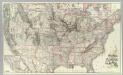
Chicago Milwaukee and St. Paul Ry. and connections.
1 : 4840000 Chicago, Milwaukee, and St. Paul Railway Company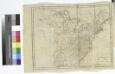
The United States of America / W. Barker sculp., Philadelphia.
from Carey's American pocket atlas; containing nineteen maps... with a brief description of each state.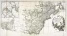
Amérique septentrionale, 2
2 Blätter : mehrfarbig ; 52 x 113 cm chez l'auteur
New Map of Upper & Lower Canada.
1 : 130000000 Morse, Jedidiah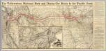
Map N.P.R.R.
1 : 2876900 Northern Pacific Railroad Company
Canada.
1 : 9000000 Finley, Anthony
Canada.
1 : 8870400 Finley, Anthony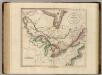
Upper & Lower Canada.
1 : 4700000 Cary, John, ca. 1754-1835
A new map of Upper & Lower Canada / from the latest authorities by John Cary, engraver.
from Canada John Cary,
(Vereinigte Staate)n v. Nordamerika II.
1 : 8000000 Berghaus, Heinrich; Flemming, Carl; Sohr, Karl
Map of the Northern and Middle States.
1 : 6900000 Morse, Jedidiah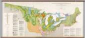
United States: East of the Rocky Mountains -- Glacial Deposits
1 : 1750000 The Geological Society of America
Vereinigte Staate(n v. Nordamerika) I.
1 : 8000000 Berghaus, Heinrich; Flemming, Carl; Sohr, Karl