Maps of Schleswig-Holstein

Spezial - Karte von Schleswig - Holstein...

NOVA & ACCVRATA | DVCATVVM | SLESVICI | ET | HOLSATIÆ | TABVLA.
Matthias und Nicolaus Pet. Goldtschmide gebr. | Hus. Cimb. sculps. [Amsterdam : Joan Blaeu]
Schleswig-Holstein, Lauenburg
1 : 608000 Hamburk (Německo : oblast) C. Flemming
Schleswig-Holstein, Lauenburg, Hamburg, Lübeck, Oldenburg
1 : 610000 Hamburk (Německo : oblast) C. Flemming
Die Herzogthümer Schleswig, Holstein und Lauenburg mit den freien Hansestädten Hamburg & Lübeck
1 : 445000 Hamburk (Německo) Haubold, G. Geographisches Institut
Die Herzogthümer Schleswig, Holstein und Lauenburg mit den freien Hansestädten Hamburg & Lübeck
1 : 540000 Hamburk (Německo) Gräf, A. Haubold, G. Geographisches Institut
Holsatiae Descriptio. [Karte], in: Theatrum orbis terrarum, S. 208.
1 Karte aus Atlas Ortelius, Abraham Vrients, Jan Baptista
General-Karte von den Herzogthümern Schleswig, Holstein und Lauenburg, den Füstenthümern Lübeck und Ratzeburg, und den freien und Hansestädten Hamburg und Lübek
1 : 450000 Dánsko Geerz, F. F. Geerz
Holsatiae Descriptio. [Karte], in: Theatrum orbis terrarum, S. 120.
1 Karte aus Atlas Ortelius, Abraham
Ducatus Holsatiae Nova Tabula [Karte] Alluvies propè Detzbul [...] [Nebenkarte] Tabula Barmerensis [...] [Nebenkarte], in: Novus Atlas, das ist, Weltbeschreibung, Bd. 1, S. 114.
1 Karte aus Atlas Blaeu, Joan Blaeu, Willem Janszoon
Ducatus Holsatiae Nova Tabula [Karte] Alluvies propè Detzbul [...] [Nebenkarte] Tabula Barmerensis [...] [Nebenkarte] , in: Gerardi Mercatoris et I. Hondii Newer Atlas, oder, Grosses Weltbuch, Bd. 1, S. 109.
1 Karte aus Atlas Mercator, Gerhard und Hondius, Jodocus Jansson, Jan
Geologische-Uebersichtskarte der Provinz Schleswig-Holstein
1 : 300000 Meyn, Ludwig Verlag der Simon Schropp'schen Hof-Landkartenhandlung (J.H. Neumann)
General Karte der Herzogthümer Schleswig Holstein und Lauenburg
1 : 500000 Lübeck (Německo : oblast) Stolzenberg, Alfred Pauliny, J. J. J.J. Pauliny
General Karte der Herzogthümer Sleswig Holstein und Lauenburg der Fürstenthümer Lübek und Ratzeburg

Schleswig, Holstein, Lauenburg.
1 : 445000 Weiland, C. F. (Carl Ferdinand), d. 1847
Ducatus Holsatiae Nova Tabula [Karte] Alluvies propè Detzbul [...] [Nebenkarte] Tabula Barmerensis [...] [Nebenkarte], in: Le théâtre du monde, ou, Nouvel atlas contenant les chartes et descriptions de tous les païs de la terre, Bd. 1, S. 143.
1 Karte aus Atlas Blaeu, Willem Janszoon und Blaeu, Joan Blaeu, Willem Janszoon
Dvcatvs Sleswicvm sive Ivtia Avstralis
1 : 390000 Mollova mapová sbírka Mejer, Johannes Peters, Matthias Blaeu, Joan I.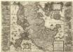
Nova & Accvrata Dvcatvvm Slesvici et Holsatiae Tabvla
1 : 600000 Mollova mapová sbírka Mejer, Johannes Peters, Nikolaus Blaeu, Joan I.
Ducatus Holsatiae Nova Tabula [Karte] Alluvies propè Detzbul [...] [Nebenkarte] Tabula Barmerensis [...] [Nebenkarte] , in: Novus atlas absolutissimus, Bd. 1, S. 143.
1 Karte aus Atlas Janssonius Offizin
Ducatus Holsatiae summâ diligentiâ accuratâq. censura noviter editus
1 : 569000 Holštýnsko Visscher, Claes Jansz. a Nicolao Iohanide Piscatore
Ducatus Holsatiae, summa diligentia accurataq. censura noviter editus
1 : 569000 Bad Segeberg (Německo) Visscher, Claes Jansz. a Nicolao Iohanide Piscatore
Ducatus Holsatiae Nova Tabula [Karte] [Umgebung von Dagebul] [und] Tabula Barmorensis Meggerensis [...] [2 Nebenkarten], in: Theatrum orbis terrarum, sive, Atlas novus, Bd. 1, S. 177.
1 Karte aus Atlas Blaeu, Joan Blaeu, Willem Janszoon
Holsatiae Tabula Generalis
1 : 310000 Mollova mapová sbírka Wit, Frederik de Mortier, Pierre
Ducatus Holsatiae Descriptio Novissima
1 : 490000 Mollova mapová sbírka Visscher, Nicolaes Visscher, Nicolaus
Ducatus Holsatiae Descriptio Novissima
1 : 490000 Mollova mapová sbírka Visscher, Nicolaes Jansz. Visscher, Nicolaus
Dvcatvs Holsatiae Nova Tabvla
1 : 850000 Mollova mapová sbírka Merian, Matthaeus Merian, Matthäus - dědici
Kiel
1 : 600000 Opitz, Carl Solbrig
Die Gebiethe der vier freien Staedte Hamburg, Lübeck, Bremen und Frankfurt, nebst dem Freistaate Krakau
in vier Special Charten dargestellt von F. W. Streit L. Beyer sc. Nürnberg : Friedrich Campe
Sprachgrenze in Schleswig
1 : 500000 Herzogtum Schleswig Sprachgrenze