Maps of Tamsweg - Lungau
Carte des Herzogthums Salzburg...

St. Michael.
from Spezialkarte der osterreichisch-ungarischen Monarchie.
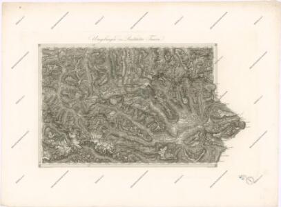
Untertauern
1 : 25000 Kartographisches Institut
Flachau
1 : 25000 Flachau (Rakousko) Kartographisches Institut
Plan des Wildbades Gastein und seiner naechsten Umgebung
Bad Gastein (Rakousko) Dits, Ferdinand Flemming, Carl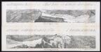
Panorama vom Sonnblick 3090 m in die Rauris
Siegl, Julius Ritter von
Hofgaštajn
1 : 200000 Hofgastein (Rakousko) Kartografska radionica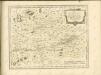

St. Johann im Pongau.
from Spezialkarte der osterreichisch-ungarischen Monarchie.
Hofgastein.
from Spezialkarte der osterreichisch-ungarischen Monarchie.
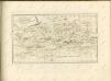
Radstadt.; Spezialkarte der osterreichisch-ungarischen Monarchie.
from Spezialkarte der osterreichisch-ungarischen Monarchie. Austro-Hungarian Monarchy. Militärgeographisches Institut.,
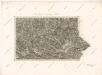
Murau.
from Spezialkarte der osterreichisch-ungarischen Monarchie.
[Bad Gastein und Umgebung]
Bad Gastein (Rakousko) Skrzeszewski, Adolf von
Umgebung von Bad Gastein und Panorama vom Gamskahr-Kogl
1 : 6000 Bad Gastein (Rakousko) Souvent, Alois Kolowrat-Liebsteinský, František Antonín
Umgebung von Bad Gastein und Panorama vom Gamskahr-Kogl
1 : 6000 Bad Gastein (Rakousko) Souvent, Alois Kolowrat-Liebsteinský, František Antonín Rudolf Maschek
Umgebung von Bad Gastein und Panorama vom Gamskahr-Kogl
1 : 6000 Bad Gastein (Rakousko) Souvent, Alois Kolowrat-Liebsteinský, František Antonín Rudolf Maschek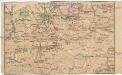
Salzburg - Nordsteirisch - Tiroler - Linie (Gisela Bahn)
Salcburk (Rakousko) K. k. Österreichische Staatsbahnen
Neueste Karte von Salzburg
Grosser Hand-Atlas über alle Theile der Erde in 170 Karten Meyer, J. Verlag des Bibliographischen Instituts

S.R.I. principatvs et archiepiscopatus Salisburgensis cum subjetis, insertis, ac finitimis regionibus
1 : 440000 Salcburk-oblast (Rakousko) Homann, Johann Baptist Ioh. Bapt. Homann
S. R. I. principatvs et archiepiscopatus Salisburgensis cum subjectis, insertis, ac finitimis regionibus
1 : 440000 Salcburk-oblast (Rakousko) Homann, Johann Baptist Harrach, František Antonín Ioh. Bapt. Homann
General-Karte von Kärnten
1 : 300000 Klagenfurt (Rakousko) R. Lechner
General-Karte von Kärnten
1 : 300000 Klagenfurt (Rakousko) R. Lechner
Carinthia ducatus distincta in superiorem et inferior
1 : 350000 Korutansko (Rakousko) Lotter, Tobias Conrad T. C. Lotter
Carinthia ducatus distincta in superiorem et inferior
1 : 350000 Korutansko (Rakousko) Lotter, Tobias Conrad T. C. Lotter
Carinthia ducatus distincta in superiorem et inferior
1 : 350000 Korutansko (Rakousko) Lotter, Tobias Conrad per Tobiam Conradum Lotter
Carinthia ducatus distincta in superiorem et inferior
1 : 350000 Korutansko (Rakousko) Lotter, Tobias Conrad per Tobiam Conradum Lotter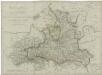
Herzogthum Salzburg