Maps of Cheb District

Normální mezinárodní letecká mapa.

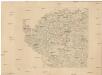
Generální mapa ČSR
Franzensbad und Seine Umgebung

Spezial Karte für Verkehr, landwirthschaftliche, Montan u. gewerbliche Jndustrie des Bezirkes der Handels und gewerbekammer Eger
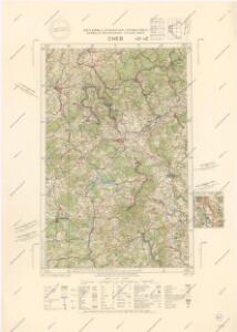
1 : 150000 Cheb-oblast (Česko) Daniel, W. R. Lechner's k. k. Hof u. Universitäts-Buchhandlung
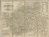
Special-Karte des Egerer Kreis, resp. politischen Verwaltungsbezirkes Königreiche Böhmen
1 : 224000 Cheb-oblast (Česko) Schmidt, Eduard Wendelin Morauer
Special-Karte des Egerer Kreis, resp. politischen Verwaltungsbezirkes Königreiche Böhmen
1 : 224000 Cheb-oblast (Česko) Schmidt, Eduard Steyrer, Fr. C. Wendelin Morauer
Special-Karte des Egerer Kreis, resp. politischen Verwaltungsbezirkes Königreiche Böhmen
1 : 224000 Cheb-oblast (Česko) Schmidt, Eduard Wendelin Morauer
Repraesentatio Geographica District Egerani nunc Circulo Cubitensi in quo simul viae Egeranae in Thermas Carolinas in distincta delineatio conspicitur
1 : 200000 Cheb-oblast (Česko) Müller, Johann Christoph apud Homannianos Heredes
Eger
Cheb-oblast (Česko) Woerl Assner, L.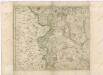
Müllerova mapa Čech
1 : 132000
Repraesentatio geographica circvli Egerani, nec non Elnbogensis, in quo simul viae Egeranae in Thermas Carolinas distincta delineato conscriptur
1 : 136000 Cheb-oblast (Česko) Müller, Johann Christoph apud Homannianos Heredes
[Repraesentatio geographica circvli Egerani, nec non Elnbo]gensis, in quo simul viae Egeranae in Thermas Carolinas distincta delineato conscriptur
1 : 136000 Cheb-oblast (Česko) Müller, Johann Christoph apud Homannianos Heredes
[Rep]raesentatio geographica circvli Egerani, nec non Elnbo[ge]nsis, in quo simul viae Egeranae in Thermas Carolinas distincta delineato con[scrip]tur
1 : 136000 Cheb-oblast (Česko) Müller, Johann Christoph apud Homannianos Heredes
Repraesentatio geographica circvli Egerani, nec non Elnbogensis, in quo simul viae Egeranae in Thermas Carolinas distincta delineato conscriptur
1 : 136000 Cheb-oblast (Česko) Müller, Johann Christoph apud Homannianos Heredes
Repraesentatio geographica circvli Egerani, nec non Elnbogensis, in quo simul viae Egeranae in Thermas Carolinas distincta delineato conscriptur
1 : 136000 Cheb-oblast (Česko) Müller, Johann Christoph apud Homannianos Heredes
Der nordwestliche Theil Böhmens
1 : 120000 Drážďany-oblast (Německo) Franieck
Mapa Chebska a Loketska
1 : 100000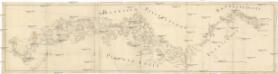
[Böhmerwald und die Umgebung von Eger]
1 : 80000 Cheb-oblast (Česko)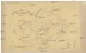
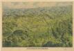
Geologische Uibersichtskarte vom Ursprunge der Eger bis Karslbad
Karlovy Vary (Česko)
Charte vom Elbogner Kreise ...
Charte vom Elbogner Kreise mit dem Egerischen Bezirk...

Charte vom Elbogner Kreise ...

Der Ellenbogner Creis, nebst dem Egerischen Districte
1 : 350000 Cheb-oblast (Česko) Schreiber, Johann Georg Johann George Schreibern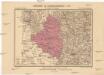
Generalkarte der Bezirkshauptmannschaft Eger
1 : 220000 Cheb-oblast (Česko) Wagner, Jan Eduard F. Kytka
Repraesentatio Geograpica Circuli Egerani nec non Elnbogensis
1 : 80000 Cheb-oblast (Česko) Müller, Johann Christoph Homannios Heredes
Mappa Chorographica Districtus Egrani
1 : 80000 Cheb-oblast (Česko) Müller, Johann Christoph Haberstumpff, Nicolas Christoph Weigel
Districtus Egranus
1 : 80000 Cheb-oblast (Česko) Müller, Johann Christoph Weigel, Christoph Christoph Weigel
Geognostische Karte der Umgebungen von Carlsbad, Franzensbad und Marienbad
1 : 144000 Františkovy Lázně-oblast (Česko)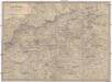
Umgebung von Aussig
1 : 110000 Ústí nad Labem-oblast (Česko) Doležal Medau, Karel Vilém C.W. Medau