Maps of Atlas Mountains
Atlas für Industrie- und Handelsgeographie: Für commercielle und technische Lehranstalten, für Kaufleute und Industrielle
Mediterranean Basin.
1 : 6800000 Johnston, W. & A.K.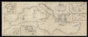
A correct chart of the Mediterranean sea from the coast of Portugal to the Levant
6 Carta nàutica. Conté: A plan of the city and Port of Civita-Vechia; The bay of Scanderoon; The bay of Tunis; A plan of the port of Neptune or Nation. Datació aproximada. Mount & Page William Mount & Thomas Page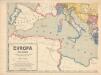
Evropa XIX. století: od vídeňského kongresu r. 1815, do rozhodnutí na frontách světové války r. 1918
Kašpar, Jan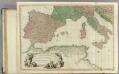
Mediterranean W.
1 : 2850000 Faden, William, 1750?-1836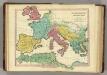
Patriarchati Occidentalis. (1826)
1 : 12100000 Tanner, Henry S.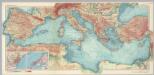
Mediterranean Sea. Pergamon World Atlas.
1 : 5000000 Polish Army Topography Service
Hispania
Kartágo (zaniklé město)
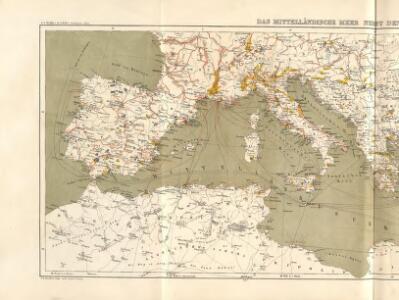
Mittelländisches Meer
1 : 8250000 Středozemní moře-oblast Elfert, P. Geogr. Anstalt von Wagner & Debes
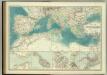
Mediterranean Sea.
1 : 8236800 Stanford, Edward
Occidentalior tractus Maris Mediterranei
1 Karte : Kupferdruck ; 47 x 56 cm Renard apud L. Renard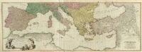
Composite: Mediterranean.
1 : 2850000 Faden, William, 1750?-1836
Paskaert van 't westelycke deel der Middelandsche Zee
1 Karte : Kupferdruck ; 41 x 51 cm Doncker by Hendrick Doncker boekverkoper en graadbooghmaker inde Nieuwbrugsteegh in 't Stuurmans gereedschap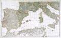
Prémière partie de la carte d'Europe contenant la France, l'Alemagne, l'Italie, l'Espagne & les isles britanniq.s, 2
1 Blatt : 53 x 85 cm s.n.
Atlas für Handel und Industrie: Für Kaufleute, Fabrikante u. Gewerbetreibende, Handlungs- u. Gewerbe-Schulen

Das Mittelländische Meer
Stieler's Hand-Atlas Stieler, Adolf bei Justus Perthes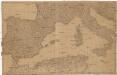
[Spanien und Italien]
Itálie Adam, Jakob

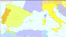
Europa befolkningskarta
Südeuropa 1861
Südeuropa Kunz, Andreas ; Röss, Wolf ; Johnen, Bettina ; Moeschl, Joachim Robert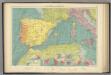
W. Mediterranean.
1 : 5000000 Philip, George
Geographie des Grecs Primitive.
Malte-Brun, Conrad, 1775-1826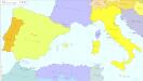
Südeuropa 1956
Südeuropa Kunz, Andreas ; Treiling, Thomas
Nordwestliches Africa
Neuer Handatlas über alle Theile der Erde Kiepert, Heinrich Verlag von Dietrich Reimer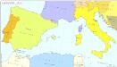
Südeuropa 1870
Südeuropa Kunz, Andreas ; Röss, Wolf ; Johnen, Bettina ; Moeschl, Joachim Robert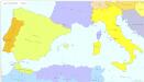
Südeuropa 1954
Südeuropa Kunz, Andreas ; Treiling, Thomas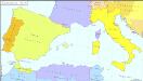
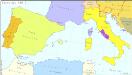
Südeuropa 1914
Südeuropa Kunz, Andreas ; Röss, Wolf ; Johnen, Bettina ; Moeschl, Joachim Robert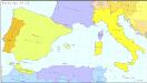
Südeuropa 1912
Südeuropa Kunz, Andreas ; Röss, Wolf ; Johnen, Bettina ; Moeschl, Joachim Robert