Maps of Canada
Atlas für Industrie- und Handelsgeographie: Für commercielle und technische Lehranstalten, für Kaufleute und Industrielle

North America.
1 : 4200000 Wyld, James, 1812-1887
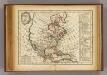
Amerique septentrionale divisée en ses principales parties, ou sont distingués les vns des autres les estats suivant qu'ils appartiennent presenteme[n]t aux François, Castillans, Anglois, Suedois, Danois, Hollandois : tirée des relations de toutes ces nations
1 : 15000000 Severní Amerika Sanson, Guillaume Jaillot, Alexis-Hubert Hubert Iaillot
[Severní Amerika]
Severní Amerika
North America.
1 : 15877000 Johnson, A.J.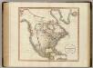
North America.
1 : 18000000 Cary, John, ca. 1754-1835
Severní Amerika se západní Indií
1 : 15800000 Severní Amerika Erben, Josef F. Lipš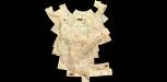
Composite: North America
1 : 1641836 Vandermaelen, Philippe, 1795-1869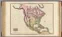
North America.
1 : 16000000 Pinkerton, John, 1758-1826
Soubor němých map pro střední školy

Map of North America.
1 : 22000000 Winterbotham, W.
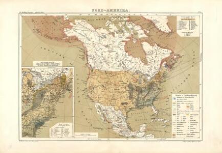
Verbreitung u. vertheilung der Saugethiere (Mammalia) in Nord Amerika.
1 : 37000000 Lange, Henry, 1821-1893.
North America.
1 : 35000000 Cummings, J. A. (Jacob Abbot)
Map of North America.
1 : 15000000 Smith, J. Calvin
North America.
1 : 15840000 Johnson, A.J.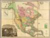
Map Of North America.
1 : 7286400 Tanner, Henry S.
A general map of North America: drawn from the best surveys / by J. Russell; J. Russell, sculpt, Constitution Row, Grey's Inn Lane.
from Charts and maps J. Russell,
Bez titulu: Mapy kontinentů

North America.
from Whole Walker, John,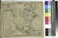
A new map of North America shewing all the new discoveries, 1797 / Hill sc.; The American gazetteer, exhibiting, in alphabetical order, a much more full and accurate account, than has been given, of the states, provinces, counties, cities, towns ... on the American continent, also of the West-India islands ... with a particular description of the Georgia western territory ... Collected and comp. by, and under the direction of, Jedidiah Morse. Illustrated with seven maps.
from The American gazetteer, exhibiting, in alphabetical order, a much more full and accurate account, than has been given, of the states, provinces, counties, cities, towns ... on the American continent, also of the West-India islands ... with a particular description of the Georgia western territory ... Collected and comp. by, and under the direction of, Jedidiah Morse. Illustrated with seven maps. Morse, Jedidiah,
North America.
1 : 117000000 Bowen, Frances

North America.
1 : 14782000 Johnston, Alexander Keith, 1804-1871
North America (physical).
1 : 28990200 Fisher, Richard Swainson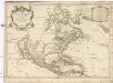
Amerique septentrionale
1 : 19420000 Severní Amerika Sanson, Guillaume Cordier, Louis chez H. Iaillot
North America.
1 : 17000000 Johnson, A.J.
North America.
1 : 17000000 Johnson, A.J.
Relief map of Canada and the United States
1 : 15400000 Geological Survey of Canada Geological Survey of Canada
Facsimile: Sir George Simpson's Map.
1 : 27000000 Simpson, George