Maps of Turkey

Atlas für Handel und Industrie: Für Kaufleute, Fabrikante u. Gewerbetreibende, Handlungs- u. Gewerbe-Schulen

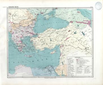
Osmanisches Reich
1 : 10000000 osmanská říše F.A. Brockhaus Geogr.-artist. Anstalt
Turkish Empire.
1 : 5702400 Fullarton, A. & Co.
Das Oströmische Reich zur Zeit Karls des Gr.
Byzantinisches Reich
Map of the Ottoman Empire, Kingdom of Greece, and the russian provinces on the Black Sea
1 : 5900000 balkánské země Dower, John
Turkey in Asia and the Caucasian Provinces of Russia.
1 : 6000000 Colton, G.W.
Imperium Turcicum
Turecko
La mer Mediterranée vers l'orient
1 Karte : Kupferdruck ; 38 x 49 cm Duval P. Duval
Das Oströmische Reich zur Zeit Karls des Gr.
Byzantinisches Reich
Das Osmanische Reich nach seiner grössten Ausdehnung im XVIIten Jahrhundert
1 : 12000000 Osmanisches Reich
Carte du théatre de la guerre
Asie jihozápadní Andriveau-Goujon, Eugene Monrocq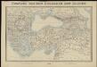
Tooneel van den oorlog in het Oosten
1 : 3000000 Top. Bureau, Min. van Oorlog ['s-Gravenhage] : Top. Bureau, Min. van Oorlog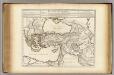
Retraite des Dix Mille Tabula.
1 : 5000000 L'Isle, Guillaume de, 1675-1726
Die Türkey
Evropa jihovýchodní
Mediterranean Sea E.
1 : 9000000 Andree, Richard; Times (London, England)
Mittelmeerlander ostliche.
1 : 9000000 Andree, Richard
The Turkish empire in Europe and Asia with the Kingdom of Greece
1 : 8400000 Blízký východ Walker, C. Society for the diffusion of useful knowledge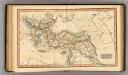
Ottoman Empire.
1 : 14100000 Fenner, Rest.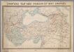
Tooneel van den oorlog in het Oosten / Top. Bureau, Min. van Oorlog
1 : 3000000 Annotatie geografische gegevens: Met 2 schaalstokken Ministerie van Oorlog. Topographisch Bureau ['s-Gravenhage : Top. Bureau, Min. van Oorlog]
Empire Ottoman.
Andriveau-Goujon, J.
Das Osmanische Reich nebst seinen Schutzstaaten nach seiner grössten Ausdehnung 1682
Osmanisches Reich
Turcia Asiatica exhibens Natoliam modernam
1 : 4900000 Arménie impensis Homannianorum Heredum
Turcia asiatica exhibens Natoliam modernam
1 : 4900000 Arménie impensis Homannianorum Heredum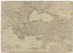
Europaeische und asiatische Türkey
1 : 7100000 Blízký východ Mollo, Tranquillo T. Mollo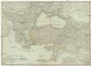
Europaeische und asiatische Türkey
1 : 7100000 Evropa jihovýchodní Mollo, Tranquillo Tranquillo Mollo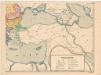
Evropa XIX. století: od vídeňského kongresu r. 1815, do rozhodnutí na frontách světové války r. 1918
Kašpar, Jan
Asia occidental I
1 mapa. Datat al s.XIX. 0 Gras y compañia, editores. Madrid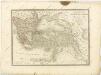

Retraite des dix mille
1 Karte : Kupferdruck ; 37 x 55 cm, Bildgrösse 45 x 57 cm L'Isle; Buache apud auctorem in ripâ vulgo dictâ la rue des Noyers