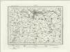
Maps of Lincolnshire

Lincoln Fens, Sheet 14 - Bartholomew's "Half Inch to the Mile Maps" of England & Wales
1 : 126720 Topographic maps Bartholomew, John George John Bartholomew & Co
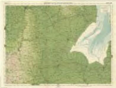
Boston and Skegness - OS One-Inch Map
1 : 63360 Topographic maps Ordnance Survey Ordnance Survey
Lincon and Grantham - OS One-Inch Map
1 : 63360 Topographic maps Ordnance Survey Ordnance Survey
Spalding - OS One-Inch Map
1 : 63360 Topographic maps Ordnance Survey Ordnance Survey
Kings Lynn - OS One-Inch Map
1 : 63360 Topographic maps Ordnance Survey Ordnance Survey
Spalding
1 : 31680 This drawing covers part of Lincolnshire, showing drains across the fens highlighted in blue. These date from the 17th century, when James I appointed Dutch engineer Cornelius Vermuyden to direct the drainage of the wetlands. Many local people opposed the scheme as the plan involved commonland on which they grazed cattle. As a result of Vermuyden's work, the fens changed radically in appearance, from an area of flooded marshes to one of extensively farmed agricultural land. In the middle of the sheet is a series of decoy ponds, built in the 17th and 18th centuries to lure wildlife. Yeakell, Thomas Jr.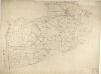
Boston
This drawing covers the part of Lincolnshire known as South Holland. It shows the saltmarshes, intertidal banks of sand and mud, shallow waters and deep channels that characterise the Wash, the largest estuarine system in Britain. Depicted further inland, to the left of the sheet, are ancient cattle droves, the long straight roads that are a prominent feature of this part of Lincolnshire. Budgen, Charles
Leverington 12
1 : 31680 This drawing shows the estuary of the River Welland flowing into the Wash. Downstream of Stamford, towards the fens, the river is embanked to create high level; channels. Tidal exclusion sluices are indicated along the coast at the top of the sheet. These were constructed to maintain water levels for irrigation and to restrict saline water. Drains across fens and marshland are highlighted in blue in the lower part of the plan. At top right, the surveyor's notes on angular observations are clearly visible. Yeakell, Thomas Jr.
Holbeach
1 : 31680 This drawing covers parts of Lincolnshire and Cambridgeshire, showing the River Witham at the top of the sheet flowing south-eastwards into Boston and the Wash. Drains across fens and marshland are highlighted in blue towards the lower part of the plan. These date from the 17th century, when James I appointed Dutch engineer, Cornelius Vermuyden to direct the drainage of the wetlands. Many local people opposed the scheme since it included commonland on which they grazed cattle. As a result of Vermuyden's work, the fens changed radically in appearance, from an area of flooded marshes to one of extensively farmed land. Yeakell, Thomas Jr.
Tattershall(002OSD000000013U00243000)
1 : 31680 This drawing covers part of the Lincolnshire coast. It shows sand dunes and silt and the navigable portion off the coast known as the Boston Deeps on the right of the sheet. Canals and dykes are a manmade feature of the East Fen and are highlighted in blue towards the left of the plan. These date from the 17th century, when James I appointed Dutch engineer Cornelius Vermuyden to direct the drainage of the fens wetlands. Many local people opposed the scheme as the plan involved commonland on which they grazed cattle. As a result of Vermuyden's work, the Fens changed radically in appearance, from an area of flooded marshes to one of extensively farmed agricultural land. Budgen, Charles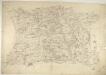
Corby
1 : 31680 This drawing covers parts of Northamptonshire and its neighbouring counties. Their boundaries are indicated by a red pecked line. The road running down the middle of the sheet is Ermine Street, the ancient Roman road from Chichester to York, passing through Lincolnshire. Right of centre is Grimsthorpe Park, with its avenues, trees, reservoir and lodge painstakingly illustrated. Boyce
Tattershall(002OSD000000013U00242000)
1 : 31680 Dikes and canals constructed to drain the fens are the prominent feature of this plan of the West Fen in Lincolnshire. These date from the 17th century, when James I appointed Dutch engineer Cornelius Vermuyden to direct the drainage of the wetlands. Many local people opposed the scheme as the plan involved commonland on which they grazed cattle. As a result of Vermuyden's work, the fens changed radically in appearance, from an area of flooded marshes to one of extensively farmed agricultural land. Budgen, Charles
Skegness (Hills) - OS One-Inch Revised New Series
1 : 63360 Topographic maps Ordnance Survey Ordnance Survey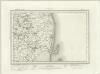
Skegness (Outline) - OS One-Inch Revised New Series
1 : 63360 Topographic maps Ordnance Survey Ordnance Survey
The Wash (Hills) - OS One-Inch Revised New Series
1 : 63360 Topographic maps Ordnance Survey Ordnance Survey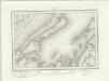
The Wash (Outline) - OS One-Inch Revised New Series
1 : 63360 Topographic maps Ordnance Survey Ordnance Survey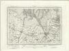
Kings Lynn (Outline) - OS One-Inch Revised New Series
1 : 63360 Topographic maps Ordnance Survey Ordnance Survey
Kings Lynn (Hills) - OS One-Inch Revised New Series
1 : 63360 Topographic maps Ordnance Survey Ordnance Survey
Horncastle (Hills) - OS One-Inch Revised New Series
1 : 63360 Topographic maps Ordnance Survey Ordnance Survey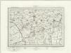
Horncastle (Outline) - OS One-Inch Revised New Series
1 : 63360 Topographic maps Ordnance Survey Ordnance Survey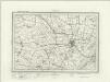
Boston (Outline) - OS One-Inch Revised New Series
1 : 63360 Topographic maps Ordnance Survey Ordnance Survey
Boston (Hills) - OS One-Inch Revised New Series
1 : 63360 Topographic maps Ordnance Survey Ordnance Survey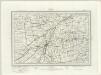
Spalding (Outline) - OS One-Inch Revised New Series
1 : 63360 Topographic maps Ordnance Survey Ordnance Survey
Grantham (Outline) - OS One-Inch Revised New Series
1 : 63360 Topographic maps Ordnance Survey Ordnance Survey
Grantham (Hills) - OS One-Inch Revised New Series
1 : 63360 Topographic maps Ordnance Survey Ordnance Survey
Bourn (Hills) - OS One-Inch Revised New Series
1 : 63360 Topographic maps Ordnance Survey Ordnance Survey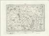
Bourn (Outline) - OS One-Inch Revised New Series
1 : 63360 Topographic maps Ordnance Survey Ordnance Survey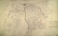
Lincoln
1 : 31680 This drawing shows the county boundary of Lincolnshire and Nottinghamshire as a red dotted line down the left of the sheet. The county town is depicted at the top of the plan on the north bank of the river Witham, set on the summit of the limestone ridge known as the Cliff Hills. Water-filled dykes, constructed to drain the fens, are represented to the right of the sheet, together with the ancient cattle droves, long straight roads that characterise this part of the Lincolnshire landscape. Stevens, Henry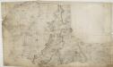
Grantham 24
1 : 31680 This drawing depicts the county boundary of Lincolnshire and Leicestershire as a red dotted line at lower left. The Ermine Street (or High Dyke) is shown running down the right of the sheet. This Roman road extended from Cichester in Sussex to York, passing through Lincolnshire. At lower left, in the Vale of Belvoir, the villages of Plungar, Redmile, Bottesford and Muston are recorded along the Grantham Canal, along with the prominent Belvoir Castle. Budgen, Charles
Lincoln (Hills) - OS One-Inch Revised New Series
1 : 63360 Topographic maps Ordnance Survey Ordnance Survey