Maps of Southwark
London XI.NE - OS Six-Inch Map
1 : 10560 Topographic maps Ordnance Survey Ordnance Survey
Surrey III.SE - OS Six-Inch Map
1 : 10560 Topographic maps Ordnance Survey Ordnance Survey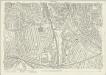
London (1915- Numbered sheets) IX.8 (includes: Deptford St Paul) - 25 Inch Map
1 : 2500 Topographic maps Ordnance Survey Ordnance Survey
London (Edition of 1894-96) CIV (includes: Deptford St Paul) - 25 Inch Map
1 : 2500 Topographic maps Ordnance Survey Ordnance Survey
London (First Editions c1850s) LXVIII (includes: Deptford St Paul) - 25 Inch Map
1 : 2500 Topographic maps Ordnance Survey Ordnance Survey
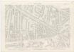
London South East Vol. J: Key Plan
1 : 4800 This "key plan" indicates coverage of the Goad 1897 series of fire insurance maps of London that were originally produced to aid insurance companies in assessing fire risks. The building footprints, their use (commercial, residential, educational, etc.), the number of floors and the height of the building, as well as construction materials (and thus risk of burning) and special fire hazards (chemicals, kilns, ovens) were documented in order to estimate premiums. Names of individual businesses, property lines, and addresses were also often recorded. Together these maps provide a rich historical shapshot of the commercial activity and urban landscape of towns and cities at the time. The British Library holds a comprehensive collection of fire insurance plans produced by the London-based firm Charles E. Goad Ltd. dating back to 1885. These plans were made for most important towns and cities of the British Isles at the scales of 1:480 (1 inch to 40 feet), as well as many foreign towns at 1:600 (1 inch to 50 feet). Chas E Goad Limited Chas E Goad Limited
London (1915- Numbered sheets) IX.7 (includes: Camberwell) - 25 Inch Map
1 : 2500 Topographic maps Ordnance Survey Ordnance Survey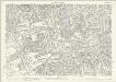
London (Edition of 1894-96) CIII (includes: Camberwell) - 25 Inch Map
1 : 2500 Topographic maps Ordnance Survey Ordnance Survey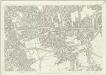
London (First Editions c1850s) LXVII (includes: Camberwell) - 25 Inch Map
1 : 2500 Topographic maps Ordnance Survey Ordnance Survey
London (1915- Numbered sheets) IX.3 (includes: Bermondsey; Camberwell; Southwark) - 25 Inch Map
1 : 2500 Topographic maps Ordnance Survey Ordnance Survey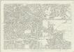
London (First Editions c1850s) LVI (includes: Bermondsey; Camberwell; Southwark) - 25 Inch Map
1 : 2500 Topographic maps Ordnance Survey Ordnance Survey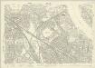
London (1915- Numbered sheets) IX.4 (includes: Bermondsey; Borough Of Greenwich; Deptford St Paul) - 25 Inch Map
1 : 2500 Topographic maps Ordnance Survey Ordnance Survey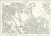
London (Edition of 1894-96) XCI (includes: Bermondsey; Borough Of Greenwich; Deptford St Paul) - 25 Inch Map
1 : 2500 Topographic maps Ordnance Survey Ordnance Survey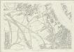
London (First Editions c1850s) LVII (includes: Bermondsey; Borough Of Greenwich; Deptford St Paul) - 25 Inch Map
1 : 2500 Topographic maps Ordnance Survey Ordnance Survey
View of the Dockyard at Deptford Folios 65v 66
As the royal dockyard closest to London, Deptford was the headquarters of the administration of the navy from Tudor times onwards, and the focus of a populous community of shipyard workers. This drawing is part of a comprehensive survey of the royal dockyards made in 1698. This work is attributed to Edmund Dummer who was chief surveyor to the British Royal Navy at this time, and was intended to illustrate the exact state of the dockyards. The 2 plans below the view of Deptford from the river illustrate the changes and improvements to the dockyard between 1688 and 1698. [Dummer, Edmund]
A Plan of the East Country Dock
1 : 1200 Plan of the proposed East Country Dock adjoining the Royal Dockyard at Deptford showing the perimeter of the area to be developed highlighted in blue. Mathews, David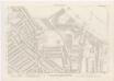
London XI.20 - OS London Town Plan
1 : 1056 Topographic maps Ordnance Survey Ordnance Survey
London XI.30 - OS London Town Plan
1 : 1056 Topographic maps Ordnance Survey Ordnance Survey
London XI.40 - OS London Town Plan
1 : 1056 Topographic maps Ordnance Survey Ordnance Survey
London XI.50 - OS London Town Plan
1 : 1056 Topographic maps Ordnance Survey Ordnance Survey
London XI.10 - OS London Town Plan
1 : 1056 Topographic maps Ordnance Survey Ordnance Survey
London XI.19 - OS London Town Plan
1 : 1056 Topographic maps Ordnance Survey Ordnance Survey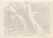
London XI.29 - OS London Town Plan
1 : 1056 Topographic maps Ordnance Survey Ordnance Survey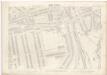
London XI.39 - OS London Town Plan
1 : 1056 Topographic maps Ordnance Survey Ordnance Survey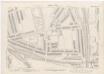
London XI.49 - OS London Town Plan
1 : 1056 Topographic maps Ordnance Survey Ordnance Survey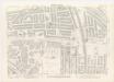
London XI.18 - OS London Town Plan
1 : 1056 Topographic maps Ordnance Survey Ordnance Survey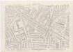
London XI.28 - OS London Town Plan
1 : 1056 Topographic maps Ordnance Survey Ordnance Survey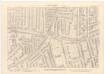
London XI.38 - OS London Town Plan
1 : 1056 Topographic maps Ordnance Survey Ordnance Survey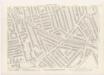
London XI.48 - OS London Town Plan
1 : 1056 Topographic maps Ordnance Survey Ordnance Survey