Maps of Chiltern

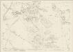
SP80 - OS 1:25,000 Provisional Series Map
1 : 25000 Topographic maps Ordnance Survey Ordnance Survey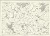
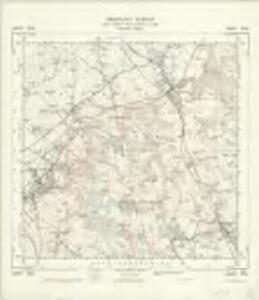
Buckinghamshire XXXVIII - OS Six-Inch Map
1 : 10560 Topographic maps Ordnance Survey Ordnance Survey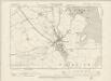
Buckinghamshire XXXIV.SW - OS Six-Inch Map
1 : 10560 Topographic maps Ordnance Survey Ordnance Survey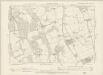
Buckinghamshire XXXVIII.NW - OS Six-Inch Map
1 : 10560 Topographic maps Ordnance Survey Ordnance Survey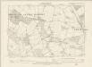
Buckinghamshire XXXVIII.SW - OS Six-Inch Map
1 : 10560 Topographic maps Ordnance Survey Ordnance Survey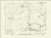
Buckinghamshire XXXIII.SE - OS Six-Inch Map
1 : 10560 Topographic maps Ordnance Survey Ordnance Survey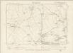
Buckinghamshire XXXIII.SE - OS Six-Inch Map
1 : 10560 Topographic maps Ordnance Survey Ordnance Survey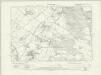
Buckinghamshire XXXVII.NE - OS Six-Inch Map
1 : 10560 Topographic maps Ordnance Survey Ordnance Survey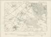
Buckinghamshire XXXVII.NE - OS Six-Inch Map
1 : 10560 Topographic maps Ordnance Survey Ordnance Survey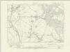
Buckinghamshire XXXVII.SE - OS Six-Inch Map
1 : 10560 Topographic maps Ordnance Survey Ordnance Survey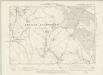
Buckinghamshire XXXVII.SE - OS Six-Inch Map
1 : 10560 Topographic maps Ordnance Survey Ordnance Survey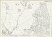
Buckinghamshire XXXIV.10 (includes: Halton; Wendover) - 25 Inch Map
1 : 2500 Topographic maps Ordnance Survey Ordnance Survey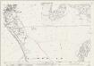
Buckinghamshire XXXIV.14 (includes: Halton; The Lee; Wendover) - 25 Inch Map
1 : 2500 Topographic maps Ordnance Survey Ordnance Survey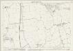
Buckinghamshire XXXVIII.2 (includes: The Lee; Wendover) - 25 Inch Map
1 : 2500 Topographic maps Ordnance Survey Ordnance Survey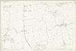
Buckinghamshire XXXVIII.2 (includes: The Lee; Wendover) - 25 Inch Map
1 : 2500 Topographic maps Ordnance Survey Ordnance Survey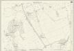
Buckinghamshire XXXVIII.6 (includes: Great Missenden; Wendover) - 25 Inch Map
1 : 2500 Topographic maps Ordnance Survey Ordnance Survey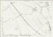
Buckinghamshire XXXIV.9 (includes: Ellesborough; Wendover; Weston Turville) - 25 Inch Map
1 : 2500 Topographic maps Ordnance Survey Ordnance Survey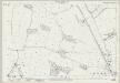
Buckinghamshire XXXVIII.10 (includes: Great Missenden; Wendover) - 25 Inch Map
1 : 2500 Topographic maps Ordnance Survey Ordnance Survey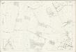
Buckinghamshire XXXVIII.10 (includes: Great Missenden; Wendover) - 25 Inch Map
1 : 2500 Topographic maps Ordnance Survey Ordnance Survey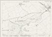
Buckinghamshire XXXIV.13 (includes: Ellesborough; Wendover) - 25 Inch Map
1 : 2500 Topographic maps Ordnance Survey Ordnance Survey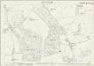
Buckinghamshire XXXVIII.1 (includes: Ellesborough; Wendover) - 25 Inch Map
1 : 2500 Topographic maps Ordnance Survey Ordnance Survey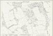
Buckinghamshire XXXVIII.5 (includes: Ellesborough; Great and Little Hampden) - 25 Inch Map
1 : 2500 Topographic maps Ordnance Survey Ordnance Survey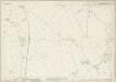
Buckinghamshire XXXIII.12 (includes: Ellesborough; Stoke Mandeville) - 25 Inch Map
1 : 2500 Topographic maps Ordnance Survey Ordnance Survey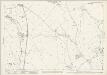
Buckinghamshire XXXIII.12 (includes: Ellesborough; Stoke Mandeville) - 25 Inch Map
1 : 2500 Topographic maps Ordnance Survey Ordnance Survey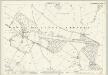
Buckinghamshire XXXVIII.9 (includes: Ellesborough; Great and Little Hampden) - 25 Inch Map
1 : 2500 Topographic maps Ordnance Survey Ordnance Survey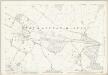
Buckinghamshire XXXVIII.9 (includes: Ellesborough; Great and Little Hampden) - 25 Inch Map
1 : 2500 Topographic maps Ordnance Survey Ordnance Survey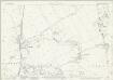
Buckinghamshire XXXIII.16 (includes: Ellesborough; Great and Little Kimble) - 25 Inch Map
1 : 2500 Topographic maps Ordnance Survey Ordnance Survey
Buckinghamshire XXXIII.16 (includes: Ellesborough; Great and Little Kimble) - 25 Inch Map
1 : 2500 Topographic maps Ordnance Survey Ordnance Survey
Buckinghamshire XXXVIII.13 (includes: Great and Little Hampden; Great Missenden; Hughenden) - 25 Inch Map
1 : 2500 Topographic maps Ordnance Survey Ordnance Survey
Buckinghamshire XXXVII.4 (includes: Ellesborough; Great and Little Kimble) - 25 Inch Map
1 : 2500 Topographic maps Ordnance Survey Ordnance Survey