Maps of Leeds

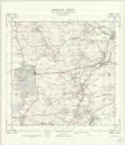
SE34 - OS 1:25,000 Provisional Series Map
1 : 25000 Topographic maps Ordnance Survey Ordnance Survey
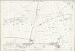
Yorkshire 188 - OS Six-Inch Map
1 : 10560 Topographic maps Ordnance Survey Ordnance Survey
Yorkshire CLXXXVIII.NE - OS Six-Inch Map
1 : 10560 Topographic maps Ordnance Survey Ordnance Survey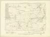
Yorkshire CLXXXVIII.SE - OS Six-Inch Map
1 : 10560 Topographic maps Ordnance Survey Ordnance Survey
Yorkshire CLXXXVIII.SE - OS Six-Inch Map
1 : 10560 Topographic maps Ordnance Survey Ordnance Survey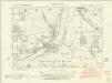
Yorkshire CLXXXIX.NW - OS Six-Inch Map
1 : 10560 Topographic maps Ordnance Survey Ordnance Survey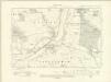
Yorkshire CLXXXIX.NW - OS Six-Inch Map
1 : 10560 Topographic maps Ordnance Survey Ordnance Survey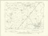
Yorkshire CLXXXIX.NW - OS Six-Inch Map
1 : 10560 Topographic maps Ordnance Survey Ordnance Survey
Yorkshire CLXXXIX.SW - OS Six-Inch Map
1 : 10560 Topographic maps Ordnance Survey Ordnance Survey
Yorkshire CLXXXIX.SW - OS Six-Inch Map
1 : 10560 Topographic maps Ordnance Survey Ordnance Survey
Yorkshire CLXXXIX.SW - OS Six-Inch Map
1 : 10560 Topographic maps Ordnance Survey Ordnance Survey
Yorkshire CLXXI.SE - OS Six-Inch Map
1 : 10560 Topographic maps Ordnance Survey Ordnance Survey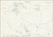
Yorkshire CLXXI.15 (includes: Kearby With Netherby; Kirkby Overblow; Spofforth With Stockeld) - 25 Inch Map
1 : 2500 Topographic maps Ordnance Survey Ordnance Survey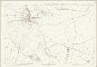
Yorkshire CLXXI.15 (includes: Kearby With Netherby; Kirkby Overblow; Spofforth With Stockeld) - 25 Inch Map
1 : 2500 Topographic maps Ordnance Survey Ordnance Survey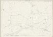
Yorkshire CLXXXVIII.3 (includes: Harewood; Kearby With Netherby; Kirkby Overblow) - 25 Inch Map
1 : 2500 Topographic maps Ordnance Survey Ordnance Survey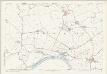
Yorkshire CLXXXVIII.3 (includes: Harewood; Kearby With Netherby; Kirkby Overblow) - 25 Inch Map
1 : 2500 Topographic maps Ordnance Survey Ordnance Survey
Yorkshire CLXXXVIII.7 (includes: East Keswick; Harewood; Kearby With Netherby) - 25 Inch Map
1 : 2500 Topographic maps Ordnance Survey Ordnance Survey
Yorkshire CLXXXVIII.7 (includes: East Keswick; Harewood; Kearby With Netherby) - 25 Inch Map
1 : 2500 Topographic maps Ordnance Survey Ordnance Survey
Yorkshire CLXXXVIII.11 (includes: Bardsey Cum Rigton; East Keswick; Harewood) - 25 Inch Map
1 : 2500 Topographic maps Ordnance Survey Ordnance Survey
Yorkshire CLXXXVIII.11 (includes: Bardsey Cum Rigton; East Keswick; Harewood) - 25 Inch Map
1 : 2500 Topographic maps Ordnance Survey Ordnance Survey
Yorkshire CLXXXVIII.11 (includes: Bardsey Cum Rigton; East Keswick; Harewood) - 25 Inch Map
1 : 2500 Topographic maps Ordnance Survey Ordnance Survey
Yorkshire CLXXI.16 (includes: Kearby With Netherby; Sicklinghall; Spofforth With Stockeld) - 25 Inch Map
1 : 2500 Topographic maps Ordnance Survey Ordnance Survey
Yorkshire CLXXI.16 (includes: Kearby With Netherby; Sicklinghall; Spofforth With Stockeld) - 25 Inch Map
1 : 2500 Topographic maps Ordnance Survey Ordnance Survey
Yorkshire CLXXXVIII.15 (includes: Bardsey Cum Rigton; Harewood) - 25 Inch Map
1 : 2500 Topographic maps Ordnance Survey Ordnance Survey
Yorkshire CLXXXVIII.15 (includes: Bardsey Cum Rigton; Harewood) - 25 Inch Map
1 : 2500 Topographic maps Ordnance Survey Ordnance Survey
Yorkshire CLXXXVIII.15 (includes: Bardsey Cum Rigton; Harewood) - 25 Inch Map
1 : 2500 Topographic maps Ordnance Survey Ordnance Survey
Yorkshire CLXXXVIII.4 (includes: East Keswick; Kearby With Netherby; Sicklinghall) - 25 Inch Map
1 : 2500 Topographic maps Ordnance Survey Ordnance Survey
Yorkshire CLXXXVIII.4 (includes: East Keswick; Kearby With Netherby; Sicklinghall) - 25 Inch Map
1 : 2500 Topographic maps Ordnance Survey Ordnance Survey
Yorkshire CCIII.3 (includes: Bardsey Cum Rigton; Harewood; Leeds) - 25 Inch Map
1 : 2500 Topographic maps Ordnance Survey Ordnance Survey
Yorkshire CCIII.3 (includes: Bardsey Cum Rigton; Harewood; Leeds) - 25 Inch Map
1 : 2500 Topographic maps Ordnance Survey Ordnance Survey
Yorkshire CCIII.3 (includes: Bardsey Cum Rigton; Harewood; Leeds) - 25 Inch Map
1 : 2500 Topographic maps Ordnance Survey Ordnance Survey