Maps of Fylde

SD43 - OS 1:25,000 Provisional Series Map
1 : 25000 Topographic maps Ordnance Survey Ordnance Survey
Lancashire LII - OS Six-Inch Map
1 : 10560 Topographic maps Ordnance Survey Ordnance Survey
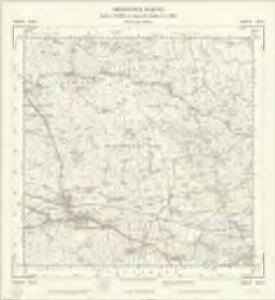
Lancashire LX - OS Six-Inch Map
1 : 10560 Topographic maps Ordnance Survey Ordnance Survey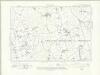
Lancashire LII.SW - OS Six-Inch Map
1 : 10560 Topographic maps Ordnance Survey Ordnance Survey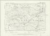
Lancashire LII.SW - OS Six-Inch Map
1 : 10560 Topographic maps Ordnance Survey Ordnance Survey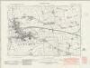
Lancashire LX.NW - OS Six-Inch Map
1 : 10560 Topographic maps Ordnance Survey Ordnance Survey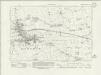
Lancashire LX.NW - OS Six-Inch Map
1 : 10560 Topographic maps Ordnance Survey Ordnance Survey
Lancashire LX.NW - OS Six-Inch Map
1 : 10560 Topographic maps Ordnance Survey Ordnance Survey
Lancashire LX.NW - OS Six-Inch Map
1 : 10560 Topographic maps Ordnance Survey Ordnance Survey
Lancashire LX.NW - OS Six-Inch Map
1 : 10560 Topographic maps Ordnance Survey Ordnance Survey
Lancashire LII.NW - OS Six-Inch Map
1 : 10560 Topographic maps Ordnance Survey Ordnance Survey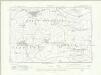
Lancashire LII.NW - OS Six-Inch Map
1 : 10560 Topographic maps Ordnance Survey Ordnance Survey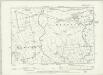
Lancashire LII.NW - OS Six-Inch Map
1 : 10560 Topographic maps Ordnance Survey Ordnance Survey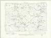
Lancashire LII.SE - OS Six-Inch Map
1 : 10560 Topographic maps Ordnance Survey Ordnance Survey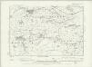
Lancashire LII.SE - OS Six-Inch Map
1 : 10560 Topographic maps Ordnance Survey Ordnance Survey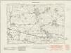
Lancashire LX.NE - OS Six-Inch Map
1 : 10560 Topographic maps Ordnance Survey Ordnance Survey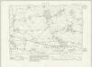
Lancashire LX.NE - OS Six-Inch Map
1 : 10560 Topographic maps Ordnance Survey Ordnance Survey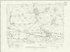
Lancashire LX.NE - OS Six-Inch Map
1 : 10560 Topographic maps Ordnance Survey Ordnance Survey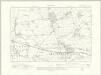
Lancashire LX.NE - OS Six-Inch Map
1 : 10560 Topographic maps Ordnance Survey Ordnance Survey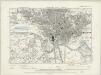
Lancashire LX.NE - OS Six-Inch Map
1 : 10560 Topographic maps Ordnance Survey Ordnance Survey
Lancashire LII.NE - OS Six-Inch Map
1 : 10560 Topographic maps Ordnance Survey Ordnance Survey
Lancashire LII.NE - OS Six-Inch Map
1 : 10560 Topographic maps Ordnance Survey Ordnance Survey
Lancashire LII.5 (includes: Elswick; Great Eccleston; Greenhalgh With Thistleton; Inskip With Sowerby; Treales Roseacre And Wharles) - 25 Inch Map
1 : 2500 Topographic maps Ordnance Survey Ordnance Survey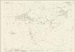
Lancashire LII.5 (includes: Elswick; Great Eccleston; Greenhalgh With Thistleton; Inskip With Sowerby; Treales Roseacre And Wharles) - 25 Inch Map
1 : 2500 Topographic maps Ordnance Survey Ordnance Survey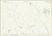
Lancashire LII.9 (includes: Elswick; Greenhalgh With Thistleton; Medlar With Wesham; Treales Roseacre And Wharles) - 25 Inch Map
1 : 2500 Topographic maps Ordnance Survey Ordnance Survey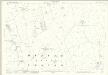
Lancashire LII.13 (includes: Greenhalgh With Thistleton; Medlar With Wesham; Treales Roseacre And Wharles) - 25 Inch Map
1 : 2500 Topographic maps Ordnance Survey Ordnance Survey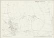
Lancashire LX.1 (includes: Kirkham; Medlar With Wesham; Treales Roseacre And Wharles) - 25 Inch Map
1 : 2500 Topographic maps Ordnance Survey Ordnance Survey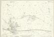
Lancashire LX.1 (includes: Kirkham; Medlar With Wesham; Treales Roseacre And Wharles) - 25 Inch Map
1 : 2500 Topographic maps Ordnance Survey Ordnance Survey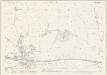
Lancashire LX.1 (includes: Kirkham; Medlar With Wesham; Treales Roseacre And Wharles) - 25 Inch Map
1 : 2500 Topographic maps Ordnance Survey Ordnance Survey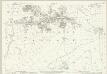
Lancashire LX.5 (includes: Freckleton; Kirkham; Newton With Clifton; Ribby With Wrea; Treales Roseacre And Wharles) - 25 Inch Map
1 : 2500 Topographic maps Ordnance Survey Ordnance Survey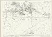
Lancashire LX.5 (includes: Freckleton; Kirkham; Newton With Clifton; Ribby With Wrea; Treales Roseacre And Wharles) - 25 Inch Map
1 : 2500 Topographic maps Ordnance Survey Ordnance Survey