Maps of East Sussex

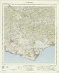
Eastbourne - OS One-Inch Map
1 : 63360 Topographic maps Ordnance Survey Ordnance Survey
A sketch of the roads within fourteen miles of Tunbridge Wells
1 : 100000 Brackett, William Clifford, J J. Clifford
London passenger transport map
Ordnance Survey
Tunbridge Wells (Hills) - OS One-Inch Revised New Series
1 : 63360 Topographic maps Ordnance Survey Ordnance Survey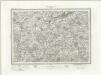
Tunbridge Wells (Outline) - OS One-Inch Revised New Series
1 : 63360 Topographic maps Ordnance Survey Ordnance Survey
Lewes (Hills) - OS One-Inch Revised New Series
1 : 63360 Topographic maps Ordnance Survey Ordnance Survey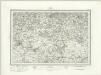
Lewes (Outline) - OS One-Inch Revised New Series
1 : 63360 Topographic maps Ordnance Survey Ordnance Survey
Eridge Park
1 : 31680 .This plan of the hilly Weald of Sussex runs from Maresfield and Rotherfield on the left of the map, past East Hoathly at the central bottom, to Wadhurst and Dallington on the right. The village of Frant, home of the Ordnance Survey draughtsman, Charles Budgen, appears at the top of the plan. .The location of wooded areas was of great importance in planning a military campaign. Woods could either hinder progress or provide cover for the movement of a regiment. Hence the painstaking detail with which woodland is drawn. Single trees, and those in small orchards or lining avenues, are drawn with a thin trunk and shadow. More densely forested areas are represented by treetops alone. Budgen, Thomas
Eastbourne (Hills) - OS One-Inch Revised New Series
1 : 63360 Topographic maps Ordnance Survey Ordnance Survey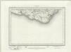
Eastbourne (Outline) - OS One-Inch Revised New Series
1 : 63360 Topographic maps Ordnance Survey Ordnance Survey
Eastbourne 2
1 : 31680 .This plan of the South Downs coastline runs from Newhaven Harbour at the bottom left to Pevensey Bay at the bottom right. The exposed south-coast region was heavily defended against invasion. Barracks are shown at Seaford, 'East Bourn', Pevensey and Hailsham, with a series of batteries at 'South Bourn'. Mount Caburn and Firle Beacon, are indicated to the central left of this drawing. From 1816, the recording of such archaeological sites would become obligatory. Budgen, Thomas
A topographical-map, of the county of Kent, 17
1 Blatt : 54 x 71 cm A. Dury, W. Herbert
Hastings 8
1 : 31680 Produced against the background of the Napoleonic Wars, these Ordnance Survey drawings exhibit a hightened interest in defence, particularly along the vulnerable south coast. Military barracks are recorded at Hastings, 'Bopeep' and Bexhill. A faded aquamarine wash defines the coastline from Pevensey Bay to Hastings, with red circles indicating observation stations used to plot the distinctive features of the land being surveyed. Inland, agricultural land (delineated by field boundaries) and woodland dominate the landscape.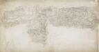
East Grinstead 19
1 : 31680 A blue watercolour wash has been used here to describe relief, with the summits of hills left bare. Dense forestation in the area is indicated by rashes of small trees. Main communication routes are coloured buff-yellow, conforming to military cartographic convention. A red pecked line describes the county boundary.
Cranbrook (Kent)
1 : 21120 Drawing showing the area around Cranbrook in Kent. Green washes distinguish cultivated land and woodland from uncultivated land. Relative relief is indicated by shading and brushwork interlining - a technique known as hachuring. One of the notable features of the Ordnance Survey is the attention paid to accurately recording relief, an important issue in planning military campaigns.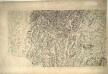
Maresfield
This drawing shows different stages of the drawing process. The lower section of the drawing is complete, with place names recorded and brushwork interlining ('hachuring') depicting the relief of the land. The other half of the drawing is unfinished. No record of the steepness of the land has been made and place names are absent. This gives us an idea of the order in which draughtsmen recorded different types of information. A pencil note records that this drawing was published in 1813.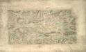
Tunbridge Wells (Kent)
This drawing shows the area around Tunbridge Wells in Kent. The town itself is indicated by red blocks, with the surrounding forests and downs depicted by various green washes. Brushwork interlinging and shading ('hachuring') records relative relief. It is in this area in particular that the Ordnance Survey drawings surpass earlier county maps. The draughtsman has represented individual trees forming avenues and blocks, notably in Eridge Park.
TQ63 - OS 1:25,000 Provisional Series Map
1 : 25000 Topographic maps Ordnance Survey Ordnance Survey
TQ62 - OS 1:25,000 Provisional Series Map
1 : 25000 Topographic maps Ordnance Survey Ordnance Survey
TQ61 - OS 1:25,000 Provisional Series Map
1 : 25000 Topographic maps Ordnance Survey Ordnance Survey
TQ53 - OS 1:25,000 Provisional Series Map
1 : 25000 Topographic maps Ordnance Survey Ordnance Survey
TQ60 - OS 1:25,000 Provisional Series Map
1 : 25000 Topographic maps Ordnance Survey Ordnance Survey
TQ52 - OS 1:25,000 Provisional Series Map
1 : 25000 Topographic maps Ordnance Survey Ordnance Survey
TQ51 - OS 1:25,000 Provisional Series Map
1 : 25000 Topographic maps Ordnance Survey Ordnance Survey
TQ43 - OS 1:25,000 Provisional Series Map
1 : 25000 Topographic maps Ordnance Survey Ordnance Survey
TQ50 - OS 1:25,000 Provisional Series Map
1 : 25000 Topographic maps Ordnance Survey Ordnance Survey
TQ42 - OS 1:25,000 Provisional Series Map
1 : 25000 Topographic maps Ordnance Survey Ordnance Survey
TQ41 - OS 1:25,000 Provisional Series Map
1 : 25000 Topographic maps Ordnance Survey Ordnance Survey
TQ40 & Parts of TV49 - OS 1:25,000 Provisional Series Map
1 : 25000 Topographic maps Ordnance Survey Ordnance Survey