Maps of Telford and Wrekin

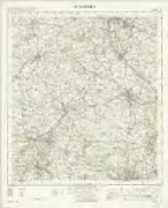
Stafford - OS One-Inch Map
1 : 63360 Topographic maps Ordnance Survey Ordnance Survey
Actual Survey of the County of Salop
Rocque, John
Newport 22
1 : 31680 This plan covers East Shropshire and Staffordshire. Across the plan, highlighted in yellow, is the toll road to Shrewsbury, built on a Roman road, the Watling Street. Along the road is Weston House and Park. Originally part of a medieval deer forest, the park was landscaped in the 18th century by Lancelot 'Capability' Brown - so-called because he was in the habit of telling prospective clients that their gardens had "great capabilities." With his followers, Brown dominated parkland design in the 18th century, creating the modern English parkland view with extensive sweeps of grass, groups of trees, lakes and planned vistas. At lower left is the Wrekin, a hill standing 1,334 ft hill above the Severn plain. It is formed by some of the oldest rocks in Britain: lava, ashes and debris thrown up from a volcanic cleft 900m years ago. Dawson, Robert
Actual survey of the county of Salop, 2
1 Blatt : 71 x 53 cm John Rocque
Market Drayton
1 : 31680 This plan covers the Shropshire,Northern Plain, near the border with Cheshire and Staffordshire. The area,is characterised by small woodlands, formal parkland, meres (lakes), mosses, pools and other wetland habitats. Mills are indicated near the town of Market Drayton, central towards the top,,where about two hundred workers were employed in the manufacture of horse-hair products. Stevens, Henry
Stafford (Outline) - OS One-Inch Revised New Series
1 : 63360 Topographic maps Ordnance Survey Ordnance Survey
Stafford (Hills) - OS One-Inch Revised New Series
1 : 63360 Topographic maps Ordnance Survey Ordnance Survey
Wolverhampton (Hills) - OS One-Inch Revised New Series
1 : 63360 Topographic maps Ordnance Survey Ordnance Survey
Wolverhampton (Outline) - OS One-Inch Revised New Series
1 : 63360 Topographic maps Ordnance Survey Ordnance Survey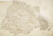
Part of Staffordshire Containing 100 Square Miles Surveyed by Mr Field and Drawn by Mr Stevens 1817
1 : 31680 .This plan of part of Staffordshire shows the Trent and Sow River valleys. The red lines to the right of the,drawing,probably indicate stone walls,,prominent features of the Staffordshire landscape. Stevens, Henry
Penkridge
1 : 31680 This plan covers part of Staffordshire, with Cannock Chase depicted at top right. Framed by the more formal landscapes of Haywood Park, Oakedge Park and Wolseley Park, this large area of heathland was once a great medieval hunting forest favoured by royalty. Triangles are clearly visible outside the plan, and trigonometrical calculations are noted in a table at bottom right. Dawson, Robert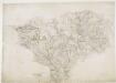
Bridgenorth
1 : 31680 This plan covers East Shropshire and part of Staffordshire, with the River Severn Valley depicted down the left side of the sheet. Here, in its middle course, the river becomes deeper and wider, forming a floodplain in which crops such as wheat and barley are grown. Down the right side of the plan is a section of the Staffordshire and Worcestershire Canal, built by the canal engineer, James Brindley as part of his 'Grand Cross', a farsighted scheme to link the ports of Hull, Liverpool and Bristol by connecting the rivers Mersey, Trent and Severn. The canal opened in May 1772. Ironbridge on the Severn at the top left of the plan is said to be the birthplace of the Industrial Revolution. This tiny town gave the world its first iron bridge in 1779. Dawson, Robert
Chartley Park
1 : 31680 A triangulation diagram appears on the reverse of this drawing. This enabled the draughtsman to plot the exact location of topographical features. The drawing lacks any indication of relief, suggesting that it is a 'rough' copy. Stevens, Henry
Stoke upon Trent (Hills) - OS One-Inch Revised New Series
1 : 63360 Topographic maps Ordnance Survey Ordnance Survey
Stoke upon Trent (Outline) - OS One-Inch Revised New Series
1 : 63360 Topographic maps Ordnance Survey Ordnance Survey
Betley
1 : 31680 .A triangulation diagram appears on the reverse of this drawing. This was an essential tool enabling draughtsmen to plot the exact location of prominent features of the landscape. A section of the Shropshire Union Canal is shown in blue near Audlem at the bottom left of the map. Stevens, Henry
SJ63 - OS 1:25,000 Provisional Series Map
1 : 25000 Topographic maps Ordnance Survey Ordnance Survey
SJ62 - OS 1:25,000 Provisional Series Map
1 : 25000 Topographic maps Ordnance Survey Ordnance Survey
SJ61 - OS 1:25,000 Provisional Series Map
1 : 25000 Topographic maps Ordnance Survey Ordnance Survey
SJ73 - OS 1:25,000 Provisional Series Map
1 : 25000 Topographic maps Ordnance Survey Ordnance Survey
SJ60 - OS 1:25,000 Provisional Series Map
1 : 25000 Topographic maps Ordnance Survey Ordnance Survey
SJ72 - OS 1:25,000 Provisional Series Map
1 : 25000 Topographic maps Ordnance Survey Ordnance Survey
SJ71 - OS 1:25,000 Provisional Series Map
1 : 25000 Topographic maps Ordnance Survey Ordnance Survey
SJ83 - OS 1:25,000 Provisional Series Map
1 : 25000 Topographic maps Ordnance Survey Ordnance Survey
SJ70 - OS 1:25,000 Provisional Series Map
1 : 25000 Topographic maps Ordnance Survey Ordnance Survey
SJ82 - OS 1:25,000 Provisional Series Map
1 : 25000 Topographic maps Ordnance Survey Ordnance Survey
SJ81 - OS 1:25,000 Provisional Series Map
1 : 25000 Topographic maps Ordnance Survey Ordnance Survey
SJ93 - OS 1:25,000 Provisional Series Map
1 : 25000 Topographic maps Ordnance Survey Ordnance Survey
SJ80 - OS 1:25,000 Provisional Series Map
1 : 25000 Topographic maps Ordnance Survey Ordnance Survey