Maps of North Ayshire

Isle of Arran - OS One-Inch Map
1 : 63360 Topographic maps Ordnance Survey Ordnance Survey
ARANIA | Insula in æstuario Glottæ | THE YLE OF ARREN | in the Fyrth of Clyd
Timotheo Pont Auctore. [Amsterdam : Joan Blaeu]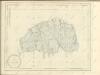

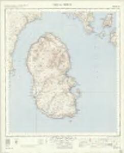
Island of Arran (77) - OS One-Inch map
1 : 63360 Topographic maps Ordnance Survey Ordnance Survey
Island of Arran (77) - OS One-Inch map
1 : 63360 Topographic maps Ordnance Survey Ordnance Survey
Buteshire.
1 : 85000 Thomson, John
Arania insula in æstuario Glottæ
1 Karte : Kupferdruck ; 38 x 51 cm Blaeu; Pont Joan Blaeu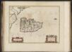
Arania Insula in aestuario Glottae, [vulgo], The Yle of Arren in the Fyrth of Clyd / Timotheo Pont, auctore.
Pont, Timothy, 1560?-1614? Blaeu, Joan, 1596-1673
Buteshire.
Thomson, John, 1777- ca. 1840
Arran - OS One-Inch map
1 : 63360 Topographic maps Ordnance Survey Ordnance Survey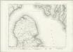
Arran - OS One-Inch map
1 : 63360 Topographic maps Ordnance Survey Ordnance Survey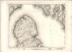
Arran - OS One-Inch map
1 : 63360 Topographic maps Ordnance Survey Ordnance Survey
BUTHE INSULA | Vulgo | THE YLE OF BOOT.
Auct. Tim. Pont. [Amsterdam : Joan Blaeu]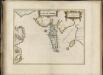
Buthe Insula, vulgo, The Yle of Boot / Auct. Tim. Pont.
Pont, Timothy, 1560?-1614? Blaeu, Joan, 1596-1673
Arran - OS One-Inch map
1 : 63360 Topographic maps Ordnance Survey Ordnance Survey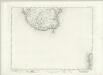
Arran - OS One-Inch map
1 : 63360 Topographic maps Ordnance Survey Ordnance Survey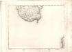
Arran - OS One-Inch map
1 : 63360 Topographic maps Ordnance Survey Ordnance Survey
Firth of Clyde, between Little Cumbrae and Toward Point
Great Britain. Hydrographic Office
NS05 - OS 1:25,000 Provisional Series Map
1 : 25000 Topographic maps Ordnance Survey Ordnance Survey
NS15 & Parts of NS14 - OS 1:25,000 Provisional Series Map
1 : 25000 Topographic maps Ordnance Survey Ordnance Survey
NS03 - OS 1:25,000 Provisional Series Map
1 : 25000 Topographic maps Ordnance Survey Ordnance Survey
NS02 & Parts of NS01 - OS 1:25,000 Provisional Series Map
1 : 25000 Topographic maps Ordnance Survey Ordnance Survey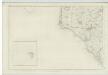
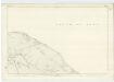
Ayrshire, Sheet X (with inset of sheet XV) - OS 6 Inch map
1 : 10560 Topographic maps Ordnance Survey Ordnance Survey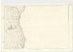
Argyllshire, Sheet CCLV - OS 6 Inch map
1 : 10560 Topographic maps Ordnance Survey Ordnance Survey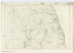
Argyllshire, Sheet CCXXXVIII - OS 6 Inch map
1 : 10560 Topographic maps Ordnance Survey Ordnance Survey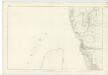
Ayrshire, Sheet III - OS 6 Inch map
1 : 10560 Topographic maps Ordnance Survey Ordnance Survey
Argyllshire, Sheet CCLX - OS 6 Inch map
1 : 10560 Topographic maps Ordnance Survey Ordnance Survey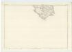
Argyllshire, Sheet CCXXVII - OS 6 Inch map
1 : 10560 Topographic maps Ordnance Survey Ordnance Survey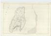
Argyllshire, Sheet CCXVI - OS 6 Inch map
1 : 10560 Topographic maps Ordnance Survey Ordnance Survey