Maps of Outer Hebrides

Isle of Lewis And North Harris - OS One-Inch Map
1 : 63360 Topographic maps Ordnance Survey Ordnance Survey
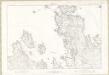
Loch Roag & Tarbert (13) - OS One-Inch map
1 : 63360 Topographic maps Ordnance Survey Ordnance Survey
Loch Roag & Tarbert (13) - OS One-Inch map
1 : 63360 Topographic maps Ordnance Survey Ordnance Survey
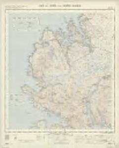
Sound of Harris to Aird Bhreidhnis, including Lochs Tarbert & Resort
Great Britain. Hydrographic Office
Inverness-shire (Hebrides), Sheet III - OS 6 Inch map
1 : 10560 Topographic maps Ordnance Survey Ordnance Survey
Ross-shire (Island of Lewis), Sheet 39 - OS 6 Inch map
1 : 10560 Topographic maps Ordnance Survey Ordnance Survey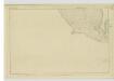
Ross-shire (Island of Lewis), Sheet 40 - OS 6 Inch map
1 : 10560 Topographic maps Ordnance Survey Ordnance Survey
Inverness-shire (Hebrides), Sheet II - OS 6 Inch map
1 : 10560 Topographic maps Ordnance Survey Ordnance Survey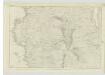
Ross-shire (Island of Lewis), Sheet 29 - OS 6 Inch map
1 : 10560 Topographic maps Ordnance Survey Ordnance Survey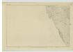
Ross-shire (Island of Lewis), Sheet 44 - OS 6 Inch map
1 : 10560 Topographic maps Ordnance Survey Ordnance Survey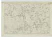
Ross-shire (Island of Lewis), Sheet 31 - OS 6 Inch map
1 : 10560 Topographic maps Ordnance Survey Ordnance Survey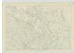
Ross-shire (Island of Lewis), Sheet 25 - OS 6 Inch map
1 : 10560 Topographic maps Ordnance Survey Ordnance Survey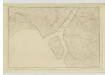
Ross-shire (Island of Lewis), Sheet 41 - OS 6 Inch map
1 : 10560 Topographic maps Ordnance Survey Ordnance Survey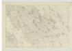
Ross-shire (Island of Lewis), Sheet 18 - OS 6 Inch map
1 : 10560 Topographic maps Ordnance Survey Ordnance Survey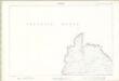
Ross and Cromarty - Isle of Lewis Sheet XVI - OS 6 Inch map
1 : 10560 Topographic maps Ordnance Survey Ordnance Survey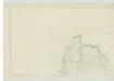
Ross-shire (Island of Lewis), Sheet 16 - OS 6 Inch map
1 : 10560 Topographic maps Ordnance Survey Ordnance Survey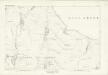
Inverness-shire (Hebrides), Sheet VI - OS 6 Inch map
1 : 10560 Topographic maps Ordnance Survey Ordnance Survey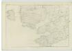
Ross-shire (Island of Lewis), Sheet 34 - OS 6 Inch map
1 : 10560 Topographic maps Ordnance Survey Ordnance Survey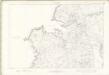
Ross and Cromarty - Isle of Lewis Sheet XXIII - OS 6 Inch map
1 : 10560 Topographic maps Ordnance Survey Ordnance Survey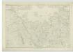
Ross-shire (Island of Lewis), Sheet 24 - OS 6 Inch map
1 : 10560 Topographic maps Ordnance Survey Ordnance Survey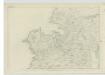
Ross-shire (Island of Lewis), Sheet 23 - OS 6 Inch map
1 : 10560 Topographic maps Ordnance Survey Ordnance Survey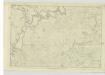
Ross-shire (Island of Lewis), Sheet 36 - OS 6 Inch map
1 : 10560 Topographic maps Ordnance Survey Ordnance Survey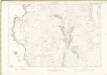
Ross and Cromarty - Isle of Lewis Sheet XXIX - OS 6 Inch map
1 : 10560 Topographic maps Ordnance Survey Ordnance Survey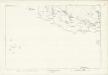
Inverness-shire (Hebrides), Sheet IX - OS 6 Inch map
1 : 10560 Topographic maps Ordnance Survey Ordnance Survey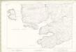
Ross and Cromarty - Isle of Lewis Sheet XXXIV - OS 6 Inch map
1 : 10560 Topographic maps Ordnance Survey Ordnance Survey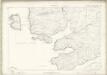
Inverness-shire - Hebrides Sheet II - OS 6 Inch map
1 : 10560 Topographic maps Ordnance Survey Ordnance Survey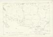
Inverness-shire (Hebrides), Sheet X - OS 6 Inch map
1 : 10560 Topographic maps Ordnance Survey Ordnance Survey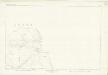
Inverness-shire (Hebrides), Sheet VII - OS 6 Inch map
1 : 10560 Topographic maps Ordnance Survey Ordnance Survey
Inverness-shire (Hebrides), Sheet XI - OS 6 Inch map
1 : 10560 Topographic maps Ordnance Survey Ordnance Survey