Maps of Waltham Forest
Essex (New Series 1913-) n LXXVIII.9 (includes: Leyton; Walthamstow) - 25 Inch Map
1 : 2500 Topographic maps Ordnance Survey Ordnance Survey
Essex (New Series 1913-) n LXXVIII.9 (includes: Leyton; Walthamstow) - 25 Inch Map
1 : 2500 Topographic maps Ordnance Survey Ordnance Survey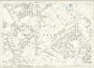
London (Edition of 1894-96) XXIII (includes: Leyton; Walthamstow) - 25 Inch Map
1 : 2500 Topographic maps Ordnance Survey Ordnance Survey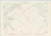
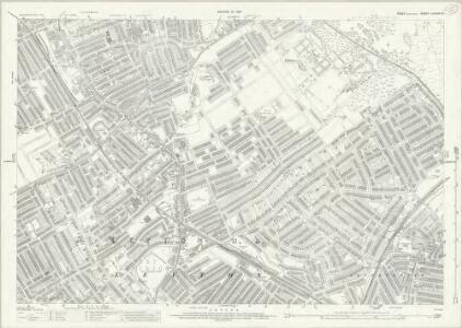
London IV.52 - OS London Town Plan
1 : 1056 Topographic maps Ordnance Survey Ordnance Survey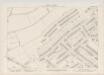
London IV.62 - OS London Town Plan
1 : 1056 Topographic maps Ordnance Survey Ordnance Survey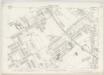
London IV.61 - OS London Town Plan
1 : 1056 Topographic maps Ordnance Survey Ordnance Survey
London IV.51 - OS London Town Plan
1 : 1056 Topographic maps Ordnance Survey Ordnance Survey
London IV.71 - OS London Town Plan
1 : 1056 Topographic maps Ordnance Survey Ordnance Survey
London IV.63 - OS London Town Plan
1 : 1056 Topographic maps Ordnance Survey Ordnance Survey
London IV.72 - OS London Town Plan
1 : 1056 Topographic maps Ordnance Survey Ordnance Survey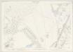
London IV.53 - OS London Town Plan
1 : 1056 Topographic maps Ordnance Survey Ordnance Survey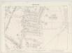
London IV.73 - OS London Town Plan
1 : 1056 Topographic maps Ordnance Survey Ordnance Survey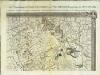
An exact survey of the city's of London Westminster , IV
1 Blatt : 53 x 71 cm John Rocque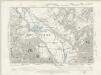
Essex LXXIII.NW - OS Six-Inch Map
1 : 10560 Topographic maps Ordnance Survey Ordnance Survey
Essex LXV.SW - OS Six-Inch Map
1 : 10560 Topographic maps Ordnance Survey Ordnance Survey
Essex (1st Ed/Rev 1862-96) LXXIII.3 (includes: Leyton; Wanstead) - 25 Inch Map
1 : 2500 Topographic maps Ordnance Survey Ordnance Survey
London Sheet H - OS Six-Inch Map
1 : 10560 Topographic maps Ordnance Survey Ordnance Survey
London Sheet H - OS Six-Inch Map
1 : 10560 Topographic maps Ordnance Survey Ordnance Survey
Middlesex XVIII (inset XIII & XXIII) - OS Six-Inch Map
1 : 10560 Topographic maps Ordnance Survey Ordnance Survey
TQ38 - OS 1:25,000 Provisional Series Map
1 : 25000 Topographic maps Ordnance Survey Ordnance Survey
Stratford - Le - Bow
1 : 21120 This plan of north east London extends from the Isle of Dogs and Wapping at the bottom, to 'Layton Stone' and Epping Forest at the top. Field boundaries infilled with stripes depict tilled land. Major settlements are drawn in red ink. North of Stoke Newington, to the top left, a road is plotted as a series of fixed points pricked off with dividers and joined by ruled pencil lines. These protractions were made directly from the Ordnance Survey field books. Pencil rays intersect across the map, evidence of measurements taken by the surveyor between fixed triangulation points. Poplar Gut is outlined in red at the Isle of Dogs, the beginnings of the development of the West India Docks.
Plan of the roads and main objects on the eastern part of London : as connected with the tunnel excavating under the Thames from Rotherhithe to Wapping
1 : 48000 Brunel, Marc Isambard, Sir, 1769-1849 H. Teape & Son
London : guide to the International Exhibition, 1862
1 : 15840 Dower, John, fl. 1838-1846? Illustrated London News
METROPOLITAN BOROUGHS
This map of London was produced for the 1832 Reform Bill that established the metropolitan boroughs. The map's title features along the top; with a compass star at top right, an explanatory note at bottom right. At bottom left is a list of the 'liberties' of the city - the name given to areas exempt from the jurisdiction of the country sheriff, being subject to a separate commission of the peace (in this case royal and governmental authorities). The new boroughs are highlighted in colour, with the shaded area representing the old boundaries of London, Westminster and Southwark. Dawson, Lieut. Robert K.
LONDON AND ITS ENVIRONS LEVELS TAKEN BY ORDER OF THE COMMISSIONERS OF SEWERS
The cholera outbreaks of the 1830s and 1840s forced the government to make drastic improvements to the methods of drainage and sewage disposal in London. A Metropolitan Commission of Sewers was charged with the central task of unifying the existing piecemeal drainage system and forming a plan for a completely new one. A new map showing the levels of the land to be drained was needed for this. In March 1848, officers of the Royal Engineers began to prepare stations for triangulation. Observation posts were set up on one of the towers of Westminster Abbey and over the cross of St Paul's. This map is the result of the survey, showing the relative altitude of the land, a necessary preamble to planning drainage systems, as sewage can only be washed away downhill. Wyld, James
Kaart van Londen enz. en van het naby gelegen land ruim een uur gaans rondom dezelve stad : getrokken uit de groote gemeeten kaart van de Hr. John Rocque
1 : 63500 Amstersdam : Isaak Tirion
The fourth sheet of an actual survey of the county of Middlesex in which the parishes within the bills of mortality are bounded with red to be distinguished from the others
1 Blatt : 53 x 70 cm John Rocque
[Recto], uit: Map of general routes / Fred J.H. Elston
1 : 12500 Elston, Fred J. H. London : General Omnibus Co.
England and Wales, Cities, Ports & Harbours.
1 : 63360 Fullarton, A. & Co.