Maps of Worton
Oxfordshire XV - OS Six-Inch Map
1 : 10560 Topographic maps Ordnance Survey Ordnance Survey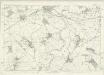
Oxfordshire XV - OS Six-Inch Map
1 : 10560 Topographic maps Ordnance Survey Ordnance Survey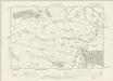
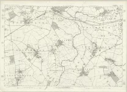
Oxfordshire XV.NW - OS Six-Inch Map
1 : 10560 Topographic maps Ordnance Survey Ordnance Survey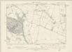
Oxfordshire XV.SW - OS Six-Inch Map
1 : 10560 Topographic maps Ordnance Survey Ordnance Survey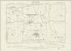
Oxfordshire XV.NE - OS Six-Inch Map
1 : 10560 Topographic maps Ordnance Survey Ordnance Survey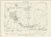
Oxfordshire XV.SE - OS Six-Inch Map
1 : 10560 Topographic maps Ordnance Survey Ordnance Survey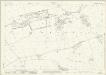
Oxfordshire XV.1 (includes: Hook Norton; Little Tew; Swerford) - 25 Inch Map
1 : 2500 Topographic maps Ordnance Survey Ordnance Survey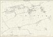
Oxfordshire XV.1 (includes: Hook Norton; Little Tew; Swerford) - 25 Inch Map
1 : 2500 Topographic maps Ordnance Survey Ordnance Survey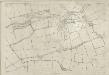
Oxfordshire XV.1 (includes: Hook Norton; Little Tew; Swerford) - 25 Inch Map
1 : 2500 Topographic maps Ordnance Survey Ordnance Survey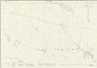
Oxfordshire XV.5 (includes: Heythrop; Little Tew; Swerford) - 25 Inch Map
1 : 2500 Topographic maps Ordnance Survey Ordnance Survey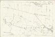
Oxfordshire XV.5 (includes: Heythrop; Little Tew; Swerford) - 25 Inch Map
1 : 2500 Topographic maps Ordnance Survey Ordnance Survey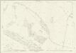
Oxfordshire XV.9 (includes: Enstone; Great Tew; Heythrop; Little Tew) - 25 Inch Map
1 : 2500 Topographic maps Ordnance Survey Ordnance Survey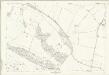
Oxfordshire XV.9 (includes: Enstone; Great Tew; Heythrop; Little Tew) - 25 Inch Map
1 : 2500 Topographic maps Ordnance Survey Ordnance Survey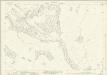
Oxfordshire XV.13 (includes: Enstone; Heythrop; Little Tew) - 25 Inch Map
1 : 2500 Topographic maps Ordnance Survey Ordnance Survey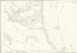
Oxfordshire XV.13 (includes: Enstone; Heythrop; Little Tew) - 25 Inch Map
1 : 2500 Topographic maps Ordnance Survey Ordnance Survey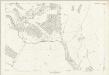
Oxfordshire XV.13 (includes: Enstone; Heythrop; Little Tew) - 25 Inch Map
1 : 2500 Topographic maps Ordnance Survey Ordnance Survey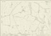
Oxfordshire XV.2 (includes: Great Tew; Little Tew; Sandford St Martin; South Newington; Swerford) - 25 Inch Map
1 : 2500 Topographic maps Ordnance Survey Ordnance Survey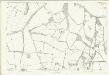
Oxfordshire XV.2 (includes: Great Tew; Little Tew; Sandford St Martin; South Newington; Swerford) - 25 Inch Map
1 : 2500 Topographic maps Ordnance Survey Ordnance Survey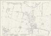
Oxfordshire XV.6 (includes: Great Tew; Little Tew; Sandford St Martin; Swerford) - 25 Inch Map
1 : 2500 Topographic maps Ordnance Survey Ordnance Survey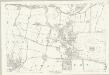
Oxfordshire XV.6 (includes: Great Tew; Little Tew; Sandford St Martin; Swerford) - 25 Inch Map
1 : 2500 Topographic maps Ordnance Survey Ordnance Survey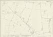
Oxfordshire XV.10 (includes: Great Tew; Little Tew; Sandford St Martin) - 25 Inch Map
1 : 2500 Topographic maps Ordnance Survey Ordnance Survey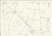
Oxfordshire XV.10 (includes: Great Tew; Little Tew; Sandford St Martin) - 25 Inch Map
1 : 2500 Topographic maps Ordnance Survey Ordnance Survey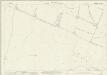
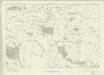
Oxfordshire XV.14 (includes: Enstone; Great Tew; Little Tew) - 25 Inch Map
1 : 2500 Topographic maps Ordnance Survey Ordnance Survey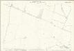
Oxfordshire XV.14 (includes: Enstone; Great Tew; Little Tew) - 25 Inch Map
1 : 2500 Topographic maps Ordnance Survey Ordnance Survey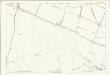
Oxfordshire XV.14 (includes: Enstone; Great Tew; Little Tew) - 25 Inch Map
1 : 2500 Topographic maps Ordnance Survey Ordnance Survey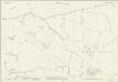
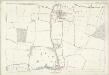
Oxfordshire XV.3 (includes: Barford St John and St Michael; Deddington; Great Tew; Sandford St Martin; South Newington; Worton) - 25 Inch Map
1 : 2500 Topographic maps Ordnance Survey Ordnance Survey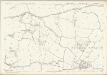
Oxfordshire XV.3 (includes: Barford St John and St Michael; Deddington; Great Tew; Sandford St Martin; South Newington; Worton) - 25 Inch Map
1 : 2500 Topographic maps Ordnance Survey Ordnance Survey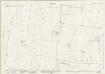
Oxfordshire XV.7 (includes: Great Tew; Sandford St Martin; Worton) - 25 Inch Map
1 : 2500 Topographic maps Ordnance Survey Ordnance Survey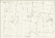
Oxfordshire XV.7 (includes: Great Tew; Sandford St Martin; Worton) - 25 Inch Map
1 : 2500 Topographic maps Ordnance Survey Ordnance Survey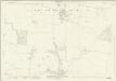
Oxfordshire XV.11 (includes: Great Tew; Sandford St Martin; Westcott Barton; Worton) - 25 Inch Map
1 : 2500 Topographic maps Ordnance Survey Ordnance Survey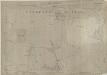
Oxfordshire XV.11 (includes: Great Tew; Sandford St Martin; Westcott Barton; Worton) - 25 Inch Map
1 : 2500 Topographic maps Ordnance Survey Ordnance Survey