Maps of Selby
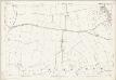
Yorkshire 190 - OS Six-Inch Map
1 : 10560 Topographic maps Ordnance Survey Ordnance Survey
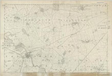
Yorkshire CXC.NW - OS Six-Inch Map
1 : 10560 Topographic maps Ordnance Survey Ordnance Survey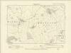
Yorkshire CXC.NW - OS Six-Inch Map
1 : 10560 Topographic maps Ordnance Survey Ordnance Survey
Yorkshire CXC.NW - OS Six-Inch Map
1 : 10560 Topographic maps Ordnance Survey Ordnance Survey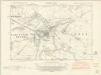
Yorkshire CXC.SW - OS Six-Inch Map
1 : 10560 Topographic maps Ordnance Survey Ordnance Survey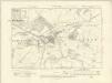
Yorkshire CXC.SW - OS Six-Inch Map
1 : 10560 Topographic maps Ordnance Survey Ordnance Survey
Yorkshire CXC.SW - OS Six-Inch Map
1 : 10560 Topographic maps Ordnance Survey Ordnance Survey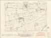
Yorkshire CXC.NE - OS Six-Inch Map
1 : 10560 Topographic maps Ordnance Survey Ordnance Survey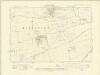
Yorkshire CXC.NE - OS Six-Inch Map
1 : 10560 Topographic maps Ordnance Survey Ordnance Survey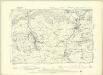
Yorkshire CXC.NE - OS Six-Inch Map
1 : 10560 Topographic maps Ordnance Survey Ordnance Survey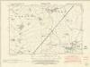
Yorkshire CXC.SE - OS Six-Inch Map
1 : 10560 Topographic maps Ordnance Survey Ordnance Survey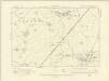
Yorkshire CXC.SE - OS Six-Inch Map
1 : 10560 Topographic maps Ordnance Survey Ordnance Survey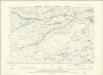
Yorkshire CXC.SE - OS Six-Inch Map
1 : 10560 Topographic maps Ordnance Survey Ordnance Survey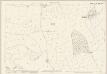
Yorkshire CXC.5 (includes: Healaugh; Newton Kyme Cum Toulston; Wighill) - 25 Inch Map
1 : 2500 Topographic maps Ordnance Survey Ordnance Survey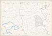
Yorkshire CXC.5 (includes: Healaugh; Newton Kyme Cum Toulston; Wighill) - 25 Inch Map
1 : 2500 Topographic maps Ordnance Survey Ordnance Survey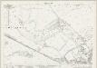
Yorkshire CXC.9 (includes: Healaugh; Newton Kyme Cum Toulston; Tadcaster East; Tadcaster West; Wighill) - 25 Inch Map
1 : 2500 Topographic maps Ordnance Survey Ordnance Survey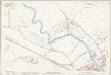
Yorkshire CXC.9 (includes: Healaugh; Newton Kyme Cum Toulston; Tadcaster East; Tadcaster West; Wighill) - 25 Inch Map
1 : 2500 Topographic maps Ordnance Survey Ordnance Survey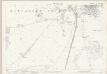
Yorkshire CXC.13 (includes: Grimston; Stutton With Hazlewood; Tadcaster West) - 25 Inch Map
1 : 2500 Topographic maps Ordnance Survey Ordnance Survey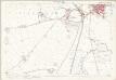
Yorkshire CXC.13 (includes: Grimston; Stutton With Hazlewood; Tadcaster West) - 25 Inch Map
1 : 2500 Topographic maps Ordnance Survey Ordnance Survey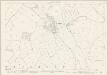
Yorkshire CXC.2 (includes: Bilbrough; Catterton; Healaugh; Hutton Wandesley) - 25 Inch Map
1 : 2500 Topographic maps Ordnance Survey Ordnance Survey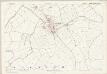
Yorkshire CXC.2 (includes: Bilbrough; Catterton; Healaugh; Hutton Wandesley) - 25 Inch Map
1 : 2500 Topographic maps Ordnance Survey Ordnance Survey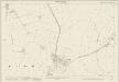
Yorkshire CXC.1 (includes: Healaugh; Walton; Wighill) - 25 Inch Map
1 : 2500 Topographic maps Ordnance Survey Ordnance Survey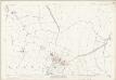
Yorkshire CXC.1 (includes: Healaugh; Walton; Wighill) - 25 Inch Map
1 : 2500 Topographic maps Ordnance Survey Ordnance Survey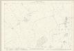
Yorkshire CXC.6 (includes: Catterton; Healaugh) - 25 Inch Map
1 : 2500 Topographic maps Ordnance Survey Ordnance Survey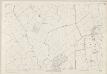
Yorkshire CXC.6 (includes: Catterton; Healaugh) - 25 Inch Map
1 : 2500 Topographic maps Ordnance Survey Ordnance Survey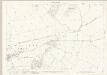
Yorkshire CXC.10 (includes: Catterton; Healaugh; Oxton; Steeton; Tadcaster East; Tadcaster West) - 25 Inch Map
1 : 2500 Topographic maps Ordnance Survey Ordnance Survey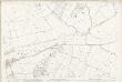
Yorkshire CXC.10 (includes: Catterton; Healaugh; Oxton; Steeton; Tadcaster East; Tadcaster West) - 25 Inch Map
1 : 2500 Topographic maps Ordnance Survey Ordnance Survey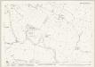
Yorkshire CXC.14 (includes: Bolton Percy; Grimston; Kirkby Wharfe And North Milford; Oxton; Tadcaster East; Tadcaster West) - 25 Inch Map
1 : 2500 Topographic maps Ordnance Survey Ordnance Survey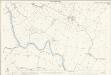
Yorkshire CXC.14 (includes: Bolton Percy; Grimston; Kirkby Wharfe And North Milford; Oxton; Tadcaster East; Tadcaster West) - 25 Inch Map
1 : 2500 Topographic maps Ordnance Survey Ordnance Survey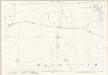
Yorkshire CXC.3 (includes: Angram; Askham Richard; Bilbrough; Catterton; Healaugh; Hutton Wandesley) - 25 Inch Map
1 : 2500 Topographic maps Ordnance Survey Ordnance Survey