Maps of York
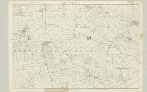
Yorkshire 140 - OS Six-Inch Map
1 : 10560 Topographic maps Ordnance Survey Ordnance Survey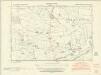
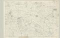
Yorkshire CXL.SE - OS Six-Inch Map
1 : 10560 Topographic maps Ordnance Survey Ordnance Survey
Yorkshire CXL.SE - OS Six-Inch Map
1 : 10560 Topographic maps Ordnance Survey Ordnance Survey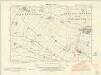
Yorkshire CXL.NE - OS Six-Inch Map
1 : 10560 Topographic maps Ordnance Survey Ordnance Survey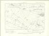
Yorkshire CXL.NE - OS Six-Inch Map
1 : 10560 Topographic maps Ordnance Survey Ordnance Survey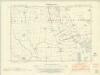
Yorkshire CXL.SW - OS Six-Inch Map
1 : 10560 Topographic maps Ordnance Survey Ordnance Survey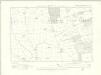
Yorkshire CXL.SW - OS Six-Inch Map
1 : 10560 Topographic maps Ordnance Survey Ordnance Survey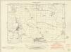
Yorkshire CXL.NW - OS Six-Inch Map
1 : 10560 Topographic maps Ordnance Survey Ordnance Survey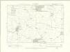
Yorkshire CXL.NW - OS Six-Inch Map
1 : 10560 Topographic maps Ordnance Survey Ordnance Survey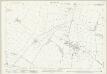
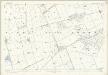
Yorkshire CXL.8 (includes: Lillings Ambo; Sheriff Hutton With Cornbrough) - 25 Inch Map
1 : 2500 Topographic maps Ordnance Survey Ordnance Survey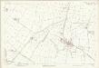
Yorkshire CXL.8 (includes: Lillings Ambo; Sheriff Hutton With Cornbrough) - 25 Inch Map
1 : 2500 Topographic maps Ordnance Survey Ordnance Survey
Yorkshire CXL.12 (includes: Lillings Ambo; Sheriff Hutton With Cornbrough) - 25 Inch Map
1 : 2500 Topographic maps Ordnance Survey Ordnance Survey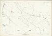
Yorkshire CXL.12 (includes: Lillings Ambo; Sheriff Hutton With Cornbrough) - 25 Inch Map
1 : 2500 Topographic maps Ordnance Survey Ordnance Survey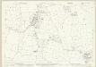
Yorkshire CXL.5 (includes: Huby; Sutton On The Forest) - 25 Inch Map
1 : 2500 Topographic maps Ordnance Survey Ordnance Survey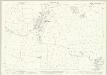
Yorkshire CXL.5 (includes: Huby; Sutton On The Forest) - 25 Inch Map
1 : 2500 Topographic maps Ordnance Survey Ordnance Survey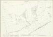
Yorkshire CXL.16 (includes: Flaxton; Lillings Ambo; Sheriff Hutton With Cornbrough; Strensall) - 25 Inch Map
1 : 2500 Topographic maps Ordnance Survey Ordnance Survey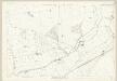
Yorkshire CXL.16 (includes: Flaxton; Lillings Ambo; Sheriff Hutton With Cornbrough; Strensall) - 25 Inch Map
1 : 2500 Topographic maps Ordnance Survey Ordnance Survey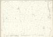
Yorkshire CXL.9 (includes: Huby; Sutton On The Forest) - 25 Inch Map
1 : 2500 Topographic maps Ordnance Survey Ordnance Survey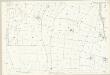
Yorkshire CXL.9 (includes: Huby; Sutton On The Forest) - 25 Inch Map
1 : 2500 Topographic maps Ordnance Survey Ordnance Survey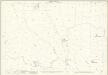
Yorkshire CXL.13 (includes: Huby; Sutton On The Forest) - 25 Inch Map
1 : 2500 Topographic maps Ordnance Survey Ordnance Survey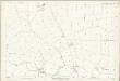
Yorkshire CXL.13 (includes: Huby; Sutton On The Forest) - 25 Inch Map
1 : 2500 Topographic maps Ordnance Survey Ordnance Survey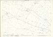
Yorkshire CXL.7 (includes: Farlington; Sheriff Hutton With Cornbrough; Sutton On The Forest) - 25 Inch Map
1 : 2500 Topographic maps Ordnance Survey Ordnance Survey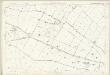
Yorkshire CXL.7 (includes: Farlington; Sheriff Hutton With Cornbrough; Sutton On The Forest) - 25 Inch Map
1 : 2500 Topographic maps Ordnance Survey Ordnance Survey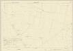
Yorkshire CXL.6 (includes: Marton Cum Moxby; Sutton On The Forest) - 25 Inch Map
1 : 2500 Topographic maps Ordnance Survey Ordnance Survey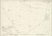
Yorkshire CXL.6 (includes: Marton Cum Moxby; Sutton On The Forest) - 25 Inch Map
1 : 2500 Topographic maps Ordnance Survey Ordnance Survey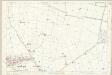
Yorkshire CXL.6 (includes: Marton Cum Moxby; Sutton On The Forest) - 25 Inch Map
1 : 2500 Topographic maps Ordnance Survey Ordnance Survey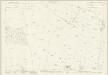
Yorkshire CXL.11 (includes: Sheriff Hutton With Cornbrough; Sutton On The Forest) - 25 Inch Map
1 : 2500 Topographic maps Ordnance Survey Ordnance Survey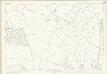
Yorkshire CXL.11 (includes: Sheriff Hutton With Cornbrough; Sutton On The Forest) - 25 Inch Map
1 : 2500 Topographic maps Ordnance Survey Ordnance Survey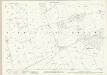
Yorkshire CXL.10 (includes: Sutton On The Forest) - 25 Inch Map
1 : 2500 Topographic maps Ordnance Survey Ordnance Survey