Maps of Brentwood
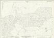
Essex nLXI - OS Six-Inch Map
1 : 10560 Topographic maps Ordnance Survey Ordnance Survey
Essex L.SE - OS Six-Inch Map
1 : 10560 Topographic maps Ordnance Survey Ordnance Survey
Essex L.SE - OS Six-Inch Map
1 : 10560 Topographic maps Ordnance Survey Ordnance Survey
Essex nLXI.NE - OS Six-Inch Map
1 : 10560 Topographic maps Ordnance Survey Ordnance Survey
Essex nLXI.SE - OS Six-Inch Map
1 : 10560 Topographic maps Ordnance Survey Ordnance Survey
Essex nLXI.NW - OS Six-Inch Map
1 : 10560 Topographic maps Ordnance Survey Ordnance Survey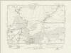
Essex nLXI.NW - OS Six-Inch Map
1 : 10560 Topographic maps Ordnance Survey Ordnance Survey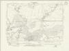
Essex nLXI.NW - OS Six-Inch Map
1 : 10560 Topographic maps Ordnance Survey Ordnance Survey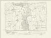
Essex nLXI.SW - OS Six-Inch Map
1 : 10560 Topographic maps Ordnance Survey Ordnance Survey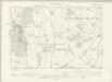
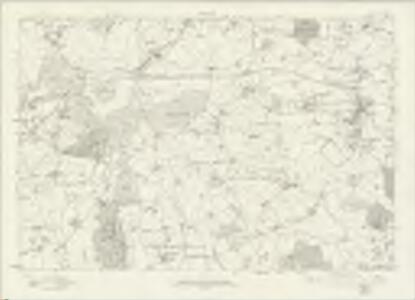
Essex LVIII.NE - OS Six-Inch Map
1 : 10560 Topographic maps Ordnance Survey Ordnance Survey
Essex (1st Ed/Rev 1862-96) L.11 (includes: High Ongar; North Weald Bassett; Stanford Rivers; Theydon Garnon; Theydon Mount) - 25 Inch Map
1 : 2500 Topographic maps Ordnance Survey Ordnance Survey
Essex (1st Ed/Rev 1862-96) L.15 (includes: Stanford Rivers; Stapleford Tawney; Theydon Garnon; Theydon Mount) - 25 Inch Map
1 : 2500 Topographic maps Ordnance Survey Ordnance Survey
Essex (1st Ed/Rev 1862-96) LVIII.3 (includes: Stapleford Tawney; Theydon Mount) - 25 Inch Map
1 : 2500 Topographic maps Ordnance Survey Ordnance Survey
Essex (1st Ed/Rev 1862-96) L.12 (includes: Bobbingworth; Greenstead; High Ongar; Stanford Rivers) - 25 Inch Map
1 : 2500 Topographic maps Ordnance Survey Ordnance Survey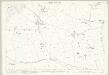
Essex (1st Ed/Rev 1862-96) L.16 (includes: Greenstead; Stanford Rivers) - 25 Inch Map
1 : 2500 Topographic maps Ordnance Survey Ordnance Survey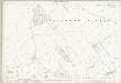
Essex (1st Ed/Rev 1862-96) LVIII.4 (includes: Stanford Rivers) - 25 Inch Map
1 : 2500 Topographic maps Ordnance Survey Ordnance Survey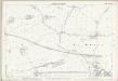
Essex (1st Ed/Rev 1862-96) LI.9 (includes: Bobbingworth; Chipping Ongar; Greenstead; Shelley) - 25 Inch Map
1 : 2500 Topographic maps Ordnance Survey Ordnance Survey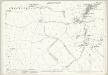
Essex (1st Ed/Rev 1862-96) LI.13 (includes: Chipping Ongar; Greenstead; High Ongar; Stanford Rivers) - 25 Inch Map
1 : 2500 Topographic maps Ordnance Survey Ordnance Survey
Essex (New Series 1913-) n LXI.8 (includes: Chipping Ongar; Greenstead; High Ongar) - 25 Inch Map
1 : 2500 Topographic maps Ordnance Survey Ordnance Survey
Essex (1st Ed/Rev 1862-96) LIX.1 (includes: Kelvedon Hatch; Stanford Rivers) - 25 Inch Map
1 : 2500 Topographic maps Ordnance Survey Ordnance Survey
Essex (New Series 1913-) n LXI.12 (includes: High Ongar; Kelvedon Hatch; Stanford Rivers) - 25 Inch Map
1 : 2500 Topographic maps Ordnance Survey Ordnance Survey
Essex (New Series 1913-) n LXI.16 (includes: Kelvedon Hatch; Navestock; Stanford Rivers) - 25 Inch Map
1 : 2500 Topographic maps Ordnance Survey Ordnance Survey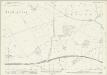
Essex (New Series 1913-) n LXI.3 (includes: Bobbingworth; High Ongar; Stanford Rivers) - 25 Inch Map
1 : 2500 Topographic maps Ordnance Survey Ordnance Survey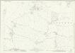
Essex (New Series 1913-) n LXI.7 (includes: Bobbingworth; Greenstead; Stanford Rivers) - 25 Inch Map
1 : 2500 Topographic maps Ordnance Survey Ordnance Survey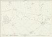
Essex (New Series 1913-) n LXI.11 (includes: Stanford Rivers) - 25 Inch Map
1 : 2500 Topographic maps Ordnance Survey Ordnance Survey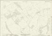
Essex (New Series 1913-) n LXI.15 (includes: Navestock; Stanford Rivers) - 25 Inch Map
1 : 2500 Topographic maps Ordnance Survey Ordnance Survey
Essex (New Series 1913-) n LXI.4 (includes: Bobbingworth; Chipping Ongar; High Ongar; Shelley) - 25 Inch Map
1 : 2500 Topographic maps Ordnance Survey Ordnance Survey
Essex LI.SW - OS Six-Inch Map
1 : 10560 Topographic maps Ordnance Survey Ordnance Survey
Essex (New Series 1913-) n LXI.2 (includes: High Ongar; North Weald Bassett; Stanford Rivers) - 25 Inch Map
1 : 2500 Topographic maps Ordnance Survey Ordnance Survey