Maps of Essex
Essex XLIV - OS Six-Inch Map
1 : 10560 Topographic maps Ordnance Survey Ordnance Survey
Essex nLV.NW - OS Six-Inch Map
1 : 10560 Topographic maps Ordnance Survey Ordnance Survey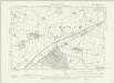
Essex XLIV.SW - OS Six-Inch Map
1 : 10560 Topographic maps Ordnance Survey Ordnance Survey
Essex XLIV.NW - OS Six-Inch Map
1 : 10560 Topographic maps Ordnance Survey Ordnance Survey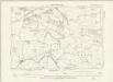
Essex XLIV.SE - OS Six-Inch Map
1 : 10560 Topographic maps Ordnance Survey Ordnance Survey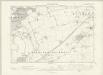
Essex XLIV.NE - OS Six-Inch Map
1 : 10560 Topographic maps Ordnance Survey Ordnance Survey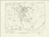
Essex nXLV.SW - OS Six-Inch Map
1 : 10560 Topographic maps Ordnance Survey Ordnance Survey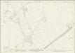
Essex (New Series 1913-) n XLV.14 (includes: Hatfield Peverel; Terling) - 25 Inch Map
1 : 2500 Topographic maps Ordnance Survey Ordnance Survey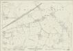
Essex (New Series 1913-) n LV.2 (includes: Hatfield Peverel) - 25 Inch Map
1 : 2500 Topographic maps Ordnance Survey Ordnance Survey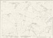
Essex (New Series 1913-) n LV.6 (includes: Hatfield Peverel; Little Baddow; Woodham Walter) - 25 Inch Map
1 : 2500 Topographic maps Ordnance Survey Ordnance Survey
Essex (New Series 1913-) n XLV.13 (includes: Boreham; Hatfield Peverel; Terling) - 25 Inch Map
1 : 2500 Topographic maps Ordnance Survey Ordnance Survey
Essex (New Series 1913-) n LV.1 (includes: Boreham; Hatfield Peverel; Terling) - 25 Inch Map
1 : 2500 Topographic maps Ordnance Survey Ordnance Survey
Essex (New Series 1913-) n LV.5 (includes: Boreham; Hatfield Peverel) - 25 Inch Map
1 : 2500 Topographic maps Ordnance Survey Ordnance Survey
Essex (New Series 1913-) n XLIV.16 (includes: Boreham; Great and Little Leighs; Little Waltham) - 25 Inch Map
1 : 2500 Topographic maps Ordnance Survey Ordnance Survey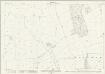
Essex (New Series 1913-) n LIV.4 (includes: Boreham; Little Waltham; Springfield) - 25 Inch Map
1 : 2500 Topographic maps Ordnance Survey Ordnance Survey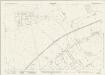
Essex (New Series 1913-) n LIV.8 (includes: Boreham; Springfield) - 25 Inch Map
1 : 2500 Topographic maps Ordnance Survey Ordnance Survey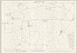
Essex (1st Ed/Rev 1862-96) XLIV.5 (includes: Boreham; Great and Little Leighs; Little Waltham) - 25 Inch Map
1 : 2500 Topographic maps Ordnance Survey Ordnance Survey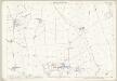
Essex (1st Ed/Rev 1862-96) XLIV.9 (includes: Boreham; Broomfield; Little Waltham; Springfield) - 25 Inch Map
1 : 2500 Topographic maps Ordnance Survey Ordnance Survey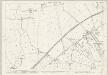
Essex (1st Ed/Rev 1862-96) XLIV.13 (includes: Boreham; Springfield) - 25 Inch Map
1 : 2500 Topographic maps Ordnance Survey Ordnance Survey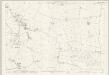
Essex (1st Ed/Rev 1862-96) XLIV.12 (includes: Hatfield Peverel) - 25 Inch Map
1 : 2500 Topographic maps Ordnance Survey Ordnance Survey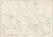
Essex (1st Ed/Rev 1862-96) XLIV.6 (includes: Boreham; Hatfield Peverel; Terling) - 25 Inch Map
1 : 2500 Topographic maps Ordnance Survey Ordnance Survey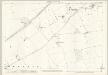
Essex (1st Ed/Rev 1862-96) XLIV.8 (includes: Hatfield Peverel; Witham) - 25 Inch Map
1 : 2500 Topographic maps Ordnance Survey Ordnance Survey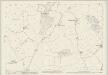
Essex (1st Ed/Rev 1862-96) XLIV.1 (includes: Great and Little Leighs; Little Waltham) - 25 Inch Map
1 : 2500 Topographic maps Ordnance Survey Ordnance Survey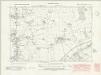
Essex nLIV.NE - OS Six-Inch Map
1 : 10560 Topographic maps Ordnance Survey Ordnance Survey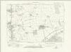
Essex nLIV.NE - OS Six-Inch Map
1 : 10560 Topographic maps Ordnance Survey Ordnance Survey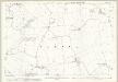
Essex (1st Ed/Rev 1862-96) XLIV.16 (includes: Hatfield Peverel; Ulting) - 25 Inch Map
1 : 2500 Topographic maps Ordnance Survey Ordnance Survey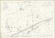
Essex (1st Ed/Rev 1862-96) XLIV.10 (includes: Boreham) - 25 Inch Map
1 : 2500 Topographic maps Ordnance Survey Ordnance Survey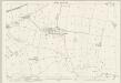
Essex (1st Ed/Rev 1862-96) XLIV.14 (includes: Boreham) - 25 Inch Map
1 : 2500 Topographic maps Ordnance Survey Ordnance Survey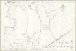
Essex (1st Ed/Rev 1862-96) XLIV.7 (includes: Hatfield Peverel; Terling) - 25 Inch Map
1 : 2500 Topographic maps Ordnance Survey Ordnance Survey