Maps of Somerset
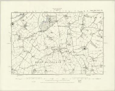
Somerset LXXIX.SW - OS Six-Inch Map
1 : 10560 Topographic maps Ordnance Survey Ordnance Survey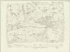
Somerset LXXIX.SW - OS Six-Inch Map
1 : 10560 Topographic maps Ordnance Survey Ordnance Survey
Somerset LXXIX.SW - OS Six-Inch Map
1 : 10560 Topographic maps Ordnance Survey Ordnance Survey
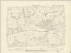
Somerset LXXIX.9 (includes: Wellington Without; West Buckland) - 25 Inch Map
1 : 2500 Topographic maps Ordnance Survey Ordnance Survey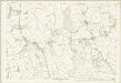
Somerset LXXIX.9 (includes: Wellington Without; West Buckland) - 25 Inch Map
1 : 2500 Topographic maps Ordnance Survey Ordnance Survey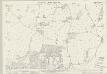
Somerset LXXIX.10 (includes: Pitminster; West Buckland) - 25 Inch Map
1 : 2500 Topographic maps Ordnance Survey Ordnance Survey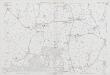
Somerset LXXIX.10 (includes: Pitminster; West Buckland) - 25 Inch Map
1 : 2500 Topographic maps Ordnance Survey Ordnance Survey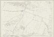
Somerset LXXIX.14 (includes: Churchstanton; Clayhidon; Pitminster; West Buckland) - 25 Inch Map
1 : 2500 Topographic maps Ordnance Survey Ordnance Survey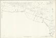
Somerset LXXIX.14 (includes: Churchstanton; Clayhidon; Pitminster; West Buckland) - 25 Inch Map
1 : 2500 Topographic maps Ordnance Survey Ordnance Survey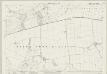
Somerset LXXIX.13 (includes: Clayhidon; Hemyock; Wellington Without; West Buckland) - 25 Inch Map
1 : 2500 Topographic maps Ordnance Survey Ordnance Survey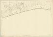
Somerset LXXIX.13 (includes: Clayhidon; Hemyock; Wellington Without; West Buckland) - 25 Inch Map
1 : 2500 Topographic maps Ordnance Survey Ordnance Survey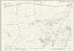
Devon XXXVI.12 (includes: Churchstanton; Clayhidon; Hemyock; Pitminster; Wellington Without; West Buckland) - 25 Inch Map
1 : 2500 Topographic maps Ordnance Survey Ordnance Survey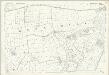
Devon XXXVI.12 (includes: Churchstanton; Clayhidon; Hemyock; Pitminster; Wellington Without; West Buckland) - 25 Inch Map
1 : 2500 Topographic maps Ordnance Survey Ordnance Survey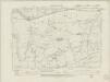
Devonshire XXXVI.SE - OS Six-Inch Map
1 : 10560 Topographic maps Ordnance Survey Ordnance Survey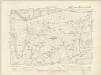
Devonshire XXXVI.SE - OS Six-Inch Map
1 : 10560 Topographic maps Ordnance Survey Ordnance Survey
Devonshire XXXVI.SE - OS Six-Inch Map
1 : 10560 Topographic maps Ordnance Survey Ordnance Survey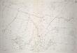
Devon XXXVII.9 - 25 Inch Map
1 : 2500 Topographic maps Ordnance Survey Ordnance Survey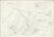
Devon XXXVII.9 (includes: Churchstanton; Pitminster; West Buckland) - 25 Inch Map
1 : 2500 Topographic maps Ordnance Survey Ordnance Survey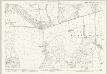
Devon XXXVI.11 (includes: Clayhidon; Hemyock; Wellington Without; West Buckland) - 25 Inch Map
1 : 2500 Topographic maps Ordnance Survey Ordnance Survey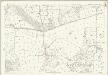
Devon XXXVI.11 (includes: Clayhidon; Hemyock; Wellington Without; West Buckland) - 25 Inch Map
1 : 2500 Topographic maps Ordnance Survey Ordnance Survey
ST11 - OS 1:25,000 Provisional Series Map
1 : 25000 Topographic maps Ordnance Survey Ordnance Survey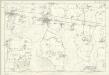
Devonshire XXXVII.SW - OS Six-Inch Map
1 : 10560 Topographic maps Ordnance Survey Ordnance Survey
Milverton
This drawing covers the boundary between Devon and Somerset. A red pecked line running across the Black Down Hills indicates the border. Dark brushwork interlining ('hachuring') describes relief, making certain place names and details hard to distinguish. Settlements are indicated by red blocks. The draughtsman has drawn individual trees in gardens and orchards. The sandbanks of the River Culm are described by dots. Major communication routes are tinted yellow, following military cartographic practice. Those crossing uncultivated land are drawn with a pecked line.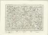
Wellington (Outline) - OS One-Inch Revised New Series
1 : 63360 Topographic maps Ordnance Survey Ordnance Survey
Wellington (Hills) - OS One-Inch Revised New Series
1 : 63360 Topographic maps Ordnance Survey Ordnance Survey
Minehead - OS One-Inch Map
1 : 63360 Topographic maps Ordnance Survey Ordnance Survey
Exeter - OS One-Inch Map
1 : 63360 Topographic maps Ordnance Survey Ordnance Survey
Cary's Improved Map of England and Wales
Cary, George, & Cary, John London : G. & J. Cary
An accurate map of Dorset Shire divided into hundreds
1 : 222000
An improved map of the county of Somerset
1 Karte : Kupferdruck ; 51 x 68 cm Bowen; Hinton sold by I. Hinton at the Kings Arms in St. Pauls Church Yard
Somersettensis comitatvs
1 Karte : Kupferdruck ; 36 x 48 cm Valck; Schenk apud G. Valk et P. Schenk