Maps of Tower Hamlets

Kent I.NE - OS Six-Inch Map
1 : 10560 Topographic maps Ordnance Survey Ordnance Survey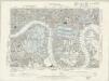
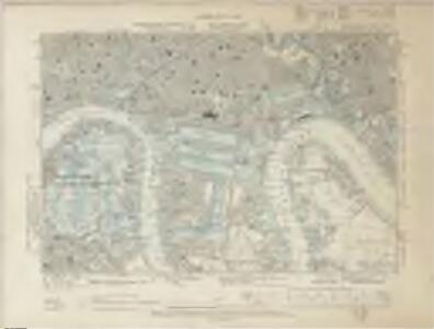
Essex LXXXI.NW - OS Six-Inch Map
1 : 10560 Topographic maps Ordnance Survey Ordnance Survey
Insurance Plan of London Vol. xi: Key Plan 3
1 : 960 This "key plan" indicates coverage of the Goad 1891 series of fire insurance maps of London that were originally produced to aid insurance companies in assessing fire risks. The building footprints, their use (commercial, residential, educational, etc.), the number of floors and the height of the building, as well as construction materials (and thus risk of burning) and special fire hazards (chemicals, kilns, ovens) were documented in order to estimate premiums. Names of individual businesses, property lines, and addresses were also often recorded. Together these maps provide a rich historical shapshot of the commercial activity and urban landscape of towns and cities at the time. The British Library holds a comprehensive collection of fire insurance plans produced by the London-based firm Charles E. Goad Ltd. dating back to 1885. These plans were made for most important towns and cities of the British Isles at the scales of 1:480 (1 inch to 40 feet), as well as many foreign towns at 1:600 (1 inch to 50 feet). Chas E Goad Limited Chas E Goad Limited
Insurance Plan of London Vol. V: Key Plan 3
1 : 480 This detailed 1887 plan of London is one of a series of twenty-five sheets in an atlas originally produced to aid insurance companies in assessing fire risks. The building footprints, their use (commercial, residential, educational, etc.), the number of floors and the height of the building, as well as construction materials (and thus risk of burning) and special fire hazards (chemicals, kilns, ovens) were documented in order to estimate premiums. Names of individual businesses, property lines, and addresses were also often recorded. Together these maps provide a rich historical shapshot of the commercial activity and urban landscape of towns and cities at the time. The British Library holds a comprehensive collection of fire insurance plans produced by the London-based firm Charles E. Goad Ltd. dating back to 1885. These plans were made for most important towns and cities of the British Isles at the scales of 1:480 (1 inch to 40 feet), as well as many foreign towns at 1:600 (1 inch to 50 feet). Chas E Goad Limited Chas E Goad Limited
Insurance Plan of London: sheet 4
This detailed 1889 plan of London is one of a series of six sheets in an atlas originally produced to aid insurance companies in assessing fire risks. The building footprints, their use (commercial, residential, educational, etc.), the number of floors and the height of the building, as well as construction materials (and thus risk of burning) and special fire hazards (chemicals, kilns, ovens) were documented in order to estimate premiums. Names of individual businesses, property lines, and addresses were also often recorded. Together these maps provide a rich historical shapshot of the commercial activity and urban landscape of towns and cities at the time. The British Library holds a comprehensive collection of fire insurance plans produced by the London-based firm Charles E. Goad Ltd. dating back to 1885. These plans were made for most important towns and cities of the British Isles at the scales of 1:480 (1 inch to 40 feet), as well as many foreign towns at 1:600 (1 inch to 50 feet). Chas E Goad Limited Chas E Goad Limited
Vrbium Londini et West-Monasterii nec non suburbii Southwark accurata ichnographia, 3
1 Blatt : 53 x 57 cm Homännische Erben
Essex (New Series 1913-) n LXXXVI.13 (includes: Borough Of Greenwich; Poplar Borough) - 25 Inch Map
1 : 2500 Topographic maps Ordnance Survey Ordnance Survey
London (First Editions c1850s) XLVII (includes: Borough Of Greenwich; Poplar Borough) - 25 Inch Map
1 : 2500 Topographic maps Ordnance Survey Ordnance Survey
A New & Exact Plan of ye City of LONDON, detail showing Blackwall
Detail showing Bethnal Green from Bowles' folding map of London of 1731. This is a later edition of the map first issued by Bowles in 1719 extended to include Stepney and the Isle of Dogs. Bowles based this part of the map on Gascoigne's Survey of Stepney of 1703. Gascoigne, J.
An Accurate Plan of the Docks for the West India Trade
Plan of the West India Docks in the Isle of Dogs with title along the top, compass star at top left and key to colours and reference table in panel below the plan. Designed by William Jessop, the docks were completed in 1802 allowing West India Company merchants to discharge their ships in four days instead of the usual four weeks. Fairburn, John
London (1915- Numbered sheets) V.16 (includes: Bermondsey; Poplar Borough) - 25 Inch Map
1 : 2500 Topographic maps Ordnance Survey Ordnance Survey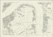
London (First Editions c1850s) XLVI (includes: Bermondsey; Poplar Borough) - 25 Inch Map
1 : 2500 Topographic maps Ordnance Survey Ordnance Survey
Insurance Plan of London Vol. VII: sheet 172-1
1 : 480 This detailed 1887 plan of London is one of a series of twenty-six sheets in an atlas originally produced to aid insurance companies in assessing fire risks. The building footprints, their use (commercial, residential, educational, etc.), the number of floors and the height of the building, as well as construction materials (and thus risk of burning) and special fire hazards (chemicals, kilns, ovens) were documented in order to estimate premiums. Names of individual businesses, property lines, and addresses were also often recorded. Together these maps provide a rich historical shapshot of the commercial activity and urban landscape of towns and cities at the time. The British Library holds a comprehensive collection of fire insurance plans produced by the London-based firm Charles E. Goad Ltd. dating back to 1885. These plans were made for most important towns and cities of the British Isles at the scales of 1:480 (1 inch to 40 feet), as well as many foreign towns at 1:600 (1 inch to 50 feet). Chas E Goad Limited Chas E Goad Limited
Insurance Plan of London Vol. xi: sheet 356-2
1 : 480 This detailed 1891 plan of London is one of a series of forty seven sheets in an atlas originally produced to aid insurance companies in assessing fire risks. The building footprints, their use (commercial, residential, educational, etc.), the number of floors and the height of the building, as well as construction materials (and thus risk of burning) and special fire hazards (chemicals, kilns, ovens) were documented in order to estimate premiums. Names of individual businesses, property lines, and addresses were also often recorded. Together these maps provide a rich historical shapshot of the commercial activity and urban landscape of towns and cities at the time. The British Library holds a comprehensive collection of fire insurance plans produced by the London-based firm Charles E. Goad Ltd. dating back to 1885. These plans were made for most important towns and cities of the British Isles at the scales of 1:480 (1 inch to 40 feet), as well as many foreign towns at 1:600 (1 inch to 50 feet). Chas E Goad Limited Chas E Goad Limited
Insurance Plan of London East District Vol. G: sheet D
1 : 3600 This detailed 1900 plan of London is one of a series of thirty-five sheets in an atlas originally produced to aid insurance companies in assessing fire risks. The building footprints, their use (commercial, residential, educational, etc.), the number of floors and the height of the building, as well as construction materials (and thus risk of burning) and special fire hazards (chemicals, kilns, ovens) were documented in order to estimate premiums. Names of individual businesses, property lines, and addresses were also often recorded. Together these maps provide a rich historical shapshot of the commercial activity and urban landscape of towns and cities at the time. The British Library holds a comprehensive collection of fire insurance plans produced by the London-based firm Charles E. Goad Ltd. dating back to 1885. These plans were made for most important towns and cities of the British Isles at the scales of 1:480 (1 inch to 40 feet), as well as many foreign towns at 1:600 (1 inch to 50 feet). Chas E Goad Limited Chas E Goad Limited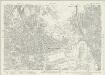
Essex (New Series 1913-) n LXXXVI.9 (includes: Poplar Borough; West Ham) - 25 Inch Map
1 : 2500 Topographic maps Ordnance Survey Ordnance Survey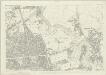
London (First Editions c1850s) XXXVIII (includes: Poplar Borough; West Ham) - 25 Inch Map
1 : 2500 Topographic maps Ordnance Survey Ordnance Survey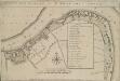
A MAP OF THE PARISH OF ST. MARY ROTHERHITH.
1 : 4800 This plan was first published in Strype's 1755 edition of Stow's 'Survey of England'. The title appears along the top with compass rose, scale bar and table of reference in the centre. Damaged by repeated flooding, the old medieval parish church of St. Mary was demolished at the beginning of the 18th Century.In 1715, a new parish church was erected on the site with funds raised by the parishioners themselves after the commissioners of the Fifty New Churches Act turned down their request for money. Blome, Richard
Insurance Plan of London Vol. VII: sheet 173
1 : 480 This detailed 1887 plan of London is one of a series of twenty-six sheets in an atlas originally produced to aid insurance companies in assessing fire risks. The building footprints, their use (commercial, residential, educational, etc.), the number of floors and the height of the building, as well as construction materials (and thus risk of burning) and special fire hazards (chemicals, kilns, ovens) were documented in order to estimate premiums. Names of individual businesses, property lines, and addresses were also often recorded. Together these maps provide a rich historical shapshot of the commercial activity and urban landscape of towns and cities at the time. The British Library holds a comprehensive collection of fire insurance plans produced by the London-based firm Charles E. Goad Ltd. dating back to 1885. These plans were made for most important towns and cities of the British Isles at the scales of 1:480 (1 inch to 40 feet), as well as many foreign towns at 1:600 (1 inch to 50 feet). Chas E Goad Limited Chas E Goad Limited
Insurance Plan of London East District Vol. G: sheet C
1 : 480 This detailed 1900 plan of London is one of a series of thirty-five sheets in an atlas originally produced to aid insurance companies in assessing fire risks. The building footprints, their use (commercial, residential, educational, etc.), the number of floors and the height of the building, as well as construction materials (and thus risk of burning) and special fire hazards (chemicals, kilns, ovens) were documented in order to estimate premiums. Names of individual businesses, property lines, and addresses were also often recorded. Together these maps provide a rich historical shapshot of the commercial activity and urban landscape of towns and cities at the time. The British Library holds a comprehensive collection of fire insurance plans produced by the London-based firm Charles E. Goad Ltd. dating back to 1885. These plans were made for most important towns and cities of the British Isles at the scales of 1:480 (1 inch to 40 feet), as well as many foreign towns at 1:600 (1 inch to 50 feet). Chas E Goad Limited Chas E Goad Limited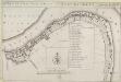
A MAP OF THE PARISH OF ST. MARY ROTHERHITH
1 : 4800 This plan was first published in Strype's 1720 annotated edition of Stow's 'Survey of England'. The title appears along the top, with compass rose, scale bar and table of reference in the centre. Damaged by repeated flooding, the old medieval parish church of St. Mary was demolished at the beginning of the 18th Century. In 1715, a new parish church was erected on the site with funds raised by the parishioners themselves after the commissioners of the Fifty New Churches Act turned down their request for money. Harris, J.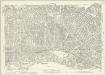
London (1915- Numbered sheets) V.12 (includes: Bermondsey; Stepney) - 25 Inch Map
1 : 2500 Topographic maps Ordnance Survey Ordnance Survey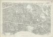
London (First Editions c1850s) XXXVII (includes: Bermondsey; Stepney) - 25 Inch Map
1 : 2500 Topographic maps Ordnance Survey Ordnance Survey
London VIII.62 - OS London Town Plan
1 : 1056 Topographic maps Ordnance Survey Ordnance Survey
London VIII.72 - OS London Town Plan
1 : 1056 Topographic maps Ordnance Survey Ordnance Survey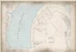
London VIII.82 - OS London Town Plan
1 : 1056 Topographic maps Ordnance Survey Ordnance Survey
London VIII.92 - OS London Town Plan
1 : 1056 Topographic maps Ordnance Survey Ordnance Survey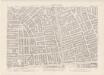
London VIII.61 - OS London Town Plan
1 : 1056 Topographic maps Ordnance Survey Ordnance Survey
London VIII.71 - OS London Town Plan
1 : 1056 Topographic maps Ordnance Survey Ordnance Survey